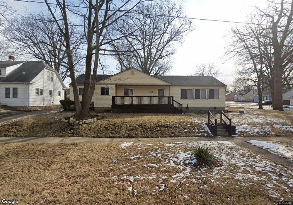
3911 Circle Dr Flint, MI 48507
Circle Drive NeighborhoodEstimated Value: $133,000 - $210,000
4
Beds
2
Baths
1,976
Sq Ft
$81/Sq Ft
Est. Value
About This Home
This home is located at 3911 Circle Dr, Flint, MI 48507 and is currently estimated at $159,330, approximately $80 per square foot. 3911 Circle Dr is a home located in Genesee County with nearby schools including Freeman Elementary School, Flint Southwestern Classical Academy, and Burton Glen Charter Academy.
Ownership History
Date
Name
Owned For
Owner Type
Purchase Details
Closed on
Nov 6, 2025
Sold by
Dudley Phillip Reed
Bought by
Thompson Phillip J
Current Estimated Value
Purchase Details
Closed on
May 6, 2025
Sold by
Dudley Phillip
Bought by
Dudley Phillip
Purchase Details
Closed on
Mar 3, 2025
Sold by
Dudley Phillip
Bought by
Dudley Phillip and Harris-Dudley Reeklia
Purchase Details
Closed on
Dec 18, 2014
Sold by
Dudley Phillip
Bought by
Dudley Phillip and Dudley Brenda F
Purchase Details
Closed on
May 27, 2011
Sold by
Gisewhite Joseph and Gisewhite Mary Ann
Bought by
Dudley Phillip
Create a Home Valuation Report for This Property
The Home Valuation Report is an in-depth analysis detailing your home's value as well as a comparison with similar homes in the area
Home Values in the Area
Average Home Value in this Area
Purchase History
| Date | Buyer | Sale Price | Title Company |
|---|---|---|---|
| Thompson Phillip J | -- | None Listed On Document | |
| Dudley Phillip | -- | None Listed On Document | |
| Dudley Phillip | -- | Michigan Land Title | |
| Dudley Phillip | -- | None Available | |
| Dudley Phillip | $58,000 | Sargents Title Company |
Source: Public Records
Tax History
| Year | Tax Paid | Tax Assessment Tax Assessment Total Assessment is a certain percentage of the fair market value that is determined by local assessors to be the total taxable value of land and additions on the property. | Land | Improvement |
|---|---|---|---|---|
| 2025 | $1,928 | $74,200 | $0 | $0 |
| 2024 | $1,769 | $66,100 | $0 | $0 |
| 2023 | $1,714 | $61,100 | $0 | $0 |
| 2022 | $0 | $49,900 | $0 | $0 |
| 2021 | $1,747 | $48,200 | $0 | $0 |
| 2020 | $1,588 | $38,800 | $0 | $0 |
| 2019 | $1,539 | $30,200 | $0 | $0 |
| 2018 | $1,569 | $26,200 | $0 | $0 |
| 2017 | $1,524 | $0 | $0 | $0 |
| 2016 | $1,513 | $0 | $0 | $0 |
| 2015 | -- | $0 | $0 | $0 |
| 2014 | -- | $0 | $0 | $0 |
| 2012 | -- | $25,400 | $0 | $0 |
Source: Public Records
Map
Nearby Homes
- 420 Burroughs Ave
- 621 Burroughs Ave
- 630 Buckingham Ave
- 4126 Circle Dr
- 366 E Atherton Rd
- 4127 Custer Ave
- 352 Buckingham Ave
- 326 Burroughs Ave
- 720 Algonquin Ave
- 3914 Red Arrow Rd
- 617 McKeighan Ave
- 530 McKeighan Ave
- 3505 Comanche Ave
- 4526 Milton Dr
- 4424 Cheyenne Ave
- 1030 McKeighan Ave
- 3218 Collingwood Pkwy
- 213 E Lakeview Ave
- 2910 Shawnee Ave
- 3110 Menominee Ave
- 3907 Circle Dr
- 515 Burroughs Ave
- 3901 Circle Dr
- 521 Burroughs Ave
- 514 Buckingham Ave
- 4001 Circle Dr
- 520 Buckingham Ave
- 525 Burroughs Ave
- 514 Burroughs Ave
- 3916 Circle Dr
- 3912 Circle Dr
- 4007 Circle Dr
- 3910 Circle Dr
- 524 Buckingham Ave
- 520 Burroughs Ave
- 4002 Circle Dr
- 3902 Circle Dr
- 529 Burroughs Ave
- 524 Burroughs Ave
- 3817 Circle Dr
Your Personal Tour Guide
Ask me questions while you tour the home.