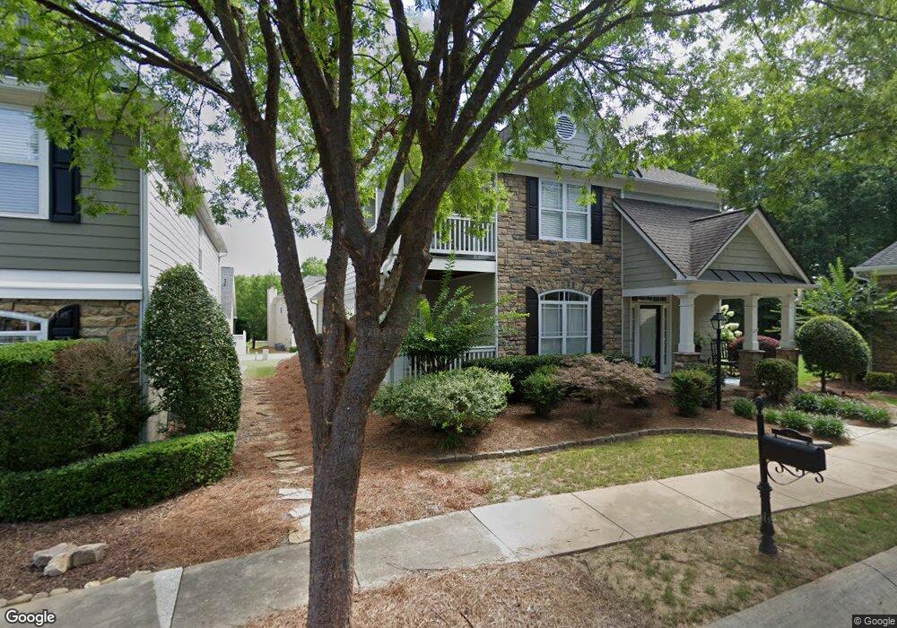
3913 Baluster Ct Suwanee, GA 30024
Estimated Value: $490,000 - $510,028
About This Home
This home is located at 3913 Baluster Ct, Suwanee, GA 30024 and is currently estimated at $498,257, approximately $257 per square foot. 3913 Baluster Ct is a home located in Gwinnett County with nearby schools including Roberts Elementary School, North Gwinnett Middle School, and North Gwinnett High School.
Ownership History
We collect this data history from publicly available records. To have your information removed, we recommend requesting removal directly through your county’s website.
Purchase Details
Home Financials for this Owner
Home Financials are based on the most recent Mortgage that was taken out on this home.Purchase Details
Home Financials for this Owner
Home Financials are based on the most recent Mortgage that was taken out on this home.Purchase Details
Home Financials for this Owner
Home Financials are based on the most recent Mortgage that was taken out on this home.Home Values in the Area
Average Home Value in this Area
Purchase History
We collect this data history from publicly available records. To have your information removed, we recommend requesting removal directly through your county’s website.
| Date | Buyer | Sale Price | Title Company |
|---|---|---|---|
| $215,000 | -- | ||
| $226,900 | -- | ||
| $191,400 | -- |
Mortgage History
We collect this data history from publicly available records. To have your information removed, we recommend requesting removal directly through your county’s website.
| Date | Status | Borrower | Loan Amount |
|---|---|---|---|
| Open | $172,000 | ||
| Previous Owner | $105,000 | ||
| Previous Owner | $180,405 |
Tax History
We collect this data history from publicly available records. To have your information removed, we recommend requesting removal directly through your county’s website.
| Year | Tax Paid | Tax Assessment Tax Assessment Total Assessment is a certain percentage of the fair market value that is determined by local assessors to be the total taxable value of land and additions on the property. | Land | Improvement |
|---|---|---|---|---|
| 2025 | $4,554 | $202,560 | $44,080 | $158,480 |
| 2024 | $4,725 | $197,440 | $40,800 | $156,640 |
| 2023 | $4,725 | $170,040 | $35,600 | $134,440 |
| 2022 | $4,951 | $164,000 | $35,600 | $128,400 |
| 2021 | $3,951 | $125,040 | $26,800 | $98,240 |
| 2020 | $3,805 | $118,360 | $23,080 | $95,280 |
| 2019 | $3,216 | $118,360 | $23,080 | $95,280 |
| 2018 | $3,129 | $113,560 | $23,080 | $90,480 |
| 2016 | $2,636 | $90,800 | $24,000 | $66,800 |
| 2015 | $2,482 | $82,360 | $18,400 | $63,960 |
| 2014 | $2,497 | $82,360 | $18,400 | $63,960 |
Map
- 870 Scales Rd
- 878 Scales Rd
- 3343 Harvest Park Ln
- 3615 Belle Fields Crossing
- 3625 Belle Fields Crossing
- 3675 Belle Fields Crossing
- 3655 Belle Fields Crossing
- 3635 Belle Fields Crossing
- 3685 Belle Fields Crossing
- 3645 Belle Fields Crossing
- 3880 Prairie Field Crossing
- 754 Urban Grange Way
- 744 Urban Grange Way
- 3405 Crop Corner Rd
- 734 Urban Grange Way
- 527 Red Clay Farm Ln
- 517 Red Clay Farm Ln
- 694 Urban Grange Way
- 507 Red Clay Farm Ln
- 497 Red Clay Farm Ln
- 773 Cambron Commons Trace Unit 2
- 763 Cambron Commons Trace Unit 2
- 763 Cambron Commons Trace
- 783 Cambron Commons Trace Unit 1
- 793 Cambron Commons Trace
- 793 Cambron Commons
- 828 Scales Rd Unit 2
- 3922 Baluster Ct
- 824 Scales Rd
- 824 Scales Rd
- 832 Scales Rd
- 743 Cambron Commons Trace Unit 2
- 820 Scales Rd
- 836 Scales Rd
- 836 Scales Rd Unit 2
- 792 Cambron Commons Trace
- 3912 Baluster Ct Unit 2
- 816 Scales Rd Unit 2
- 3923 Baluster Ct
- 723 Cambron Commons Trace Unit 2
Ask me questions while you tour the home.