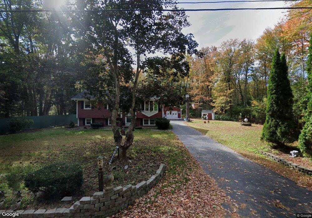
392 Flag Pond Rd Saco, ME 04072
North Saco NeighborhoodEstimated Value: $427,000 - $514,000
About This Home
This home is located at 392 Flag Pond Rd, Saco, ME 04072 and is currently estimated at $454,146, approximately $477 per square foot. 392 Flag Pond Rd is a home located in York County with nearby schools including C K Burns School and Saco Middle School.
Ownership History
We collect this data history from publicly available records. To have your information removed, we recommend requesting removal directly through your county’s website.
Purchase Details
Home Financials for this Owner
Home Financials are based on the most recent Mortgage that was taken out on this home.Home Values in the Area
Average Home Value in this Area
Purchase History
We collect this data history from publicly available records. To have your information removed, we recommend requesting removal directly through your county’s website.
| Date | Buyer | Sale Price | Title Company |
|---|---|---|---|
| -- | -- |
Mortgage History
We collect this data history from publicly available records. To have your information removed, we recommend requesting removal directly through your county’s website.
| Date | Status | Borrower | Loan Amount |
|---|---|---|---|
| Open | $322,175 |
Tax History
We collect this data history from publicly available records. To have your information removed, we recommend requesting removal directly through your county’s website.
| Year | Tax Paid | Tax Assessment Tax Assessment Total Assessment is a certain percentage of the fair market value that is determined by local assessors to be the total taxable value of land and additions on the property. | Land | Improvement |
|---|---|---|---|---|
| 2025 | $4,979 | $350,600 | $139,600 | $211,000 |
| 2024 | $4,849 | $345,100 | $139,600 | $205,500 |
| 2023 | $5,090 | $345,100 | $139,600 | $205,500 |
| 2022 | $4,669 | $254,700 | $106,400 | $148,300 |
| 2021 | $4,514 | $239,100 | $94,900 | $144,200 |
| 2020 | $4,266 | $216,900 | $83,600 | $133,300 |
| 2019 | $4,204 | $216,900 | $83,600 | $133,300 |
| 2018 | $351 | $201,100 | $76,000 | $125,100 |
| 2017 | $3,771 | $194,600 | $69,100 | $125,500 |
| 2016 | $336 | $166,600 | $51,400 | $115,200 |
| 2015 | $3,179 | $165,400 | $51,400 | $114,000 |
| 2014 | $3,104 | $166,700 | $52,700 | $114,000 |
| 2013 | $3,097 | $166,700 | $52,700 | $114,000 |
Map
- 7 Memory Ln
- 169 Jenkins Rd
- 8 Dirigo Dr
- 295 Buxton Rd
- 213 Buxton Rd
- 84 Jenkins Rd
- 6 Sugar Woods Way
- 320 Holmes Rd
- 2 June Dr Unit 101
- 1 June Dr Unit 101
- 1 June Dr Unit 102
- 82 Jenkins Rd
- 5 Sullivan Ln
- 48 Louden Rd
- 91 C Broadturn Rd
- 219 Broadturn Rd
- 461 Buxton Rd
- 211 Broadturn Rd
- 13 Blake Ave
- 334 Broadturn Rd
- 390 Flag Pond Rd
- 396 Flag Pond Rd
- 388 Flag Pond Rd
- Lot 3 Ricker Rd
- 394 Flag Pond Rd
- 398 Flag Pond Rd
- 0 Ricker
- Lot 2 Ricker Rd
- 386 Flag Pond Rd
- Lot 4 Ricker Rd
- 405 Flag Pond Rd
- 402 Flag Pond Rd
- 4 Ricker Rd
- 6 Ricker Rd
- 9 Ricker Rd
- 10 Ricker Rd
- 411 Flag Pond Rd
- 415 Flag Pond Rd
- lot 1 Jada Dr
- 15 Ricker Rd
Ask me questions while you tour the home.