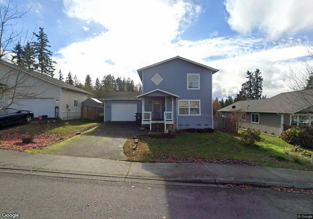
392 NE Max William Loop Poulsbo, WA 98370
Estimated Value: $463,000 - $494,000
3
Beds
2
Baths
1,232
Sq Ft
$390/Sq Ft
Est. Value
About This Home
This home is located at 392 NE Max William Loop, Poulsbo, WA 98370 and is currently estimated at $480,036, approximately $389 per square foot. 392 NE Max William Loop is a home located in Kitsap County with nearby schools including Vinland Elementary School, Poulsbo Middle School, and North Kitsap High School.
Ownership History
Date
Name
Owned For
Owner Type
Purchase Details
Closed on
Apr 20, 2016
Sold by
Watkins Nicole M
Bought by
Schafer Erin
Current Estimated Value
Home Financials for this Owner
Home Financials are based on the most recent Mortgage that was taken out on this home.
Original Mortgage
$236,195
Outstanding Balance
$187,827
Interest Rate
3.71%
Mortgage Type
New Conventional
Estimated Equity
$292,209
Purchase Details
Closed on
Apr 17, 2007
Sold by
Kitsap Cnty Consolidated Hsng Authority
Bought by
Watkins Nicole M
Home Financials for this Owner
Home Financials are based on the most recent Mortgage that was taken out on this home.
Original Mortgage
$34,900
Interest Rate
6.14%
Mortgage Type
Stand Alone Second
Create a Home Valuation Report for This Property
The Home Valuation Report is an in-depth analysis detailing your home's value as well as a comparison with similar homes in the area
Home Values in the Area
Average Home Value in this Area
Purchase History
| Date | Buyer | Sale Price | Title Company |
|---|---|---|---|
| Schafer Erin | $243,500 | Pacific Nw Title | |
| Watkins Nicole M | -- | Pacific Nw Title |
Source: Public Records
Mortgage History
| Date | Status | Borrower | Loan Amount |
|---|---|---|---|
| Open | Schafer Erin | $236,195 | |
| Previous Owner | Watkins Nicole M | $34,900 | |
| Previous Owner | Watkins Nicole M | $145,800 |
Source: Public Records
Tax History
| Year | Tax Paid | Tax Assessment Tax Assessment Total Assessment is a certain percentage of the fair market value that is determined by local assessors to be the total taxable value of land and additions on the property. | Land | Improvement |
|---|---|---|---|---|
| 2026 | $4,009 | $455,570 | $133,790 | $321,780 |
| 2025 | $4,009 | $455,570 | $133,790 | $321,780 |
| 2024 | $3,407 | $399,030 | $125,090 | $273,940 |
| 2023 | $3,464 | $399,030 | $125,090 | $273,940 |
| 2022 | $3,079 | $337,750 | $108,590 | $229,160 |
| 2021 | $2,978 | $302,740 | $97,290 | $205,450 |
| 2020 | $2,893 | $289,180 | $92,950 | $196,230 |
| 2019 | $2,712 | $271,250 | $86,870 | $184,380 |
| 2018 | $2,519 | $214,200 | $65,960 | $148,240 |
| 2017 | $2,402 | $214,200 | $65,960 | $148,240 |
| 2016 | $2,479 | $203,610 | $65,960 | $137,650 |
| 2015 | $2,401 | $198,320 | $65,960 | $132,360 |
| 2014 | -- | $159,090 | $54,970 | $104,120 |
| 2013 | -- | $159,090 | $54,970 | $104,120 |
Source: Public Records
Map
Nearby Homes
- 233 XX Washington 3
- 26663 Big Valley Rd NE
- 216xx Bond Rd NE
- 22628 Holgar Ct NE
- 21988 Urdahl Rd NW
- 216 XX Bond Rd NE
- 0 NE Sawdust Hill Rd Unit Lot 6
- 0 NE Sawdust Hill Rd Unit NWM2446451
- 21728 Urdahl Rd NW
- 0 Old Military Rd NE Unit NWM2389849
- 1784 Ashby Ave NW
- 21555 Urdahl Rd NW
- 1777 Ashby Ave NW
- 20249 State Route 305 NE
- 22158 Calvin Place NW Unit 86
- 22164 Calvin Place NW Unit 85
- 22176 Jameson Ave NW Unit 84
- 22194 Jameson Ave NW Unit 26
- 22200 Jameson Ave NW Unit 25
- 22163 Calvin Place NW Unit 81
- 388 NE Max William Loop
- 396 NE Max William Loop
- 384 NE Max William Loop
- 398 NE Max William Loop
- 395 NE Max William Loop
- 391 NE Max William Loop
- 404 NE Max William Loop
- 378 NE Max William Loop
- 176 NE Max William Loop
- 162 NE Max William Loop
- 397 NE Max William Loop
- 190 NE Max William Loop
- 148 NE Max William Loop
- 403 NE Max William Loop
- 383 NE Max William Loop
- 202 NE Max William Loop
- 408 NE Max William Loop
- 374 NE Max William Loop
- 134 NE Max William Loop
- 407 NE Max William Loop
Your Personal Tour Guide
Ask me questions while you tour the home.