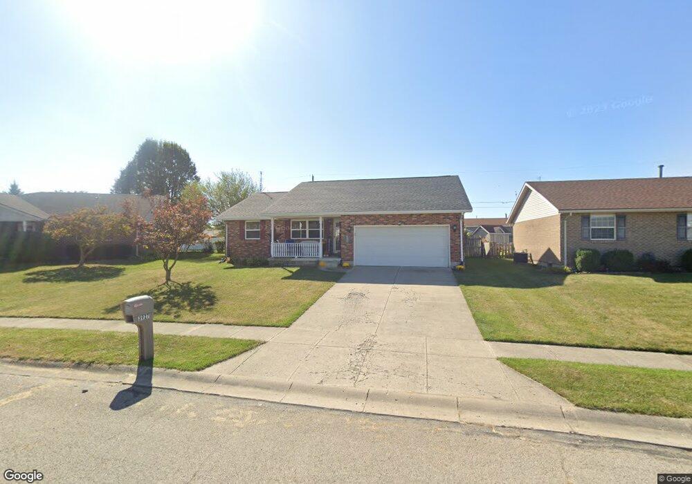
3927 Delmar Cir Springfield, OH 45503
Estimated Value: $239,857 - $260,000
3
Beds
2
Baths
1,344
Sq Ft
$187/Sq Ft
Est. Value
About This Home
This home is located at 3927 Delmar Cir, Springfield, OH 45503 and is currently estimated at $250,714, approximately $186 per square foot. 3927 Delmar Cir is a home located in Clark County with nearby schools including Northridge Elementary School, Kenton Ridge Middle & High School, and Emmanuel Christian Academy.
Ownership History
Date
Name
Owned For
Owner Type
Purchase Details
Closed on
Jul 29, 2005
Sold by
Ramsey David and Ramsey Deborah E
Bought by
Haynes Cherie L
Current Estimated Value
Home Financials for this Owner
Home Financials are based on the most recent Mortgage that was taken out on this home.
Original Mortgage
$115,920
Outstanding Balance
$59,936
Interest Rate
5.71%
Mortgage Type
Fannie Mae Freddie Mac
Estimated Equity
$190,778
Purchase Details
Closed on
May 30, 1995
Sold by
Hoppes Builders & Dev Co
Bought by
Ramsey David and Ramsey Deborah
Create a Home Valuation Report for This Property
The Home Valuation Report is an in-depth analysis detailing your home's value as well as a comparison with similar homes in the area
Home Values in the Area
Average Home Value in this Area
Purchase History
| Date | Buyer | Sale Price | Title Company |
|---|---|---|---|
| Haynes Cherie L | $144,900 | -- | |
| Ramsey David | $93,200 | -- |
Source: Public Records
Mortgage History
| Date | Status | Borrower | Loan Amount |
|---|---|---|---|
| Open | Haynes Cherie L | $115,920 |
Source: Public Records
Tax History
| Year | Tax Paid | Tax Assessment Tax Assessment Total Assessment is a certain percentage of the fair market value that is determined by local assessors to be the total taxable value of land and additions on the property. | Land | Improvement |
|---|---|---|---|---|
| 2025 | $2,357 | $77,330 | $11,310 | $66,020 |
| 2024 | $2,280 | $53,910 | $10,010 | $43,900 |
| 2023 | $2,280 | $53,910 | $10,010 | $43,900 |
| 2022 | $2,288 | $53,910 | $10,010 | $43,900 |
| 2021 | $2,236 | $44,650 | $7,760 | $36,890 |
| 2020 | $2,238 | $44,650 | $7,760 | $36,890 |
| 2019 | $2,281 | $44,650 | $7,760 | $36,890 |
| 2018 | $2,556 | $47,890 | $7,120 | $40,770 |
| 2017 | $2,192 | $41,671 | $7,119 | $34,552 |
| 2016 | $2,177 | $41,671 | $7,119 | $34,552 |
| 2015 | $2,056 | $41,465 | $6,913 | $34,552 |
| 2014 | $2,056 | $41,465 | $6,913 | $34,552 |
| 2013 | $2,008 | $41,465 | $6,913 | $34,552 |
Source: Public Records
Map
Nearby Homes
- 1644 Delmar Dr
- 1415 Montego Dr
- 4256 Midfield St Unit 9
- 1503 Kingsgate Rd
- 1505 Kingsgate Rd
- 1811 Saint Andrews Ct
- 1500 Kingsgate Rd Unit 19430
- 1502 Kingsgate Rd Unit 19432
- 1500 Kingsgate Rd
- 1502 Kingsgate Rd
- 4322 Midfield St Unit 15
- 1507 Kingsgate Rd
- 3631 Kingsgate Ln
- 4446 Ridgewood Rd E Unit 3
- 1341 Student Ave
- 4028 Ryland Dr Unit 4028
- 1201 Kingsgate Rd
- 4577 Reno Ln Unit 2
- 1162 Kingsgate Rd
- 4652 Reno Ln Unit 15
- 3923 Delmar Cir
- 3931 Delmar Cir
- 3924 Tacoma St
- 3920 Tacoma St
- 3917 Delmar Cir
- 3930 Tacoma St
- 3928 Delmar Cir
- 3937 Delmar Cir
- 3912 Tacoma St
- 3936 Tacoma St
- 3920 Delmar Cir
- 3913 Delmar Cir
- 3941 Delmar Cir
- 3906 Tacoma St
- 3942 Tacoma St
- 3951 Delmar Cir
- 3916 Delmar Cir
- 3909 Delmar Cir
- 1714 Elaina Dr
- 3963 Delmar Cir
Your Personal Tour Guide
Ask me questions while you tour the home.