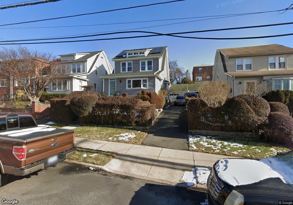
3928 Dyre Ave Bronx, NY 10466
Eastchester NeighborhoodEstimated Value: $538,000 - $706,000
Studio
--
Bath
1,536
Sq Ft
$397/Sq Ft
Est. Value
About This Home
This home is located at 3928 Dyre Ave, Bronx, NY 10466 and is currently estimated at $610,499, approximately $397 per square foot. 3928 Dyre Ave is a home located in Bronx County with nearby schools including Cornerstone Academy For Social Action, Baychester Middle School, and One World Middle School At Edenwald.
Ownership History
Date
Name
Owned For
Owner Type
Purchase Details
Closed on
Oct 18, 1999
Sold by
Mclaurin Alan C and Perez Carmen A
Bought by
Mclaurin Alan
Current Estimated Value
Home Financials for this Owner
Home Financials are based on the most recent Mortgage that was taken out on this home.
Original Mortgage
$133,500
Interest Rate
7.71%
Purchase Details
Closed on
Jun 4, 1992
Sold by
Carosella Beatrice and Carosella Joseph
Bought by
Mclaurin Alan C and Perez Carmen A
Create a Home Valuation Report for This Property
The Home Valuation Report is an in-depth analysis detailing your home's value as well as a comparison with similar homes in the area
Home Values in the Area
Average Home Value in this Area
Purchase History
We collect this data history from publicly available records. To have your information removed, we recommend requesting removal directly through your county’s website.
| Date | Buyer | Sale Price | Title Company |
|---|---|---|---|
| Mclaurin Alan | -- | Sovereign Title Company | |
| Mclaurin Alan | -- | Sovereign Title Company | |
| Mclaurin Alan C | -- | -- | |
| Mclaurin Alan C | -- | -- |
Source: Public Records
Mortgage History
We collect this data history from publicly available records. To have your information removed, we recommend requesting removal directly through your county’s website.
| Date | Status | Borrower | Loan Amount |
|---|---|---|---|
| Closed | Mclaurin Alan | $133,500 |
Source: Public Records
Tax History
| Year | Tax Paid | Tax Assessment Tax Assessment Total Assessment is a certain percentage of the fair market value that is determined by local assessors to be the total taxable value of land and additions on the property. | Land | Improvement |
|---|---|---|---|---|
| 2026 | $5,320 | $27,907 | $6,685 | $21,222 |
| 2025 | $5,282 | $27,907 | $8,057 | $19,850 |
| 2024 | $5,282 | $27,696 | $9,140 | $18,556 |
| 2023 | $5,022 | $26,129 | $7,636 | $18,493 |
| 2022 | $3,680 | $34,620 | $9,960 | $24,660 |
| 2021 | $4,591 | $31,920 | $9,960 | $21,960 |
| 2020 | $3,672 | $27,780 | $9,960 | $17,820 |
| 2019 | $3,581 | $27,780 | $9,960 | $17,820 |
| 2018 | $4,141 | $21,774 | $7,287 | $14,487 |
| 2017 | $3,888 | $20,542 | $8,461 | $12,081 |
| 2016 | $3,564 | $19,380 | $9,960 | $9,420 |
| 2015 | $2,762 | $19,560 | $9,300 | $10,260 |
| 2014 | $2,762 | $19,560 | $9,300 | $10,260 |
Source: Public Records
Map
Nearby Homes
- 3946 Secor Ave
- 3814 Secor Ave
- 4044 Harper Ave
- 6 Johnson St
- 47 Saint Pauls Place
- 3919 Pratt Ave
- 3924 Duryea Ave
- 2110 Light St
- 3704 Harper Ave
- 3964 Duryea Ave
- 3968 Duryea Ave
- 15 Saint Pauls Place
- 15 Washington Blvd
- 724 S 4th Ave
- 1389 E 233rd St
- 3963 Seton Ave
- 29 Bell Ave
- 646 S 3rd Ave
- 9 Harper Ct
- 138 W Kingsbridge Rd
- 3929 Rombouts Ave
- 3933 Rombouts Ave
- 3925 Rombouts Ave
- 3939 Rombouts Ave
- 3923 Rombouts Ave
- 3932 Dyre Ave
- 3934 Dyre Ave
- 3926 Dyre Ave
- 3919 Rombouts Ave
- 3936 Dyre Ave
- 3976 Rombouts Ave
- 3922 Dyre Ave Unit 2
- 3922 Dyre Ave Unit 1
- 3922 Dyre Ave
- 3980 Rombouts Ave
- 3972 Rombouts Ave
- 3984 Rombouts Ave
- 3917 Rombouts Ave
- 3966 Rombouts Ave
- 3949 Rombouts Ave Unit 1
Your Personal Tour Guide
Ask me questions while you tour the home.