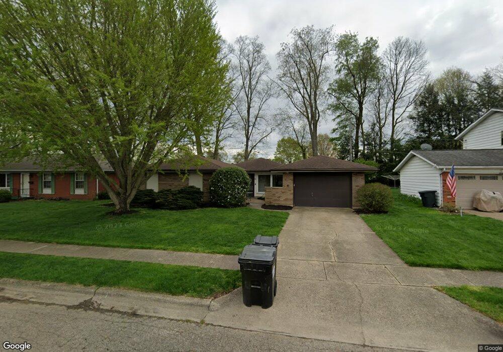
393 Alford Dr Newark, OH 43055
Estimated Value: $239,327 - $271,000
About This Home
This home is located at 393 Alford Dr, Newark, OH 43055 and is currently estimated at $261,582, approximately $207 per square foot. 393 Alford Dr is a home located in Licking County with nearby schools including John Clem Elementary School, Liberty Middle School, and Newark High School.
Ownership History
We collect this data history from publicly available records. To have your information removed, we recommend requesting removal directly through your county’s website.
Purchase Details
Purchase Details
Home Financials for this Owner
Home Financials are based on the most recent Mortgage that was taken out on this home.Home Values in the Area
Average Home Value in this Area
Purchase History
We collect this data history from publicly available records. To have your information removed, we recommend requesting removal directly through your county’s website.
| Date | Buyer | Sale Price | Title Company |
|---|---|---|---|
| -- | Attorney | ||
| $104,900 | Attorney |
Mortgage History
We collect this data history from publicly available records. To have your information removed, we recommend requesting removal directly through your county’s website.
| Date | Status | Borrower | Loan Amount |
|---|---|---|---|
| Open | $83,920 |
Tax History
We collect this data history from publicly available records. To have your information removed, we recommend requesting removal directly through your county’s website.
| Year | Tax Paid | Tax Assessment Tax Assessment Total Assessment is a certain percentage of the fair market value that is determined by local assessors to be the total taxable value of land and additions on the property. | Land | Improvement |
|---|---|---|---|---|
| 2025 | $1,613 | $58,770 | $18,030 | $40,740 |
| 2024 | $1,751 | $58,770 | $18,030 | $40,740 |
| 2023 | $1,771 | $58,770 | $18,030 | $40,740 |
| 2022 | $1,597 | $48,550 | $10,260 | $38,290 |
| 2021 | $1,675 | $48,550 | $10,260 | $38,290 |
| 2020 | $1,716 | $48,550 | $10,260 | $38,290 |
| 2019 | $1,331 | $38,510 | $7,880 | $30,630 |
| 2018 | $1,332 | $0 | $0 | $0 |
| 2017 | $1,276 | $0 | $0 | $0 |
| 2016 | $1,146 | $0 | $0 | $0 |
| 2015 | $1,171 | $0 | $0 | $0 |
| 2014 | $2,019 | $0 | $0 | $0 |
| 2013 | $1,166 | $0 | $0 | $0 |
Map
- 325 Stare Rd
- 913 Roosevelt Ct
- 584 Moull St Unit A
- 391 Moull St
- 916 Lateglow Ct
- 247 Rugg Ave
- 639 Taft Ave
- 525 W Shields St
- 712 Meadow Dr
- 976 Kingsbury Ct
- 413 Sherwood Dr W
- 785 Midway Dr
- 905 Shelbourne Place
- 855 E Village Dr
- 210 W Shields St
- 574 Mount Vernon Rd
- 574 Blakeley Place Unit 574
- 82 Moull St
- 361 Granville St
- 328 Eddy St
- 401 Alford Dr
- 385 Alford Dr
- 407 Alford Dr
- 379 Alford Dr
- 392 Alford Dr
- 472 Meadowbrook Dr
- 480 Meadowbrook Dr
- 380 Alford Dr
- 462 Meadowbrook Dr
- 415 Alford Dr
- 371 Alford Dr
- 488 Meadowbrook Dr
- 627 Canterbury Ct
- 412 Alford Dr
- 440 Reverie Place
- 626 Kennedy St
- 421 Alford Dr
- 365 Alford Dr
- 494 Meadowbrook Dr
- 626 Canterbury Ct
Ask me questions while you tour the home.