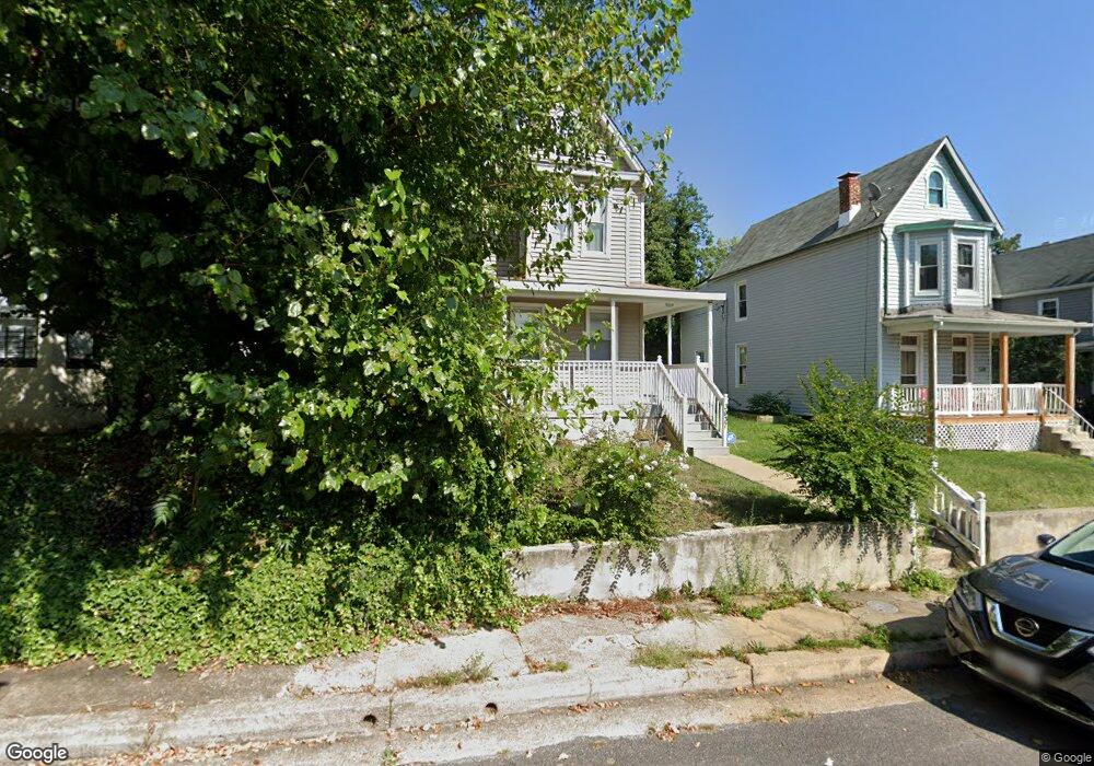
3937 Lowndes Ave Baltimore, MD 21218
Pen Lucy NeighborhoodEstimated Value: $199,203 - $213,000
Studio
2
Baths
1,140
Sq Ft
$181/Sq Ft
Est. Value
About This Home
This home is located at 3937 Lowndes Ave, Baltimore, MD 21218 and is currently estimated at $206,102, approximately $180 per square foot. 3937 Lowndes Ave is a home located in Baltimore City with nearby schools including Walter P. Carter Elementary School, Booker T. Washington Middle School, and Paul Laurence Dunbar High School.
Ownership History
Date
Name
Owned For
Owner Type
Purchase Details
Closed on
May 23, 2001
Sold by
Johnson Paul C
Bought by
Harrison Vandell
Current Estimated Value
Purchase Details
Closed on
Apr 24, 2000
Sold by
Secretary Of Housing
Bought by
Secretary Of Housing and Urban Development , The
Purchase Details
Closed on
Sep 9, 1999
Sold by
Southwick Christopher D
Bought by
Secretary Of Housing and Urban Development , The
Create a Home Valuation Report for This Property
The Home Valuation Report is an in-depth analysis detailing your home's value as well as a comparison with similar homes in the area
Home Values in the Area
Average Home Value in this Area
Purchase History
| Date | Buyer | Sale Price | Title Company |
|---|---|---|---|
| Harrison Vandell | $73,500 | -- | |
| Secretary Of Housing | $19,000 | -- | |
| Secretary Of Housing | $36,000 | -- |
Source: Public Records
Tax History
| Year | Tax Paid | Tax Assessment Tax Assessment Total Assessment is a certain percentage of the fair market value that is determined by local assessors to be the total taxable value of land and additions on the property. | Land | Improvement |
|---|---|---|---|---|
| 2025 | $2,846 | $131,200 | $30,000 | $101,200 |
| 2024 | $2,846 | $121,167 | -- | -- |
| 2023 | $2,610 | $111,133 | $0 | $0 |
| 2022 | $2,386 | $101,100 | $30,000 | $71,100 |
| 2021 | $2,386 | $101,100 | $30,000 | $71,100 |
| 2020 | $2,185 | $101,100 | $30,000 | $71,100 |
| 2019 | $2,196 | $102,200 | $30,000 | $72,200 |
| 2018 | $2,231 | $102,200 | $30,000 | $72,200 |
| 2017 | $2,255 | $102,200 | $0 | $0 |
| 2016 | $1,649 | $102,200 | $0 | $0 |
| 2015 | $1,649 | $102,200 | $0 | $0 |
| 2014 | $1,649 | $102,200 | $0 | $0 |
Source: Public Records
Map
Nearby Homes
- 3953 Wilsby Ave
- 3936 Lowndes Ave
- 665 Dumbarton Ave
- 658 Dumbarton Ave
- 4010 Wilsby Ave
- 3809 Ellerslie Ave
- 923 N Hill Rd
- 631 Cator Ave
- 918 Argonne Dr
- 3807 Old York Rd
- 611 Cator Ave
- 3907 Rexmere Rd
- 3825 Elkader Rd
- 822 E 41st St
- 712 E 41st St
- 609 E 41st St
- 605 Parkwyrth Ave
- 819 Belgian Ave
- 827 Belgian Ave
- 608 Chestnut Hill Ave
- 3941 Lowndes Ave
- 3935 Lowndes Ave
- 3933 Lowndes Ave
- 700 Argonne Dr
- 701 Wyanoke Ave
- 702 Argonne Dr
- 630 Wyanoke Ave
- 3938 Lowndes Ave
- 3948 Wilsby Ave
- 628 Wyanoke Ave
- 3940 Lowndes Ave
- 3934 Lowndes Ave
- 626 Wyanoke Ave
- 3950 Wilsby Ave
- 3932 Lowndes Ave
- 800 Argonne Dr
- 743 Argonne Dr
- 802 Argonne Dr
- 741 Argonne Dr
- 3954 Wilsby Ave
Your Personal Tour Guide
Ask me questions while you tour the home.