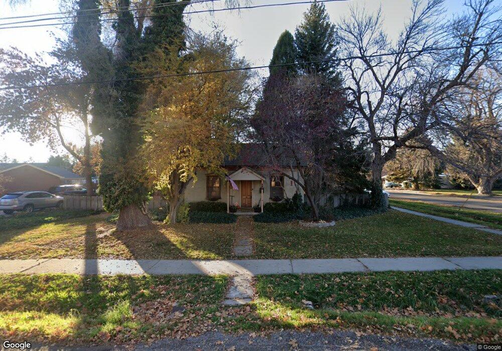
395 N 200 E American Fork, UT 84003
Estimated Value: $367,000 - $430,000
1
Bed
1
Bath
876
Sq Ft
$443/Sq Ft
Est. Value
About This Home
This home is located at 395 N 200 E, American Fork, UT 84003 and is currently estimated at $387,757, approximately $442 per square foot. 395 N 200 E is a home located in Utah County with nearby schools including Forbes Elementary School, American Fork Junior High School, and American Fork High School.
Ownership History
Date
Name
Owned For
Owner Type
Purchase Details
Closed on
Apr 17, 2017
Sold by
Aycock Claudia J
Bought by
Zobell Trevor Wade and Wilson Casey Kent
Current Estimated Value
Home Financials for this Owner
Home Financials are based on the most recent Mortgage that was taken out on this home.
Original Mortgage
$155,567
Outstanding Balance
$129,064
Interest Rate
4.1%
Mortgage Type
New Conventional
Estimated Equity
$258,694
Purchase Details
Closed on
Jul 25, 2006
Sold by
Hampton Shannon S
Bought by
Snyder Shannon C
Create a Home Valuation Report for This Property
The Home Valuation Report is an in-depth analysis detailing your home's value as well as a comparison with similar homes in the area
Home Values in the Area
Average Home Value in this Area
Purchase History
| Date | Buyer | Sale Price | Title Company |
|---|---|---|---|
| Zobell Trevor Wade | -- | Access Title Co | |
| Snyder Shannon C | -- | None Available |
Source: Public Records
Mortgage History
| Date | Status | Borrower | Loan Amount |
|---|---|---|---|
| Open | Zobell Trevor Wade | $155,567 |
Source: Public Records
Tax History
| Year | Tax Paid | Tax Assessment Tax Assessment Total Assessment is a certain percentage of the fair market value that is determined by local assessors to be the total taxable value of land and additions on the property. | Land | Improvement |
|---|---|---|---|---|
| 2025 | $1,480 | $180,125 | -- | -- |
| 2024 | $1,480 | $164,395 | $0 | $0 |
| 2023 | $1,364 | $160,710 | $0 | $0 |
| 2022 | $1,535 | $178,475 | $0 | $0 |
| 2021 | $1,302 | $236,400 | $144,500 | $91,900 |
| 2020 | $1,211 | $213,300 | $129,000 | $84,300 |
| 2019 | $1,070 | $194,900 | $121,600 | $73,300 |
| 2018 | $1,001 | $174,300 | $110,600 | $63,700 |
| 2017 | $950 | $89,265 | $0 | $0 |
| 2016 | $878 | $76,670 | $0 | $0 |
| 2015 | -- | $76,670 | $0 | $0 |
| 2014 | $903 | $73,810 | $0 | $0 |
Source: Public Records
Map
Nearby Homes
Your Personal Tour Guide
Ask me questions while you tour the home.