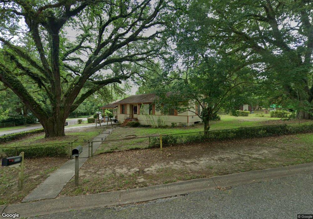
3951 Pickett Dr Mobile, AL 36618
Autumndale NeighborhoodEstimated Value: $110,270 - $150,000
3
Beds
2
Baths
1,530
Sq Ft
$87/Sq Ft
Est. Value
About This Home
This home is located at 3951 Pickett Dr, Mobile, AL 36618 and is currently estimated at $133,818, approximately $87 per square foot. 3951 Pickett Dr is a home located in Mobile County with nearby schools including Forest Hill Elementary School, CL Scarborough Middle School, and Mattie T Blount High School.
Ownership History
Date
Name
Owned For
Owner Type
Purchase Details
Closed on
Feb 4, 2011
Sold by
Chambers Leticia V and Lee Leticia C
Bought by
Banks Harold E and Banks Hedrice
Current Estimated Value
Home Financials for this Owner
Home Financials are based on the most recent Mortgage that was taken out on this home.
Original Mortgage
$71,947
Interest Rate
4.87%
Mortgage Type
FHA
Purchase Details
Closed on
Sep 18, 2000
Sold by
Chambers John W and Chambers Florine L
Bought by
Chambers Leticia V
Home Financials for this Owner
Home Financials are based on the most recent Mortgage that was taken out on this home.
Original Mortgage
$59,850
Interest Rate
9%
Create a Home Valuation Report for This Property
The Home Valuation Report is an in-depth analysis detailing your home's value as well as a comparison with similar homes in the area
Home Values in the Area
Average Home Value in this Area
Purchase History
| Date | Buyer | Sale Price | Title Company |
|---|---|---|---|
| Banks Harold E | $73,275 | None Available | |
| Chambers Leticia V | $63,350 | -- |
Source: Public Records
Mortgage History
| Date | Status | Borrower | Loan Amount |
|---|---|---|---|
| Closed | Banks Harold E | $71,947 | |
| Closed | Chambers Leticia V | $59,850 |
Source: Public Records
Tax History
| Year | Tax Paid | Tax Assessment Tax Assessment Total Assessment is a certain percentage of the fair market value that is determined by local assessors to be the total taxable value of land and additions on the property. | Land | Improvement |
|---|---|---|---|---|
| 2025 | $314 | $6,240 | $1,000 | $5,240 |
| 2024 | $314 | $5,670 | $1,000 | $4,670 |
| 2023 | $304 | $5,590 | $1,000 | $4,590 |
| 2022 | $272 | $5,340 | $1,000 | $4,340 |
| 2021 | $249 | $4,970 | $800 | $4,170 |
| 2020 | $237 | $4,770 | $600 | $4,170 |
| 2019 | $226 | $4,610 | $600 | $4,010 |
| 2018 | $226 | $4,620 | $0 | $0 |
| 2017 | $211 | $4,380 | $0 | $0 |
| 2016 | $347 | $6,520 | $0 | $0 |
| 2013 | -- | $6,400 | $0 | $0 |
Source: Public Records
Map
Nearby Homes
- 4060 Dickson Ln
- 2113 Cornell Dr
- 2205 Beau Terra Dr W
- 2004 Beau Terra Dr W
- 2210 Wolf Ridge Rd
- 0 Junius Ln
- 1758 La Pine Dr
- 1757 Le Grande Dr
- 871 Kuffskie Ln
- 4409 Eastview Dr
- 1561 Phillips Ln
- 1701 Phillips Ln
- 6632 Monarch Cir
- 21 Brucewood Dr W
- 3531 Anton St
- 3514 Anton St
- 6 Brucewood Dr W
- 4453 Myers Rd
- 1811 Butler St
- 3728 Vinewood Dr
- 2133 Hamilton Rd
- 2158 Wolf Ridge Rd
- 2154 Wolf Ridge Rd
- 2129 Hamilton Rd
- 3950 Pickett Dr
- 2132 Hamilton Rd
- 2150 Wolf Ridge Rd
- 2200 Hamilton Rd
- 2125 Hamilton Rd
- 2128 Hamilton Rd
- 3907 Pickett Dr
- 2132 Wolf Ridge Rd
- 2121 Hamilton Rd
- 2121 Hamilton Rd
- 3908 Pickett Dr
- 2128 Wolf Ridge Rd
- 2137 Baker Rd
- 2133 Baker Rd
- 2201 Wolf Ridge Rd
- 3904 Pickett Cir
Your Personal Tour Guide
Ask me questions while you tour the home.