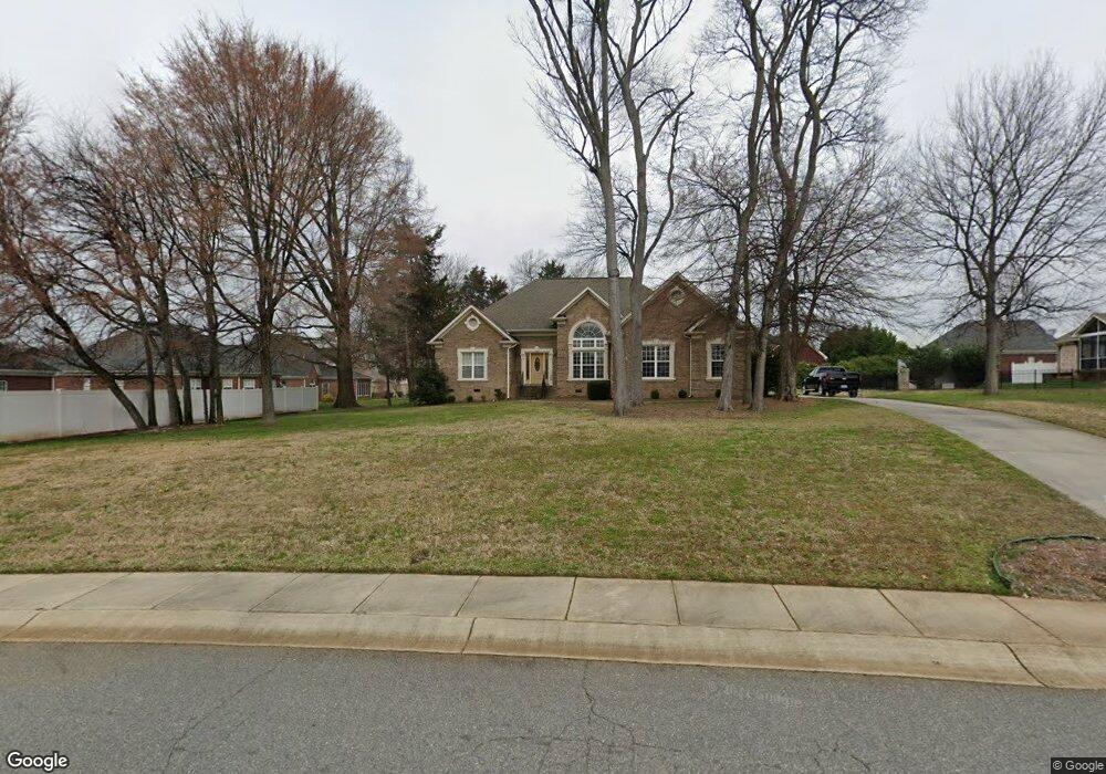
3959 Firethorne Ave SW Concord, NC 28027
Estimated Value: $457,000 - $520,000
3
Beds
2
Baths
2,267
Sq Ft
$212/Sq Ft
Est. Value
About This Home
This home is located at 3959 Firethorne Ave SW, Concord, NC 28027 and is currently estimated at $481,260, approximately $212 per square foot. 3959 Firethorne Ave SW is a home located in Cabarrus County with nearby schools including Pitts School Road Elementary School, Roberta Road Middle School, and Jay M. Robinson High School.
Ownership History
Date
Name
Owned For
Owner Type
Purchase Details
Closed on
Sep 17, 2002
Sold by
Mundt Robert M and Mundt Mary Ann A
Bought by
Carter Scott
Current Estimated Value
Home Financials for this Owner
Home Financials are based on the most recent Mortgage that was taken out on this home.
Original Mortgage
$33,768
Interest Rate
6.3%
Create a Home Valuation Report for This Property
The Home Valuation Report is an in-depth analysis detailing your home's value as well as a comparison with similar homes in the area
Home Values in the Area
Average Home Value in this Area
Purchase History
| Date | Buyer | Sale Price | Title Company |
|---|---|---|---|
| Carter Scott | $41,500 | -- |
Source: Public Records
Mortgage History
| Date | Status | Borrower | Loan Amount |
|---|---|---|---|
| Closed | Carter Scott | $33,768 |
Source: Public Records
Tax History
| Year | Tax Paid | Tax Assessment Tax Assessment Total Assessment is a certain percentage of the fair market value that is determined by local assessors to be the total taxable value of land and additions on the property. | Land | Improvement |
|---|---|---|---|---|
| 2025 | $4,334 | $435,160 | $100,000 | $335,160 |
| 2024 | $4,334 | $435,160 | $100,000 | $335,160 |
| 2023 | $3,414 | $279,840 | $65,000 | $214,840 |
| 2022 | $3,414 | $279,840 | $65,000 | $214,840 |
| 2021 | $3,414 | $279,840 | $65,000 | $214,840 |
| 2020 | $3,414 | $279,840 | $65,000 | $214,840 |
| 2019 | $3,125 | $256,130 | $55,000 | $201,130 |
| 2018 | $3,074 | $256,130 | $55,000 | $201,130 |
| 2017 | $3,022 | $256,130 | $55,000 | $201,130 |
| 2016 | $1,793 | $243,190 | $55,000 | $188,190 |
| 2015 | $2,870 | $243,190 | $55,000 | $188,190 |
| 2014 | $2,870 | $243,190 | $55,000 | $188,190 |
Source: Public Records
Map
Nearby Homes
- 706 King Fredrick Ln SW
- 4570 Lanstone Ct SW
- 781 King Fredrick Ln SW Unit 207
- 4463 Legend St SW
- 4122 Amarillo Dr SW
- 4178 Morris Burn Dr SW
- 4799 Morris Glen Dr SW
- 3947 Longwood Dr SW
- 3887 Longwood Dr SW
- 4476 Greystone Dr SW
- 4333 Glen Eagles Ln SW
- 4271 Maybrook Ct SW
- 248 Corrie Ann Dr
- 842 Treva Anne Dr SW
- 855 Juanita Dr SW
- 5421 Roberta Meadows Ct
- 278 Corrie Ann Dr
- 274 Corrie Ann Dr
- 270 Corrie Ann Dr
- 5361 Brickyard Terrace Ct
- 3953 Troon Dr SW
- 3949 Troon Dr SW
- 723 King Fredrick Ln SW
- 719 King Fredrick Ln SW
- 718 Old State St SW
- 722 Old State St SW
- 727 King Fredrick Ln SW
- 726 Old State St SW
- 3958 Firethorne Ave SW
- 707 King Fredrick Ln SW
- 3954 Firethorne Ave SW
- 720 King Fredrick Ln SW
- 716 King Fredrick Ln SW
- 3946 Troon Dr SW
- 3950 Troon Dr SW
- 717 Old State St SW
- 721 Old State St SW
- 737 King Fredrick Ln SW
- 713 Old State St SW
- 708 King Fredrick Ln SW
Your Personal Tour Guide
Ask me questions while you tour the home.