Estimated Value: $278,000 - $420,000
3
Beds
2
Baths
1,118
Sq Ft
$333/Sq Ft
Est. Value
About This Home
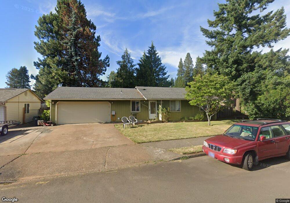
This home is located at 39825 Davis St, Sandy, OR 97055 and is currently estimated at $372,064, approximately $332 per square foot. 39825 Davis St is a home located in Clackamas County with nearby schools including Sandy Grade School, Cedar Ridge Middle School, and Sandy High School.
Ownership History
Date
Name
Owned For
Owner Type
Purchase Details
Closed on
Jul 30, 2025
Sold by
Swinehart Kandice A and Swinehart Bill T
Bought by
Kreger Kevin
Current Estimated Value
Home Financials for this Owner
Home Financials are based on the most recent Mortgage that was taken out on this home.
Original Mortgage
$260,000
Outstanding Balance
$257,963
Interest Rate
6.81%
Mortgage Type
New Conventional
Estimated Equity
$114,101
Purchase Details
Closed on
Mar 26, 2001
Sold by
Swinehart Kandice A
Bought by
Swinehart Kandice A and Swinehart Bill T
Create a Home Valuation Report for This Property
The Home Valuation Report is an in-depth analysis detailing your home's value as well as a comparison with similar homes in the area
Home Values in the Area
Average Home Value in this Area
Purchase History
We collect this data history from publicly available records. To have your information removed, we recommend requesting removal directly through your county’s website.
| Date | Buyer | Sale Price | Title Company |
|---|---|---|---|
| Kreger Kevin | $280,000 | First American Title | |
| Swinehart Kandice A | -- | -- |
Source: Public Records
Mortgage History
We collect this data history from publicly available records. To have your information removed, we recommend requesting removal directly through your county’s website.
| Date | Status | Borrower | Loan Amount |
|---|---|---|---|
| Open | Kreger Kevin | $260,000 |
Source: Public Records
Tax History
| Year | Tax Paid | Tax Assessment Tax Assessment Total Assessment is a certain percentage of the fair market value that is determined by local assessors to be the total taxable value of land and additions on the property. | Land | Improvement |
|---|---|---|---|---|
| 2025 | $2,952 | $172,094 | -- | -- |
| 2024 | $2,828 | $167,082 | -- | -- |
| 2023 | $2,828 | $162,216 | -- | -- |
| 2022 | $2,679 | $157,492 | $0 | $0 |
| 2021 | $2,587 | $152,905 | $0 | $0 |
| 2020 | $2,517 | $148,452 | $0 | $0 |
| 2019 | $2,493 | $144,129 | $0 | $0 |
| 2018 | $2,423 | $139,931 | $0 | $0 |
| 2017 | $2,364 | $135,855 | $0 | $0 |
| 2016 | $2,283 | $131,898 | $0 | $0 |
| 2015 | $2,218 | $128,056 | $0 | $0 |
| 2014 | $2,160 | $124,326 | $0 | $0 |
Source: Public Records
Map
Nearby Homes
- 17840 Wolf Dr
- 18015 Davis St
- 39465 Proctor Blvd
- 18010 SE Langensand Rd
- 39475 Hood St
- 40348 Therese St
- 38915 Sandy Heights St
- 17150 SE Ten Eyck Rd
- 38909 Sandy Heights St
- 16860 Hoffman Ave
- 18659 Van Fleet Ave
- 39576 Trillium St
- 41035 SE Coalman Rd
- 38791 Sawyer St
- 41051 SE Coalman Rd
- 17271 Scales Ave
- 0 SE Coalman Rd
- 38565 Pleasant St
- 18307 Tupper Rd
- 19000 SE Bornstedt Rd Unit A2
- 39855 Davis St
- 39825 Mccormick Dr
- 39870 Mccormick Dr
- 39800 Mccormick Dr
- 39875 Davis St
- 39840 Davis St
- 39800 Davis St
- 39900 Mccormick Dr
- 39910 Mccormick Dr
- 0 Mccormick Dr
- 39770 Davis St
- 39780 Mccormick Dr
- 39860 Davis St
- 39755 Davis St
- 39895 Davis St
- 39760 Davis St
- 39930 Mccormick Dr
- 39750 Mccormick Dr
- 17820 Davis Dr
- 17795 Van Fleet Ave
Your Personal Tour Guide
Ask me questions while you tour the home.