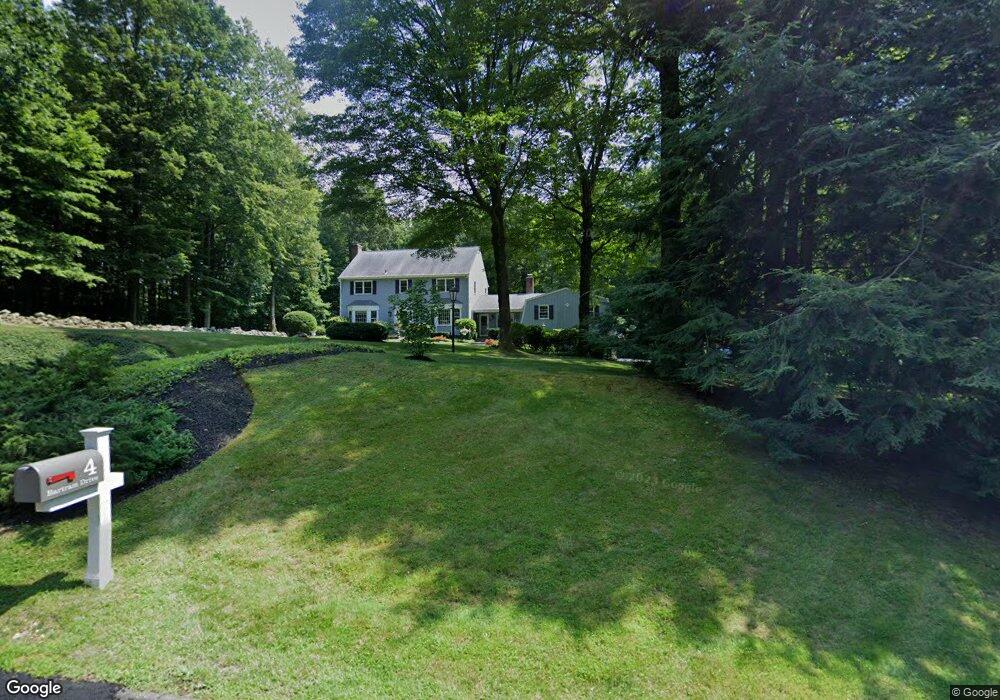
4 Bartram Dr Redding, CT 06896
Estimated Value: $1,006,911 - $1,110,000
About This Home
This home is located at 4 Bartram Dr, Redding, CT 06896 and is currently estimated at $1,062,978, approximately $289 per square foot. 4 Bartram Dr is a home located in Fairfield County with nearby schools including Redding Elementary School, John Read Middle School, and Joel Barlow High School.
Ownership History
We collect this data history from publicly available records. To have your information removed, we recommend requesting removal directly through your county’s website.
Purchase Details
Purchase Details
Home Values in the Area
Average Home Value in this Area
Purchase History
We collect this data history from publicly available records. To have your information removed, we recommend requesting removal directly through your county’s website.
| Date | Buyer | Sale Price | Title Company |
|---|---|---|---|
| -- | -- | ||
| -- | -- |
Mortgage History
We collect this data history from publicly available records. To have your information removed, we recommend requesting removal directly through your county’s website.
| Date | Status | Borrower | Loan Amount |
|---|---|---|---|
| Previous Owner | $60,000 |
Tax History
We collect this data history from publicly available records. To have your information removed, we recommend requesting removal directly through your county’s website.
| Year | Tax Paid | Tax Assessment Tax Assessment Total Assessment is a certain percentage of the fair market value that is determined by local assessors to be the total taxable value of land and additions on the property. | Land | Improvement |
|---|---|---|---|---|
| 2025 | $15,822 | $535,600 | $154,000 | $381,600 |
| 2024 | $15,382 | $535,600 | $154,000 | $381,600 |
| 2023 | $14,831 | $535,600 | $154,000 | $381,600 |
| 2022 | $14,383 | $431,400 | $166,300 | $265,100 |
| 2021 | $14,167 | $431,400 | $166,300 | $265,100 |
| 2020 | $14,167 | $431,400 | $166,300 | $265,100 |
| 2019 | $6,217 | $431,400 | $166,300 | $265,100 |
| 2018 | $13,684 | $431,400 | $166,300 | $265,100 |
| 2017 | $13,030 | $439,900 | $181,900 | $258,000 |
| 2016 | $12,863 | $439,900 | $181,900 | $258,000 |
| 2015 | $12,718 | $439,900 | $181,900 | $258,000 |
| 2014 | $12,718 | $439,900 | $181,900 | $258,000 |
Map
- 5 Musket Ln
- 127 Limekiln Rd
- 162 Lonetown Rd
- 138 Putnam Park Rd
- 127 Putnam Park Rd
- 76 Pocahontas Rd
- 2 Longwood Dr
- 134 Nashville Rd
- 27 Nashville Road Extension
- 24 Costa Ln
- 10 Chapman Place
- 143 Nashville Rd
- 13 Aunt Pattys Ln W
- 172 Gallows Hill Rd
- 8 Church Camp Ground
- 97 Nashville Rd
- 9 New Light Dr
- 31 Aunt Pattys Ln W
- 32 Whippoorwill Rd
- 44 High Ridge Rd
- 3 Bartram Dr
- 10 Bartram Dr
- 212 Lonetown Rd
- 222 Lonetown Rd
- 215 Lonetown Rd
- 221 Lonetown Rd
- 11 Bartram Dr
- 16 Bartram Dr
- 233 Lonetown Rd
- 210 Lonetown Rd
- 228 Lonetown Rd
- 15 Bartram Dr
- 230 Lonetown Rd
- 209 Lonetown Rd
- 8 Dittmar Rd
- 204 Lonetown Rd
- 207 Lonetown Rd
- 232 Lonetown Rd
- 17 Dittmar Rd
- 28 Dittmar Rd
Ask me questions while you tour the home.