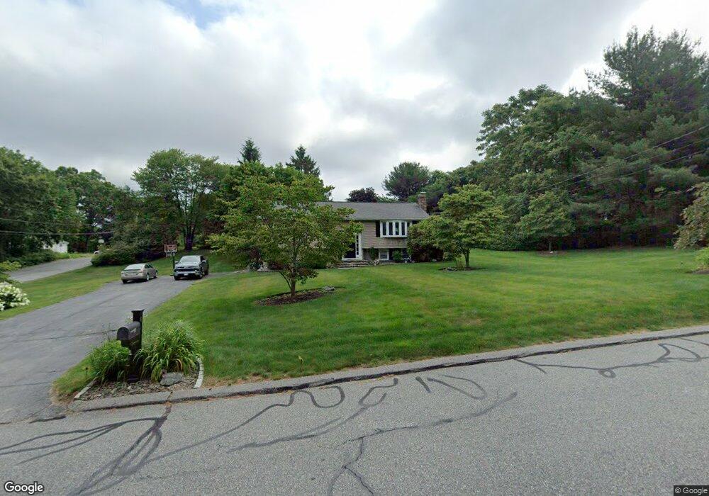
4 Braney Rd Millbury, MA 01527
Estimated Value: $494,610 - $570,000
3
Beds
3
Baths
1,258
Sq Ft
$420/Sq Ft
Est. Value
About This Home
This home is located at 4 Braney Rd, Millbury, MA 01527 and is currently estimated at $528,153, approximately $419 per square foot. 4 Braney Rd is a home located in Worcester County with nearby schools including Elmwood Street Elementary School, Raymond E. Shaw Elementary School, and Millbury Junior/Senior High School.
Ownership History
Date
Name
Owned For
Owner Type
Purchase Details
Closed on
Jul 15, 2002
Sold by
Guerin Normand P and Guerin Sylvia M
Bought by
Gilbert Jeffrey M and Gilbert Kim M
Current Estimated Value
Home Financials for this Owner
Home Financials are based on the most recent Mortgage that was taken out on this home.
Original Mortgage
$192,000
Interest Rate
6.79%
Mortgage Type
Purchase Money Mortgage
Create a Home Valuation Report for This Property
The Home Valuation Report is an in-depth analysis detailing your home's value as well as a comparison with similar homes in the area
Home Values in the Area
Average Home Value in this Area
Purchase History
| Date | Buyer | Sale Price | Title Company |
|---|---|---|---|
| Gilbert Jeffrey M | $240,000 | -- | |
| Gilbert Jeffrey M | $240,000 | -- |
Source: Public Records
Mortgage History
| Date | Status | Borrower | Loan Amount |
|---|---|---|---|
| Open | Gilbert Jeffrey M | $203,000 | |
| Closed | Gilbert Jeffrey M | $192,000 | |
| Previous Owner | Gilbert Jeffrey M | $137,000 |
Source: Public Records
Tax History
| Year | Tax Paid | Tax Assessment Tax Assessment Total Assessment is a certain percentage of the fair market value that is determined by local assessors to be the total taxable value of land and additions on the property. | Land | Improvement |
|---|---|---|---|---|
| 2025 | $6,201 | $463,100 | $124,900 | $338,200 |
| 2024 | $5,697 | $430,600 | $115,600 | $315,000 |
| 2023 | $5,245 | $363,000 | $80,900 | $282,100 |
| 2022 | $4,905 | $327,000 | $80,900 | $246,100 |
| 2021 | $4,833 | $313,200 | $80,900 | $232,300 |
| 2020 | $4,953 | $323,100 | $80,900 | $242,200 |
| 2019 | $4,658 | $293,900 | $80,500 | $213,400 |
| 2018 | $4,611 | $282,200 | $80,500 | $201,700 |
| 2017 | $4,296 | $261,500 | $84,000 | $177,500 |
| 2016 | $3,977 | $241,600 | $84,000 | $157,600 |
| 2015 | $3,977 | $241,600 | $89,500 | $152,100 |
| 2014 | $3,976 | $232,500 | $89,500 | $143,000 |
Source: Public Records
Map
Nearby Homes
- Lot 1 Cooper Rd
- 8 Autumn Gate Cir
- 46 Lexington Rd
- 2 Riverlin Pkwy
- 28 Cortland Way
- 2 Granite St
- 26 Leslie Ln
- 7 Canal St
- 17 Lincoln Ave
- 18 Lincoln Ave
- 9 Danielle Dr
- 75 Potter Hill Rd
- 75 Main St
- 2 Jessica j Dr
- 57 Barbara Jean St
- 8 Sycamore Cir
- 8 Sullivan Place
- 2 Wilson Rd Unit B
- 2 Wilson Rd Unit A
- 5 Mogren Dr
Your Personal Tour Guide
Ask me questions while you tour the home.