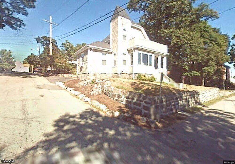
4 Carlmark St Quincy, MA 02169
South Quincy NeighborhoodEstimated Value: $539,000 - $593,778
3
Beds
1
Bath
1,054
Sq Ft
$531/Sq Ft
Est. Value
About This Home
This home is located at 4 Carlmark St, Quincy, MA 02169 and is currently estimated at $559,445, approximately $530 per square foot. 4 Carlmark St is a home located in Norfolk County with nearby schools including South West Middle School, Lincoln-Hancock Community School, and Quincy High School.
Ownership History
Date
Name
Owned For
Owner Type
Purchase Details
Closed on
Jun 28, 2002
Sold by
Cleary Paul F
Bought by
Ryan Christine L and Ryan Michael J
Current Estimated Value
Home Financials for this Owner
Home Financials are based on the most recent Mortgage that was taken out on this home.
Original Mortgage
$150,000
Interest Rate
6.92%
Mortgage Type
Purchase Money Mortgage
Purchase Details
Closed on
Jan 5, 1988
Sold by
Davidson Geoffrey A
Bought by
Cleary Paul F
Home Financials for this Owner
Home Financials are based on the most recent Mortgage that was taken out on this home.
Original Mortgage
$106,400
Interest Rate
10.59%
Mortgage Type
Purchase Money Mortgage
Purchase Details
Closed on
Oct 23, 1987
Sold by
Gauld Janet E
Bought by
Muir Rt
Home Financials for this Owner
Home Financials are based on the most recent Mortgage that was taken out on this home.
Original Mortgage
$120,000
Interest Rate
10.92%
Mortgage Type
Purchase Money Mortgage
Create a Home Valuation Report for This Property
The Home Valuation Report is an in-depth analysis detailing your home's value as well as a comparison with similar homes in the area
Home Values in the Area
Average Home Value in this Area
Purchase History
| Date | Buyer | Sale Price | Title Company |
|---|---|---|---|
| Ryan Christine L | $187,500 | -- | |
| Cleary Paul F | $133,000 | -- | |
| Muir Rt | $150,000 | -- |
Source: Public Records
Mortgage History
| Date | Status | Borrower | Loan Amount |
|---|---|---|---|
| Open | Muir Rt | $150,000 | |
| Closed | Ryan Christine L | $150,000 | |
| Previous Owner | Muir Rt | $106,400 | |
| Previous Owner | Muir Rt | $120,000 |
Source: Public Records
Tax History
| Year | Tax Paid | Tax Assessment Tax Assessment Total Assessment is a certain percentage of the fair market value that is determined by local assessors to be the total taxable value of land and additions on the property. | Land | Improvement |
|---|---|---|---|---|
| 2025 | $6,496 | $563,400 | $296,300 | $267,100 |
| 2024 | $6,073 | $538,900 | $282,200 | $256,700 |
| 2023 | $5,558 | $499,400 | $256,600 | $242,800 |
| 2022 | $5,379 | $449,000 | $213,800 | $235,200 |
| 2021 | $5,092 | $419,400 | $213,800 | $205,600 |
| 2020 | $4,953 | $398,500 | $213,800 | $184,700 |
| 2019 | $4,813 | $383,500 | $201,700 | $181,800 |
| 2018 | $4,669 | $350,000 | $186,800 | $163,200 |
| 2017 | $4,661 | $328,900 | $177,900 | $151,000 |
| 2016 | $4,248 | $295,800 | $154,700 | $141,100 |
| 2015 | $4,138 | $283,400 | $154,700 | $128,700 |
| 2014 | $4,043 | $272,100 | $154,700 | $117,400 |
Source: Public Records
Map
Nearby Homes
- 211 Copeland St
- 165 Whitwell St
- 283 Copeland St
- 312 Adams St
- 156 West St
- 43 Dixwell Ave
- 51 Branch St Unit 3
- 452 Quarry St
- 211 West St Unit 11B
- 211 West St Unit 4B
- 211 West St Unit 12B
- 8 Jackson St Unit B1
- 8 Jackson St Unit B4
- 14 Hall Place Unit 2
- 195 Thomas Burgin Pkwy Unit 301
- 21 Totman St Unit 205
- 21 Totman St Unit 403
- 21 Totman St Unit 301
- 21 Totman St Unit 204
- 56 Penn St Unit 4
- 30 Nelson St
- 30 Nelson St Unit 1
- 14 Nelson St
- 14 Nelson St Unit 2
- 14 Nelson St Unit 14
- 10 Carlmark St
- 21 -23 Nelson St
- 19 Nelson St Unit 6
- 19 Nelson St
- 19 Nelson St Unit 3
- 19 Nelson St Unit 4
- 19 Nelson St Unit 2
- 15 Nelson St
- 15 Nelson St Unit 1
- 27 Nelson St
- 29 Nelson St
- 29 Nelson St Unit 2
- 29 Nelson St Unit 3
- 36 Nelson St
- 36 Nelson St Unit 1
Your Personal Tour Guide
Ask me questions while you tour the home.