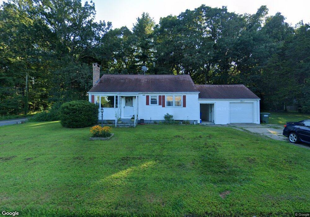
4 Carol Dr Uncasville, CT 06382
Estimated Value: $324,000 - $366,000
3
Beds
1
Bath
1,080
Sq Ft
$315/Sq Ft
Est. Value
About This Home
This home is located at 4 Carol Dr, Uncasville, CT 06382 and is currently estimated at $340,416, approximately $315 per square foot. 4 Carol Dr is a home located in New London County with nearby schools including Leonard J. Tyl Middle School, Montville High School, and Bradley School-New London Regional.
Ownership History
Date
Name
Owned For
Owner Type
Purchase Details
Closed on
Jun 28, 2016
Sold by
Edgar John B and Edgar Lee A
Bought by
Edgar Michael P
Current Estimated Value
Home Financials for this Owner
Home Financials are based on the most recent Mortgage that was taken out on this home.
Original Mortgage
$161,000
Outstanding Balance
$128,485
Interest Rate
3.57%
Mortgage Type
Purchase Money Mortgage
Estimated Equity
$211,931
Purchase Details
Closed on
Sep 5, 2008
Sold by
Golart Carol M and Faraci John M
Bought by
Edgar John B and Edgar Lee Ann
Home Financials for this Owner
Home Financials are based on the most recent Mortgage that was taken out on this home.
Original Mortgage
$125,000
Interest Rate
6.41%
Create a Home Valuation Report for This Property
The Home Valuation Report is an in-depth analysis detailing your home's value as well as a comparison with similar homes in the area
Home Values in the Area
Average Home Value in this Area
Purchase History
| Date | Buyer | Sale Price | Title Company |
|---|---|---|---|
| Edgar Michael P | $170,000 | -- | |
| Edgar Michael P | $170,000 | -- | |
| Edgar John B | $97,000 | -- | |
| Faraci David J | $97,000 | -- | |
| Edgar John B | $97,000 | -- |
Source: Public Records
Mortgage History
| Date | Status | Borrower | Loan Amount |
|---|---|---|---|
| Open | Edgar Michael P | $161,000 | |
| Closed | Edgar Michael P | $161,000 | |
| Previous Owner | Edgar John B | $125,000 | |
| Previous Owner | Edgar John B | $125,000 |
Source: Public Records
Tax History
| Year | Tax Paid | Tax Assessment Tax Assessment Total Assessment is a certain percentage of the fair market value that is determined by local assessors to be the total taxable value of land and additions on the property. | Land | Improvement |
|---|---|---|---|---|
| 2025 | $3,729 | $129,150 | $30,240 | $98,910 |
| 2024 | $3,586 | $129,150 | $30,240 | $98,910 |
| 2023 | $3,586 | $129,150 | $30,240 | $98,910 |
| 2022 | $3,450 | $129,150 | $30,240 | $98,910 |
| 2021 | $2,284 | $98,730 | $31,530 | $67,200 |
| 2020 | $3,197 | $98,730 | $31,530 | $67,200 |
| 2019 | $2,284 | $98,730 | $31,530 | $67,200 |
| 2018 | $2,213 | $98,730 | $31,530 | $67,200 |
| 2017 | $3,130 | $98,730 | $31,530 | $67,200 |
| 2016 | $3,118 | $101,860 | $39,450 | $62,410 |
| 2015 | $3,065 | $101,860 | $39,450 | $62,410 |
| 2014 | $2,992 | $101,860 | $39,450 | $62,410 |
Source: Public Records
Map
Nearby Homes
- 320 Maple Ave
- 355 Route 163
- 0 Monahan Dr
- 76 Gay Hill Rd
- 79 Cottonwood Ln
- 31 Bridge St
- 2 Fawns Meadow Rd
- 66 Rainbow Dr
- 18 Hillcrest Dr
- 82C Pires Dr
- 901 Old Colchester Rd
- 4 Pequot Rd
- 19 Moxley Rd
- 16 Greystone Dr
- 107 Woodland Dr Unit B
- 11 Mayo Ave
- 11 Blumenthal Dr
- 63 Velgouse Rd
- 4 Brewer St
- 1040 E Lake Rd
Your Personal Tour Guide
Ask me questions while you tour the home.