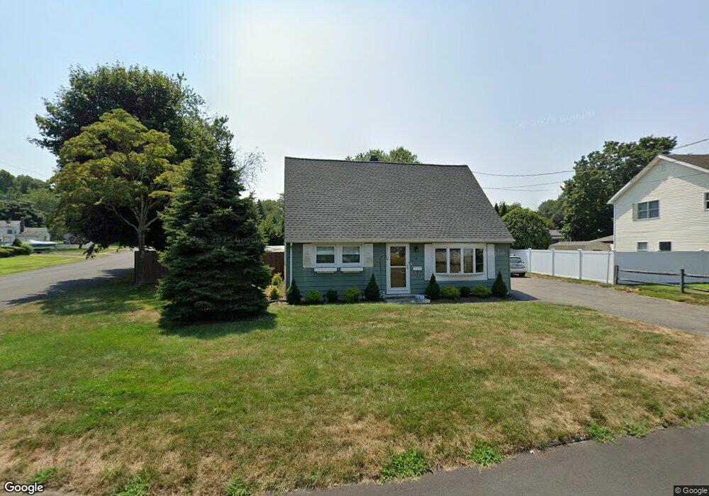
4 Dalton Rd Milford, CT 06460
East Milford NeighborhoodEstimated Value: $407,000 - $513,000
4
Beds
1
Bath
1,238
Sq Ft
$382/Sq Ft
Est. Value
About This Home
This home is located at 4 Dalton Rd, Milford, CT 06460 and is currently estimated at $473,309, approximately $382 per square foot. 4 Dalton Rd is a home located in New Haven County with nearby schools including Orchard Hills School, East Shore Middle School, and Joseph A. Foran High School.
Ownership History
Date
Name
Owned For
Owner Type
Purchase Details
Closed on
Nov 12, 2002
Sold by
Mcginnelly William J and Mcginnelly Joan H
Bought by
Cunningham Dean P
Current Estimated Value
Create a Home Valuation Report for This Property
The Home Valuation Report is an in-depth analysis detailing your home's value as well as a comparison with similar homes in the area
Home Values in the Area
Average Home Value in this Area
Purchase History
| Date | Buyer | Sale Price | Title Company |
|---|---|---|---|
| Cunningham Dean P | $210,000 | -- | |
| Cunningham Dean P | $210,000 | -- |
Source: Public Records
Mortgage History
| Date | Status | Borrower | Loan Amount |
|---|---|---|---|
| Open | Cunningham Dean P | $247,363 | |
| Closed | Cunningham Dean P | $252,000 |
Source: Public Records
Tax History
| Year | Tax Paid | Tax Assessment Tax Assessment Total Assessment is a certain percentage of the fair market value that is determined by local assessors to be the total taxable value of land and additions on the property. | Land | Improvement |
|---|---|---|---|---|
| 2025 | $6,616 | $223,890 | $100,420 | $123,470 |
| 2024 | $6,524 | $223,890 | $100,420 | $123,470 |
| 2023 | $6,083 | $223,890 | $100,420 | $123,470 |
| 2022 | $5,967 | $223,890 | $100,420 | $123,470 |
| 2021 | $5,243 | $189,610 | $71,050 | $118,560 |
| 2020 | $5,248 | $189,610 | $71,050 | $118,560 |
| 2019 | $5,254 | $189,610 | $71,050 | $118,560 |
| 2018 | $5,260 | $189,610 | $71,050 | $118,560 |
| 2017 | $5,269 | $189,610 | $71,050 | $118,560 |
| 2016 | $5,197 | $186,680 | $78,160 | $108,520 |
| 2015 | $5,205 | $186,680 | $78,160 | $108,520 |
| 2014 | $5,081 | $186,680 | $78,160 | $108,520 |
Source: Public Records
Map
Nearby Homes
- 29 Meetinghouse Ln
- 71 Dalton Rd
- 1080 New Haven Ave Unit 113
- 1066 New Haven Ave Unit 41
- 76 Sandpiper Crescent
- 120 Nicole Dr
- 77 Merwin Ave Unit A
- 16 Brewster Rd
- 1 Merwin Ave Unit B1
- 1 Merwin Ave Unit B2
- 1 Merwin Ave Unit A1
- 15 Brewster Rd
- 266 Mary Ellen Dr
- 26 Highview Ave
- 217 Merwin Ave
- 330 Merwin Ave Unit 1D
- 62 Pearson Ave
- 32 1/2 Village Rd
- 46 Salem Walk
- 106 Hawley Ave
- 10 Dalton Rd
- 43 Cornflower Dr
- 34 Cornflower Dr
- 38 Cornflower Dr
- 16 Dalton Rd
- 5 Dalton Rd
- 28 Cornflower Dr
- 44 Cornflower Dr
- 84 Mary Ellen Dr
- 51 Cornflower Dr
- 90 Mary Ellen Dr
- 20 Dalton Rd
- 24 Cornflower Dr
- 11 Dalton Rd
- 17 Cornflower Dr
- 17 Dalton Rd
- 20 Cornflower Dr
- 27 Aster Rd
- 78 Mary Ellen Dr
- 26 Dalton Rd
Your Personal Tour Guide
Ask me questions while you tour the home.