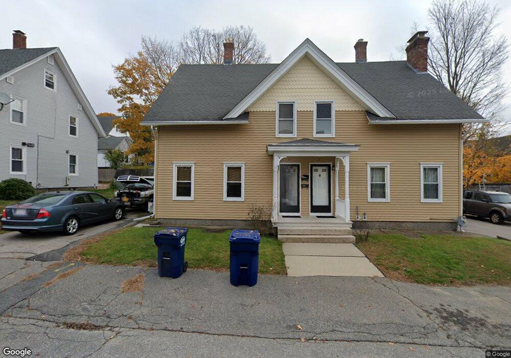
4 Maple St Whitinsville, MA 01588
Estimated Value: $273,252 - $314,000
3
Beds
1
Bath
1,228
Sq Ft
$243/Sq Ft
Est. Value
About This Home
This home is located at 4 Maple St, Whitinsville, MA 01588 and is currently estimated at $298,813, approximately $243 per square foot. 4 Maple St is a home located in Worcester County with nearby schools including Northbridge Elementary School, Northbridge Middle School, and Northbridge High School.
Create a Home Valuation Report for This Property
The Home Valuation Report is an in-depth analysis detailing your home's value as well as a comparison with similar homes in the area
Tax History
We collect this data history from publicly available records. To have your information removed, we recommend requesting removal directly through your county’s website.
| Year | Tax Paid | Tax Assessment Tax Assessment Total Assessment is a certain percentage of the fair market value that is determined by local assessors to be the total taxable value of land and additions on the property. | Land | Improvement |
|---|---|---|---|---|
| 2025 | $2,495 | $211,600 | $0 | $211,600 |
| 2024 | $2,338 | $193,400 | $0 | $193,400 |
| 2023 | $2,753 | $212,400 | $0 | $212,400 |
| 2022 | $2,614 | $189,800 | $0 | $189,800 |
| 2021 | $2,356 | $162,600 | $0 | $162,600 |
| 2020 | $2,159 | $156,000 | $0 | $156,000 |
| 2019 | $1,938 | $149,400 | $0 | $149,400 |
| 2018 | $1,784 | $137,900 | $0 | $137,900 |
| 2017 | $1,813 | $134,000 | $0 | $134,000 |
| 2016 | $1,871 | $136,100 | $0 | $136,100 |
| 2015 | $1,821 | $136,100 | $0 | $136,100 |
| 2014 | $1,750 | $132,000 | $0 | $132,000 |
Source: Public Records
Map
Nearby Homes
- 14 Linden St
- 43 High St
- 66 High St
- 68 High St
- 20 Forest St Unit 20
- 195 Hill St
- 28 Fletcher St
- 38 C St
- 132 Tipperary Dr
- 66 Linwood Ave
- 97 Cottage St Unit 97
- 30 Gill Ct
- 61 Hillview Ln
- 567-569 Hill St
- 39 Johnston Ave Unit 1
- 39 Johnston Ave Unit 3
- 39 Johnston Ave Unit 2
- 28-30 Brook St
- 26 Bayliss Way
- 377 Rebecca Rd
- 2 Maple St
- 2 Maple St Unit 2
- 8 Maple St
- 6 Maple St
- 8 Maple St Unit B
- 6 Maple St Unit A
- 6 Maple St
- 1 Linden St
- 19 Maple Ct Unit 1
- 242 Main St
- 57 Linden St
- 5-7 Linden St
- 10 Maple St Unit 12
- 12 Maple St Unit 12
- 252 Main St Unit 254
- 2-4 West St
- 9 Linden St Unit 11
- 9 Maple St Unit 11
- 11 Maple St
- 9 Maple St Unit 9
Your Personal Tour Guide
Ask me questions while you tour the home.