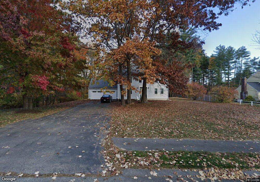
4 Pennycook Ln Amesbury, MA 01913
Estimated Value: $884,265 - $1,042,000
4
Beds
4
Baths
3,000
Sq Ft
$319/Sq Ft
Est. Value
About This Home
This home is located at 4 Pennycook Ln, Amesbury, MA 01913 and is currently estimated at $956,066, approximately $318 per square foot. 4 Pennycook Ln is a home located in Essex County with nearby schools including Amesbury High School and Amesbury Seventh-Day Adventist School.
Ownership History
Date
Name
Owned For
Owner Type
Purchase Details
Closed on
Jun 23, 2005
Sold by
Hangley Anne M
Bought by
Coleman Don C
Current Estimated Value
Purchase Details
Closed on
Sep 2, 1988
Sold by
Lane Homes Inc
Bought by
Hangley Richard J
Create a Home Valuation Report for This Property
The Home Valuation Report is an in-depth analysis detailing your home's value as well as a comparison with similar homes in the area
Home Values in the Area
Average Home Value in this Area
Purchase History
| Date | Buyer | Sale Price | Title Company |
|---|---|---|---|
| Coleman Don C | $565,000 | -- | |
| Hangley Richard J | $280,000 | -- |
Source: Public Records
Mortgage History
| Date | Status | Borrower | Loan Amount |
|---|---|---|---|
| Previous Owner | Hangley Richard J | $25,000 | |
| Previous Owner | Hangley Richard J | $107,500 | |
| Previous Owner | Hangley Richard J | $108,000 | |
| Previous Owner | Hangley Richard J | $110,000 |
Source: Public Records
Tax History
| Year | Tax Paid | Tax Assessment Tax Assessment Total Assessment is a certain percentage of the fair market value that is determined by local assessors to be the total taxable value of land and additions on the property. | Land | Improvement |
|---|---|---|---|---|
| 2025 | $11,954 | $781,300 | $288,400 | $492,900 |
| 2024 | $11,414 | $729,800 | $272,100 | $457,700 |
| 2023 | $10,463 | $640,300 | $236,600 | $403,700 |
| 2022 | $10,280 | $581,100 | $205,800 | $375,300 |
| 2021 | $9,826 | $538,400 | $166,100 | $372,300 |
| 2020 | $8,843 | $514,700 | $159,600 | $355,100 |
| 2019 | $8,979 | $488,800 | $159,600 | $329,200 |
| 2018 | $8,855 | $466,300 | $151,900 | $314,400 |
| 2017 | $9,089 | $455,600 | $151,900 | $303,700 |
| 2016 | $8,858 | $436,800 | $151,900 | $284,900 |
| 2015 | $8,695 | $423,300 | $151,900 | $271,400 |
| 2014 | $8,539 | $407,200 | $151,900 | $255,300 |
Source: Public Records
Map
Nearby Homes
- 12 Locke Hill Ln
- 149 Market St
- 51 Locust St
- 39 Unicorn Cir
- 5 Russell St Unit 1
- 20 Mason Ct
- 49 Orchard St
- 101 Market St Unit B
- 48 Orchard St
- 27 Lake St
- 2 Back River Rd
- 25 Cedar St Unit 4
- 253 Amesbury Rd
- 4 Boardman St
- 8 Winter St
- 24 Adder Ln
- 81 High St Unit 23
- 64 Whitehall Rd
- 40 Congress St
- 21 Congress St
- 6 Pennycook Ln
- 2 Pennycook Ln
- 8 Pennycook Ln
- 7 Pennycook Ln
- 5 Pennycook Ln
- 27 Woodman Rd
- 25 Woodman Rd
- 9 Pennycook Ln
- 46 Paige Farm Rd
- 36 Paige Farm Rd
- 34 Paige Farm Rd
- 40 Paige Farm Rd
- 30 Paige Farm Rd
- 4 Morse Croft Ln
- 6 Morse Croft Ln
- 42 Paige Farm Rd
- 44 Paige Farm Rd
- 8 Morse Croft Ln
- 35 Paige Farm Rd
- 37 Paige Farm Rd
Your Personal Tour Guide
Ask me questions while you tour the home.