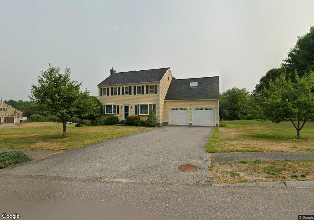
4 Primrose Ln Westford, MA 01886
Estimated Value: $1,076,950 - $1,262,000
4
Beds
3
Baths
3,084
Sq Ft
$365/Sq Ft
Est. Value
About This Home
This home is located at 4 Primrose Ln, Westford, MA 01886 and is currently estimated at $1,125,988, approximately $365 per square foot. 4 Primrose Ln is a home located in Middlesex County with nearby schools including Col John Robinson, John A. Crisafulli Elementary School, and Blanchard Middle School.
Ownership History
Date
Name
Owned For
Owner Type
Purchase Details
Closed on
Nov 19, 2010
Sold by
Cormier Ruth M and Kitowicz Ruth M
Bought by
Chuang Han
Current Estimated Value
Home Financials for this Owner
Home Financials are based on the most recent Mortgage that was taken out on this home.
Original Mortgage
$280,000
Outstanding Balance
$185,022
Interest Rate
4.3%
Mortgage Type
Purchase Money Mortgage
Estimated Equity
$940,966
Purchase Details
Closed on
Mar 29, 2000
Sold by
Applewood Constr
Bought by
Karimy Hamid F
Purchase Details
Closed on
Aug 27, 1998
Sold by
Topiwala Pankaj N and Jairath Nalini
Bought by
Kitowicz Ruth M
Purchase Details
Closed on
Dec 2, 1993
Sold by
Fafard Re & Dev Corp
Bought by
Kitowicz Ruth M
Create a Home Valuation Report for This Property
The Home Valuation Report is an in-depth analysis detailing your home's value as well as a comparison with similar homes in the area
Home Values in the Area
Average Home Value in this Area
Purchase History
| Date | Buyer | Sale Price | Title Company |
|---|---|---|---|
| Chuang Han | $545,000 | -- | |
| Karimy Hamid F | $236,295 | -- | |
| Kitowicz Ruth M | $338,000 | -- | |
| Kitowicz Ruth M | $131,990 | -- |
Source: Public Records
Mortgage History
| Date | Status | Borrower | Loan Amount |
|---|---|---|---|
| Open | Chuang Han | $280,000 | |
| Previous Owner | Kitowicz Ruth M | $186,000 | |
| Previous Owner | Kitowicz Ruth M | $325,000 | |
| Previous Owner | Kitowicz Ruth M | $301,500 |
Source: Public Records
Tax History
| Year | Tax Paid | Tax Assessment Tax Assessment Total Assessment is a certain percentage of the fair market value that is determined by local assessors to be the total taxable value of land and additions on the property. | Land | Improvement |
|---|---|---|---|---|
| 2025 | $12,608 | $936,000 | $0 | $936,000 |
| 2024 | $11,842 | $860,000 | $0 | $860,000 |
| 2023 | $11,259 | $762,800 | $0 | $762,800 |
| 2022 | $11,821 | $733,300 | $0 | $733,300 |
| 2021 | $6,127 | $671,400 | $0 | $671,400 |
| 2020 | $7,608 | $624,600 | $0 | $624,600 |
| 2019 | $10,411 | $628,700 | $0 | $628,700 |
| 2018 | $7,775 | $622,600 | $0 | $622,600 |
| 2017 | $8,568 | $522,100 | $0 | $522,100 |
| 2016 | $8,569 | $525,700 | $0 | $525,700 |
| 2015 | $8,336 | $513,300 | $0 | $513,300 |
| 2014 | $8,406 | $506,400 | $0 | $506,400 |
Source: Public Records
Map
Nearby Homes
- Lot 1 & 3 Beaver Brook Rd
- 76 Beaver Brook Rd
- 14 Robinson Rd Unit 2
- 20 Shattuck St
- 91 Jimney Dr Unit 91
- 82 Pleasant St
- 6 Colonel Rolls Dr
- 25 Laurel Rd
- 12 Patten Rd
- 17 Hartwell Ave
- 35 Forge Village Rd
- 18 Long Lake Rd
- 8 Bixby Ln
- 84 Powers Rd
- Lot 2 Monarch Path
- Lot 1 Monarch Path
- 5 Patricia Way Unit 5
- 15 Gilson Rd
- 19 Ipswich Dr
- 35 Queen Rd
Your Personal Tour Guide
Ask me questions while you tour the home.