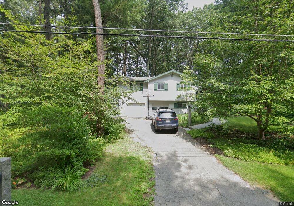
40 Tanbark Rd Sudbury, MA 01776
Estimated Value: $876,000 - $1,027,000
4
Beds
3
Baths
1,946
Sq Ft
$488/Sq Ft
Est. Value
About This Home
This home is located at 40 Tanbark Rd, Sudbury, MA 01776 and is currently estimated at $950,380, approximately $488 per square foot. 40 Tanbark Rd is a home located in Middlesex County with nearby schools including Peter Noyes Elementary School, Ephraim Curtis Middle School, and Lincoln-Sudbury Regional High School.
Ownership History
Date
Name
Owned For
Owner Type
Purchase Details
Closed on
Dec 30, 2022
Sold by
Fordiani Alfred L and Fordiani Rita U
Bought by
Fordiani Ft
Current Estimated Value
Purchase Details
Closed on
Oct 7, 1991
Sold by
Lanigan Dorothy A
Bought by
Fordiani Alfred L and N-Fordiani Rita U
Home Financials for this Owner
Home Financials are based on the most recent Mortgage that was taken out on this home.
Original Mortgage
$157,000
Interest Rate
9.08%
Mortgage Type
Purchase Money Mortgage
Create a Home Valuation Report for This Property
The Home Valuation Report is an in-depth analysis detailing your home's value as well as a comparison with similar homes in the area
Home Values in the Area
Average Home Value in this Area
Purchase History
| Date | Buyer | Sale Price | Title Company |
|---|---|---|---|
| Fordiani Ft | -- | None Available | |
| Fordiani Alfred L | $196,000 | -- |
Source: Public Records
Mortgage History
| Date | Status | Borrower | Loan Amount |
|---|---|---|---|
| Previous Owner | Fordiani Alfred L | $157,000 |
Source: Public Records
Tax History
| Year | Tax Paid | Tax Assessment Tax Assessment Total Assessment is a certain percentage of the fair market value that is determined by local assessors to be the total taxable value of land and additions on the property. | Land | Improvement |
|---|---|---|---|---|
| 2025 | $12,036 | $822,100 | $417,000 | $405,100 |
| 2024 | $11,637 | $796,500 | $404,800 | $391,700 |
| 2023 | $11,577 | $734,100 | $374,800 | $359,300 |
| 2022 | $10,884 | $603,000 | $344,000 | $259,000 |
| 2021 | $10,394 | $552,000 | $344,000 | $208,000 |
| 2020 | $10,184 | $552,000 | $344,000 | $208,000 |
| 2019 | $9,886 | $552,000 | $344,000 | $208,000 |
| 2018 | $9,580 | $534,300 | $366,800 | $167,500 |
| 2017 | $8,960 | $505,100 | $348,900 | $156,200 |
| 2016 | $8,720 | $489,900 | $335,600 | $154,300 |
| 2015 | $8,196 | $465,700 | $322,700 | $143,000 |
| 2014 | $8,159 | $452,500 | $313,200 | $139,300 |
Source: Public Records
Map
Nearby Homes
- 59 Tanbark Rd
- 7 Saddle Ridge Rd
- 11 Axdell Rd
- 17 Brentwood Rd
- 71 Robert Best Rd
- 45 Normandy Dr
- 9 Priest Rd
- 22 Hayden Cir
- 15 Ronald Rd
- 30 Harness Ln
- 42 Pinewood Ave
- 45 Webster Cir
- 8 Twillingate Rd
- 125 Hudson Rd
- 138 Fairbank Rd
- 96 Hudson Rd
- 15 Barracks Rd Unit 15
- 45 Widow Rights Ln
- 217 Nobscot Rd
- 40 Bigelow Dr
Your Personal Tour Guide
Ask me questions while you tour the home.