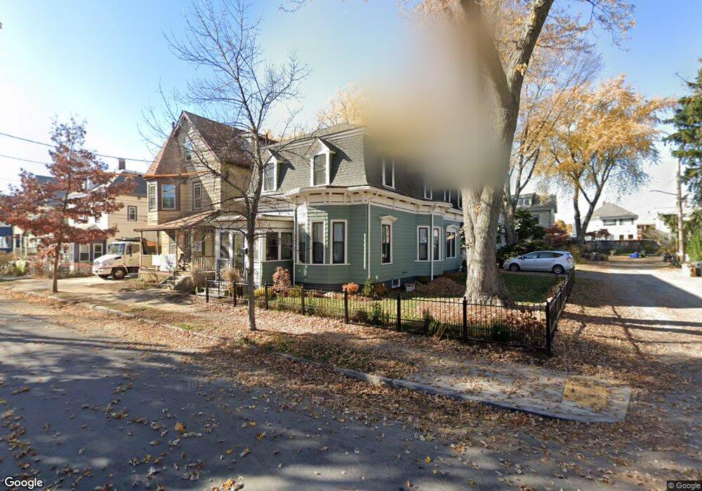
40 Teel St Arlington, MA 02474
East Arlington NeighborhoodEstimated Value: $1,009,000 - $1,417,000
3
Beds
2
Baths
2,127
Sq Ft
$581/Sq Ft
Est. Value
About This Home
This home is located at 40 Teel St, Arlington, MA 02474 and is currently estimated at $1,236,665, approximately $581 per square foot. 40 Teel St is a home located in Middlesex County with nearby schools including Hardy Elementary School, Thompson School, and Ottoson Middle School.
Ownership History
Date
Name
Owned For
Owner Type
Purchase Details
Closed on
Jun 3, 2022
Sold by
Berczuk Stephen P and Berezuk Melissa S
Bought by
40 Teel Street Rt and Berczuk
Current Estimated Value
Purchase Details
Closed on
Nov 18, 1994
Sold by
Ault John J and Ault Dorothy J
Bought by
Berczuk Stephen P and Davis Lena A
Create a Home Valuation Report for This Property
The Home Valuation Report is an in-depth analysis detailing your home's value as well as a comparison with similar homes in the area
Home Values in the Area
Average Home Value in this Area
Purchase History
| Date | Buyer | Sale Price | Title Company |
|---|---|---|---|
| 40 Teel Street Rt | -- | None Available | |
| Berczuk Stephen P | $175,700 | -- | |
| Berczuk Stephen P | $175,700 | -- |
Source: Public Records
Mortgage History
| Date | Status | Borrower | Loan Amount |
|---|---|---|---|
| Previous Owner | Berczuk Stephen P | $417,000 | |
| Previous Owner | Berczuk Stephen P | $40,000 | |
| Previous Owner | Berczuk Stephen P | $463,500 |
Source: Public Records
Tax History
| Year | Tax Paid | Tax Assessment Tax Assessment Total Assessment is a certain percentage of the fair market value that is determined by local assessors to be the total taxable value of land and additions on the property. | Land | Improvement |
|---|---|---|---|---|
| 2025 | $11,691 | $1,085,500 | $604,500 | $481,000 |
| 2024 | $10,745 | $1,014,600 | $575,400 | $439,200 |
| 2023 | $10,128 | $903,500 | $482,400 | $421,100 |
| 2022 | $9,658 | $845,700 | $465,000 | $380,700 |
| 2021 | $9,463 | $834,500 | $465,000 | $369,500 |
| 2020 | $9,227 | $834,300 | $465,000 | $369,300 |
| 2019 | $8,679 | $770,800 | $494,100 | $276,700 |
| 2018 | $7,728 | $637,100 | $360,400 | $276,700 |
| 2017 | $7,410 | $590,000 | $313,900 | $276,100 |
| 2016 | $6,957 | $543,500 | $267,400 | $276,100 |
| 2015 | $7,079 | $522,400 | $261,600 | $260,800 |
Source: Public Records
Map
Nearby Homes
- 79 Trowbridge St Unit 1
- 130 Massachusetts Ave Unit 6
- 15 Foch St
- 1328 Broadway Unit 3
- 35 Fairmont St Unit 1
- 3 Foch St
- 38 Lafayette St Unit 38
- 89 Cleveland St Unit 89
- 18 Chandler St
- 22 Madison Ave
- 7 Farragut Ave Unit 1
- 14 Farragut Ave Unit 1
- 30 Brookford St
- 22 Cottage Park Ave Unit 1
- 38 Brookford St Unit 2
- 30 Clarendon Ave
- 33 Newbury St Unit 1
- 97 Elmwood St Unit 313
- 97 Elmwood St Unit 110
- 97 Elmwood St Unit 310
Your Personal Tour Guide
Ask me questions while you tour the home.