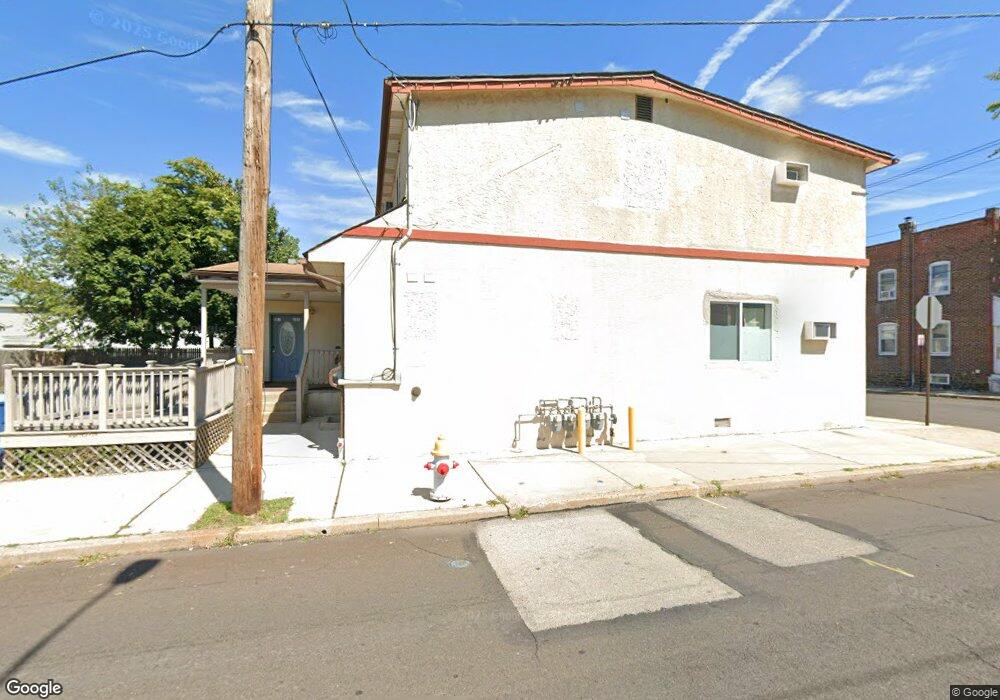
401 W 5th St Lansdale, PA 19446
Estimated Value: $289,000 - $513,000
12
Beds
8
Baths
2,655
Sq Ft
$164/Sq Ft
Est. Value
About This Home
This home is located at 401 W 5th St, Lansdale, PA 19446 and is currently estimated at $434,333, approximately $163 per square foot. 401 W 5th St is a home located in Montgomery County with nearby schools including Knapp Elementary School, Penndale Middle School, and North Penn Senior High School.
Ownership History
Date
Name
Owned For
Owner Type
Purchase Details
Closed on
Jul 6, 2012
Sold by
Bnb Bank Na
Bought by
Mohammed Rafuzzaman K G
Current Estimated Value
Purchase Details
Closed on
Oct 29, 2010
Sold by
5Th Street Public
Bought by
Bnb Real Estate Holding Llc
Purchase Details
Closed on
May 26, 2006
Sold by
Brocke Drissel Real Est Part
Bought by
Pub 5Th Street
Home Financials for this Owner
Home Financials are based on the most recent Mortgage that was taken out on this home.
Original Mortgage
$495,000
Interest Rate
6.62%
Purchase Details
Closed on
Jan 30, 1995
Sold by
Rosini Louis J and Rosini Cynthia
Bought by
Brocke Drissel Real Estate Partnership
Create a Home Valuation Report for This Property
The Home Valuation Report is an in-depth analysis detailing your home's value as well as a comparison with similar homes in the area
Home Values in the Area
Average Home Value in this Area
Purchase History
| Date | Buyer | Sale Price | Title Company |
|---|---|---|---|
| Mohammed Rafuzzaman K G | $76,000 | None Available | |
| Bnb Real Estate Holding Llc | $2,486 | None Available | |
| Pub 5Th Street | $450,000 | None Available | |
| Brocke Drissel Real Estate Partnership | $170,000 | -- |
Source: Public Records
Mortgage History
| Date | Status | Borrower | Loan Amount |
|---|---|---|---|
| Previous Owner | Pub 5Th Street | $495,000 |
Source: Public Records
Tax History
| Year | Tax Paid | Tax Assessment Tax Assessment Total Assessment is a certain percentage of the fair market value that is determined by local assessors to be the total taxable value of land and additions on the property. | Land | Improvement |
|---|---|---|---|---|
| 2025 | $7,182 | $170,730 | $47,390 | $123,340 |
| 2024 | $7,182 | $170,730 | $47,390 | $123,340 |
| 2023 | $6,718 | $170,730 | $47,390 | $123,340 |
| 2022 | $6,505 | $170,730 | $47,390 | $123,340 |
| 2021 | $6,240 | $170,730 | $47,390 | $123,340 |
| 2020 | $6,051 | $170,730 | $47,390 | $123,340 |
| 2019 | $5,653 | $170,730 | $47,390 | $123,340 |
Source: Public Records
Map
Nearby Homes
- 610 N Cannon Ave
- 89 Cannon Ct
- 816 Kenilworth Ave
- 611 W Main St
- 772 W 2nd St
- 737 Shaw Ave
- 817 W Main St
- 204 N Valley Forge Rd Unit 6B
- 418 Derstine Ave
- 21 Susquehanna Ave
- 515 N Broad St
- 1035 Poplar St
- 31 W End Dr
- 800 Forrest St
- 901 Columbia Ave
- 629 York Ave
- 350 S Cannon Ave
- 107 E 3rd St Unit 20
- 118 Elm Dr
- 403 W Mount Vernon St
Your Personal Tour Guide
Ask me questions while you tour the home.