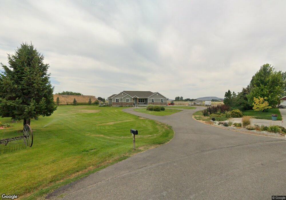
4034 Molly Dr Rexburg, ID 83440
Estimated Value: $572,000 - $658,000
5
Beds
3
Baths
3,454
Sq Ft
$178/Sq Ft
Est. Value
About This Home
This home is located at 4034 Molly Dr, Rexburg, ID 83440 and is currently estimated at $616,070, approximately $178 per square foot. 4034 Molly Dr is a home located in Madison County with nearby schools including Burton Elementary School, Kennedy Elementary School, and Madison Junior High School.
Ownership History
Date
Name
Owned For
Owner Type
Purchase Details
Closed on
Aug 2, 2021
Sold by
Sharp Blake and Sharp Cindy
Bought by
Sanders Skyler Matthew and Sanders Melissa Patricia
Current Estimated Value
Home Financials for this Owner
Home Financials are based on the most recent Mortgage that was taken out on this home.
Original Mortgage
$300,000
Outstanding Balance
$225,902
Interest Rate
2.1%
Mortgage Type
New Conventional
Estimated Equity
$390,168
Create a Home Valuation Report for This Property
The Home Valuation Report is an in-depth analysis detailing your home's value as well as a comparison with similar homes in the area
Purchase History
| Date | Buyer | Sale Price | Title Company |
|---|---|---|---|
| Sanders Skyler Matthew | -- | Alliance Title & Escrow Llc |
Source: Public Records
Mortgage History
| Date | Status | Borrower | Loan Amount |
|---|---|---|---|
| Open | Sanders Skyler Matthew | $300,000 |
Source: Public Records
Tax History
| Year | Tax Paid | Tax Assessment Tax Assessment Total Assessment is a certain percentage of the fair market value that is determined by local assessors to be the total taxable value of land and additions on the property. | Land | Improvement |
|---|---|---|---|---|
| 2025 | $2,235 | $465,124 | $85,000 | $380,124 |
| 2024 | $2,364 | $465,124 | $85,000 | $380,124 |
| 2023 | $2,364 | $448,391 | $80,000 | $368,391 |
| 2022 | $3,119 | $434,013 | $70,000 | $364,013 |
| 2021 | $2,748 | $353,706 | $50,000 | $303,706 |
| 2020 | $2,277 | $289,033 | $45,000 | $244,033 |
| 2019 | $2,189 | $258,799 | $45,000 | $213,799 |
| 2018 | $2,016 | $237,203 | $45,000 | $192,203 |
| 2017 | $1,903 | $234,207 | $45,000 | $189,207 |
| 2016 | $2,000 | $234,207 | $45,000 | $189,207 |
| 2015 | $1,832 | $216,044 | $0 | $0 |
| 2013 | -- | $216,044 | $0 | $0 |
Source: Public Records
Map
Nearby Homes
- L8B2 Debbie Ln
- 475 S 4000 W
- L7B2 Debbie Ln
- L6B2 Debbie Ln
- L5B2 Debbie Ln
- L4B2 Debbie Ln
- L3B2 Debbie Ln
- L3B1 Debbie Ln
- L2B2 Debbie Ln
- L2B1 Debbie Ln
- L1B2 Debbie Ln
- L1B1 Debbie Ln
- 264 S 5000 W
- 645 S 5500 W
- 651 S 2400 W Unit 5101
- 651 S 2400 W Unit 14102
- 651 S 2400 W Unit 24105
- 2354 W 550 S
- 2362 W 900 S
- 670 S 2315 W
- 4030 Molly Dr
- 4035 Molly Dr
- 4024 Molly Dr
- 817 Heritage Rd
- 4018 Molly Dr
- 824 Heritage Rd
- 4043 Molly Dr
- 4019 Molly Dr
- 851 Heritage Rd
- 856 Heritage Rd
- 4007 Molly Dr
- 4016 Molly Dr
- 881 Heritage Rd
- 4051 Molly Dr
- 707 S 4000 W
- 4012 Molly Dr
- 4176 W Homestead Dr
- 4008 Molly Dr
- 4148 W Homestead Dr
- Lot 14 Molly Dr
Your Personal Tour Guide
Ask me questions while you tour the home.