Estimated Value: $183,367 - $233,000
3
Beds
2
Baths
1,554
Sq Ft
$141/Sq Ft
Est. Value
About This Home
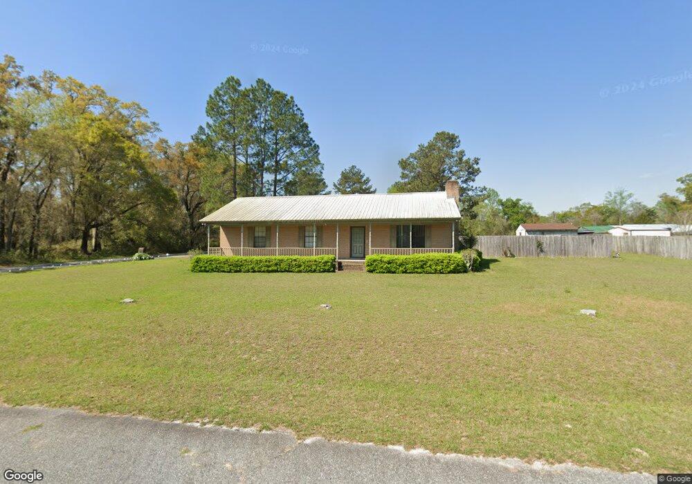
This home is located at 407 Hickory Cir, Cairo, GA 39828 and is currently estimated at $219,342, approximately $141 per square foot. 407 Hickory Cir is a home located in Grady County with nearby schools including Cairo High School.
Ownership History
Date
Name
Owned For
Owner Type
Purchase Details
Closed on
Oct 8, 2024
Sold by
Johnston Linda
Bought by
Ivey Chataqunda B and Ivey Gemika
Current Estimated Value
Purchase Details
Closed on
Jan 26, 2004
Bought by
Johnston Linda W
Purchase Details
Closed on
Nov 19, 1999
Sold by
Williamson Daniel L
Bought by
Mcbride Lamar
Purchase Details
Closed on
Sep 12, 1995
Sold by
Bergstrom Carl W
Bought by
Williamson Daniel L
Purchase Details
Closed on
Nov 12, 1993
Bought by
Bergstrom Carl W
Create a Home Valuation Report for This Property
The Home Valuation Report is an in-depth analysis detailing your home's value as well as a comparison with similar homes in the area
Purchase History
| Date | Buyer | Sale Price | Title Company |
|---|---|---|---|
| Ivey Chataqunda B | -- | -- | |
| Johnston Linda W | $87,000 | -- | |
| Mcbride Lamar | $83,500 | -- | |
| Williamson Daniel L | $74,500 | -- | |
| Bergstrom Carl W | $69,900 | -- |
Source: Public Records
Tax History
| Year | Tax Paid | Tax Assessment Tax Assessment Total Assessment is a certain percentage of the fair market value that is determined by local assessors to be the total taxable value of land and additions on the property. | Land | Improvement |
|---|---|---|---|---|
| 2025 | $2,227 | $73,980 | $2,760 | $71,220 |
| 2024 | $2,227 | $66,756 | $2,760 | $63,996 |
| 2023 | $1,614 | $45,259 | $4,800 | $40,459 |
| 2022 | $1,681 | $45,259 | $4,800 | $40,459 |
| 2021 | $1,685 | $45,259 | $4,800 | $40,459 |
| 2020 | $1,690 | $45,259 | $4,800 | $40,459 |
| 2019 | $1,690 | $45,259 | $4,800 | $40,459 |
| 2018 | $1,607 | $45,259 | $4,800 | $40,459 |
| 2017 | $1,349 | $45,259 | $4,800 | $40,459 |
| 2016 | $1,349 | $38,826 | $4,800 | $34,026 |
| 2015 | $1,336 | $38,826 | $4,800 | $34,026 |
| 2014 | $1,336 | $38,826 | $4,800 | $34,026 |
| 2013 | -- | $35,368 | $4,800 | $30,568 |
Source: Public Records
Map
Nearby Homes
- 408 Bay Tree Rd NE
- 0 20th St NE
- 00 20th St NE
- 655 12th Ave NE
- 66 22nd St NE
- 711 2nd Ave NE
- 0 State Route 188
- 2690 U S 84
- 00 Blackberry Ln
- 00 Meridian Rd
- 00 Cuffhead Rd
- 00 Union Hill Rd
- 21 24th St NE
- 79 27th St NE
- 2330 Pecan Dr
- 78.6 Ac Strickland Rd
- 2975 U S 84
- 4761 Hadley Ferry Rd
- 592 20th St SE
- 481 4th St SE
Your Personal Tour Guide
Ask me questions while you tour the home.