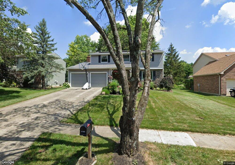
4070 Brookside Ct Mason, OH 45040
Landen NeighborhoodEstimated Value: $375,000 - $394,000
4
Beds
3
Baths
2,315
Sq Ft
$165/Sq Ft
Est. Value
About This Home
This home is located at 4070 Brookside Ct, Mason, OH 45040 and is currently estimated at $381,325, approximately $164 per square foot. 4070 Brookside Ct is a home located in Warren County with nearby schools including Kings Junior High School, Kings High School, and King Of Kings Lutheran Early Childhood Education.
Ownership History
Date
Name
Owned For
Owner Type
Purchase Details
Closed on
Mar 1, 1994
Sold by
George Allen V and George Anna M
Bought by
Poleyeff and Poleyeff Kenneth T
Current Estimated Value
Purchase Details
Closed on
Mar 7, 1990
Sold by
Donatini Jeffrey and Donatini Lisa
Bought by
George and George Allen
Purchase Details
Closed on
Jun 17, 1986
Sold by
Ryan Homes & Inc
Bought by
Donatini and Donatini Jeffrey
Purchase Details
Closed on
Apr 15, 1986
Sold by
Landen Farm Company
Bought by
Ryan Homes & Inc.
Purchase Details
Closed on
Jul 1, 1983
Sold by
Landen Farm Company
Bought by
Landen Farm Company
Create a Home Valuation Report for This Property
The Home Valuation Report is an in-depth analysis detailing your home's value as well as a comparison with similar homes in the area
Home Values in the Area
Average Home Value in this Area
Purchase History
We collect this data history from publicly available records. To have your information removed, we recommend requesting removal directly through your county’s website.
| Date | Buyer | Sale Price | Title Company |
|---|---|---|---|
| Poleyeff | $120,400 | -- | |
| George | $104,000 | -- | |
| Donatini | $75,100 | -- | |
| Ryan Homes & Inc. | $34,000 | -- | |
| Landen Farm Company | -- | -- |
Source: Public Records
Tax History
| Year | Tax Paid | Tax Assessment Tax Assessment Total Assessment is a certain percentage of the fair market value that is determined by local assessors to be the total taxable value of land and additions on the property. | Land | Improvement |
|---|---|---|---|---|
| 2025 | $5,350 | $102,590 | $24,500 | $78,090 |
| 2024 | $5,350 | $102,590 | $24,500 | $78,090 |
| 2023 | $4,763 | $82,057 | $12,915 | $69,142 |
| 2022 | $4,677 | $82,058 | $12,915 | $69,143 |
| 2021 | $3,918 | $82,058 | $12,915 | $69,143 |
| 2020 | $3,786 | $66,714 | $10,500 | $56,214 |
| 2019 | $3,832 | $66,714 | $10,500 | $56,214 |
| 2018 | $3,813 | $66,714 | $10,500 | $56,214 |
| 2017 | $3,986 | $61,761 | $10,371 | $51,391 |
| 2016 | $4,088 | $61,761 | $10,371 | $51,391 |
| 2015 | $3,476 | $61,761 | $10,371 | $51,391 |
| 2014 | $3,476 | $54,660 | $9,180 | $45,480 |
| 2013 | $3,481 | $62,530 | $10,500 | $52,030 |
Source: Public Records
Map
Nearby Homes
- 8846 Meadow Dr
- 9491 Carriage Run Cir
- 9490 Carriage Run Cir
- 9388 Hickory Hill Ct
- 3575 Green Haven Way
- 8839 Pollard Place
- 8780 S Cove Dr
- 3237 S Cove Ct
- 3516 Cutter Ln
- 8188 Columbia Rd
- 3222 Locust Ave
- 9282 Greenery Ct Unit 311E
- 3556 Twenty Mile Way Unit 3556
- 4098 Crestview Dr
- 9434 Greenery Ct
- 9045 Fields Dr
- 9594 Greenery Ct
- 8525 Landen Cove
- 7824 Golden Meadow Dr
- 8833 Dover Dr
- 4088 Brookside Ct
- 4060 Brookside Ct
- 8845 Logger Place
- 8911 Meadow Dr
- 8831 Logger Place
- 4092 Brookside Ct
- 4071 Brookside Ct
- 4059 Brookside Ct
- 4085 Brookside Ct
- 4090 Brookside Ct
- 8829 Logger Place
- 4108 Brookside Ct
- 4107 Brookside Ct
- 8825 Logger Place
- 8904 Meadow Dr
- 8951 Meadow Dr
- 8844 Logger Place
- 8883 Meadow Dr
- 8944 Meadow Dr
- 8827 Logger Place
Your Personal Tour Guide
Ask me questions while you tour the home.