
Seller's Agent in 2025
Jeffrey Carducci
McDowell Homes Real Estate Services
(440) 749-5358
1 in this area
718 Total Sales
Estimated Value: $365,000 - $407,000
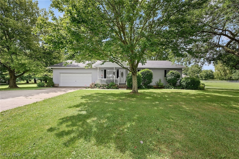
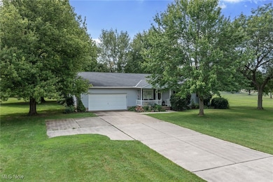
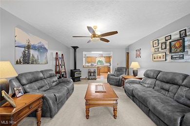
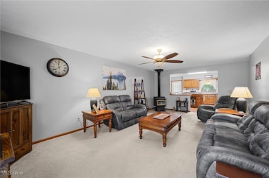
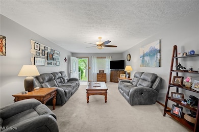
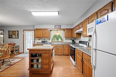
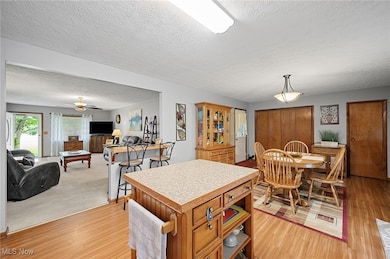
Welcome home to 40725 Biggs Road in Lagrange, situated on a beautiful 1.38-acre lot in the Keystone School District. This well-maintained ranch offers comfortable living with thoughtful updates throughout. The HVAC system was replaced just one year ago and the roof is only nine years old, providing peace of mind for years to come. Inside, the owner’s suite features a recently updated private bath with a tile walk-in shower and granite countertop, completed approximately two years ago. The partially finished basement adds additional living space that can be used as a recreation room, home gym, play area, or hobby space while still offering plenty of storage. Enjoy the benefits of a large yard with room to entertain, garden, or simply relax in a peaceful, country-like setting while still being close to town, major routes, and conveniences. This property offers a great balance of space, updates, and setting—ready for its next owner to move in and enjoy.
Last Agent to Sell the Property
McDowell Homes Real Estate Services Brokerage Email: boosells2u@gmail.com, 440-665-4442 License #2013001981 Listed on: 10/20/2025
Co-Listed By
McDowell Homes Real Estate Services Brokerage Email: boosells2u@gmail.com, 440-665-4442 License #2016000650
We collect this data history from publicly available records. To have your information removed, we recommend requesting removal directly through your county’s website.
| Date | Buyer | Sale Price | Title Company |
|---|---|---|---|
| Candelario Roy | $380,000 | Miller Home Title | |
| Mullen Ralph J | $140,000 | -- |
We collect this data history from publicly available records. To have your information removed, we recommend requesting removal directly through your county’s website.
| Date | Status | Borrower | Loan Amount |
|---|---|---|---|
| Open | Candelario Roy | $230,000 | |
| Previous Owner | Mullen Ralph J | $112,000 |
| Date | Event | Price | List to Sale | Price per Sq Ft |
|---|---|---|---|---|
| 12/15/2025 12/15/25 | Sold | $380,000 | -2.5% | $195 / Sq Ft |
| 10/20/2025 10/20/25 | For Sale | $389,900 | -- | $200 / Sq Ft |
| Year | Tax Paid | Tax Assessment Tax Assessment Total Assessment is a certain percentage of the fair market value that is determined by local assessors to be the total taxable value of land and additions on the property. | Land | Improvement |
|---|---|---|---|---|
| 2024 | $3,582 | $97,097 | $20,139 | $76,958 |
| 2023 | $3,229 | $74,984 | $19,544 | $55,440 |
| 2022 | $3,225 | $74,984 | $19,544 | $55,440 |
| 2021 | $3,225 | $74,984 | $19,544 | $55,440 |
| 2020 | $2,754 | $59,090 | $15,400 | $43,690 |
| 2019 | $2,736 | $59,090 | $15,400 | $43,690 |
| 2018 | $1,875 | $59,090 | $15,400 | $43,690 |
| 2017 | $3,120 | $55,270 | $16,290 | $38,980 |
| 2016 | $3,097 | $55,270 | $16,290 | $38,980 |
| 2015 | $3,092 | $55,270 | $16,290 | $38,980 |
| 2014 | $2,545 | $52,150 | $15,370 | $36,780 |
| 2013 | $2,465 | $52,150 | $15,370 | $36,780 |
Seller's Agent in 2025
Jeffrey Carducci
McDowell Homes Real Estate Services
(440) 749-5358
1 in this area
718 Total Sales
Seller Co-Listing Agent in 2025
Lindsay Boosinger
McDowell Homes Real Estate Services
(440) 665-4442
1 in this area
71 Total Sales
Buyer's Agent in 2025
Chad Schneider
Russell Real Estate Services
(440) 225-8449
5 in this area
272 Total Sales
Buyer Co-Listing Agent in 2025
Jesse SantoDomingo
Russell Real Estate Services
(440) 315-7569
2 in this area
30 Total Sales
Source: MLS Now
MLS Number: 5166276
APN: 15-00-035-000-024
Disclaimer: Certain information contained herein is derived from information provided by parties other than Homes.com. All information provided is deemed reliable, but is not guaranteed to be accurate and should be independently verified.
![]() IDX information is provided exclusively for personal, non-commercial use, and may not be used for any purpose other than to identify prospective properties consumers may be interested in purchasing. Information is deemed reliable but not guaranteed.
IDX information is provided exclusively for personal, non-commercial use, and may not be used for any purpose other than to identify prospective properties consumers may be interested in purchasing. Information is deemed reliable but not guaranteed.
Ask me questions while you tour the home.