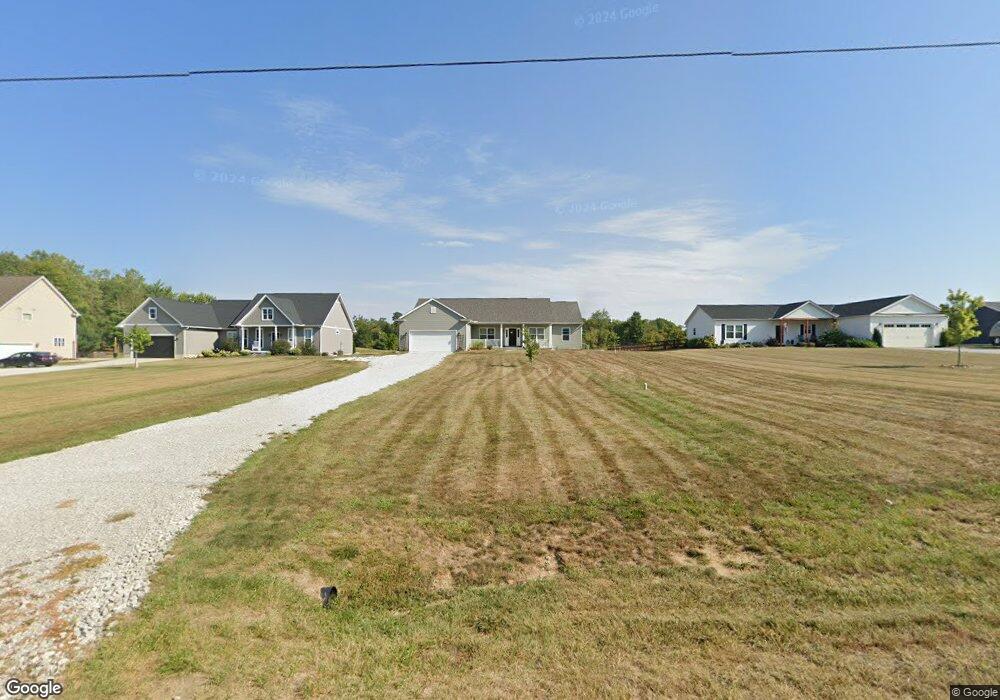
408 E Cliff St Baltimore, OH 43105
Estimated Value: $395,000 - $586,000
3
Beds
2
Baths
2,216
Sq Ft
$235/Sq Ft
Est. Value
About This Home
This home is located at 408 E Cliff St, Baltimore, OH 43105 and is currently estimated at $521,599, approximately $235 per square foot. 408 E Cliff St is a home located in Fairfield County with nearby schools including Liberty Union Elementary School, Liberty Union Middle School, and Liberty Union High School.
Ownership History
Date
Name
Owned For
Owner Type
Purchase Details
Closed on
Sep 27, 2018
Sold by
Woods S S and Woods Bernice J
Bought by
Davidson Jennifer and Davidson Chad
Current Estimated Value
Home Financials for this Owner
Home Financials are based on the most recent Mortgage that was taken out on this home.
Original Mortgage
$289,854
Outstanding Balance
$250,147
Interest Rate
4.5%
Mortgage Type
Construction
Estimated Equity
$271,452
Purchase Details
Closed on
Nov 23, 2011
Sold by
Vinton County National Bank Of Mcarthur
Bought by
Woods Roger and Woods Bernice J
Purchase Details
Closed on
Aug 1, 2011
Sold by
Laver Brigner Suzanne
Bought by
Vinton County National Bank Of Mcarthur
Purchase Details
Closed on
Oct 23, 2009
Sold by
Laver Brigner Suzanne M
Bought by
Ccb Land Development Llc
Create a Home Valuation Report for This Property
The Home Valuation Report is an in-depth analysis detailing your home's value as well as a comparison with similar homes in the area
Home Values in the Area
Average Home Value in this Area
Purchase History
We collect this data history from publicly available records. To have your information removed, we recommend requesting removal directly through your county’s website.
| Date | Buyer | Sale Price | Title Company |
|---|---|---|---|
| Davidson Jennifer | $52,000 | First Ohio Title Insurance B | |
| Woods Roger | $90,000 | Attorney | |
| Vinton County National Bank Of Mcarthur | $160,000 | Attorney | |
| Ccb Land Development Llc | -- | Attorney |
Source: Public Records
Mortgage History
We collect this data history from publicly available records. To have your information removed, we recommend requesting removal directly through your county’s website.
| Date | Status | Borrower | Loan Amount |
|---|---|---|---|
| Open | Davidson Jennifer | $289,854 |
Source: Public Records
Tax History
| Year | Tax Paid | Tax Assessment Tax Assessment Total Assessment is a certain percentage of the fair market value that is determined by local assessors to be the total taxable value of land and additions on the property. | Land | Improvement |
|---|---|---|---|---|
| 2025 | $11,812 | $167,010 | $31,920 | $135,090 |
| 2024 | $11,812 | $157,350 | $23,140 | $134,210 |
| 2023 | $6,186 | $157,350 | $23,140 | $134,210 |
| 2022 | $6,117 | $156,860 | $23,140 | $133,720 |
| 2021 | $5,157 | $119,960 | $21,040 | $98,920 |
| 2020 | $4,351 | $119,960 | $21,040 | $98,920 |
| 2019 | $3,516 | $78,650 | $21,040 | $57,610 |
| 2018 | $61 | $3,940 | $3,940 | $0 |
| 2017 | $62 | $3,940 | $3,940 | $0 |
| 2016 | $61 | $3,940 | $3,940 | $0 |
| 2015 | $54 | $3,940 | $3,940 | $0 |
| 2014 | $51 | $3,940 | $3,940 | $0 |
| 2013 | $51 | $3,940 | $3,940 | $0 |
Source: Public Records
Map
Nearby Homes
- 220 N Wagner Ave
- 222 Hansberger Ave
- 313 W Market St
- 601 S Main St
- 208 N Fremont St
- 727 W Washington St
- 300 N Oak St
- Lot 18A S Creekview Ct
- 570 Baltimore Somerset Rd NE Unit Lot 1
- 445 Baltimore Somerset Rd NE
- 0 Basil Rd NW Unit 226003110
- 7836 Basil Rd NW
- 0 Cherry Ln Unit 226008720
- 1601 W Maple St
- 9915 Lancaster-Newark Rd NE
- 2200 Leonard Rd NW
- 8078 High St
- 2179 3rd St
- 8280 Bader Rd NW
- 5870 Brook Rd NW
- 410 E Cliff St
- 406 E Cliff St
- 431 E Cliff St
- 425 E Cliff St
- 412 E Cliff St
- 435 E Cliff St
- 404 E Cliff St
- 419 E Cliff St
- 439 E Cliff St
- 415 E Cliff St
- 402 E Cliff St
- 413 E Cliff St
- 459 E Cliff St
- 219 N Wagner Ave
- 416 E Cliff St
- 215 N Wagner Ave
- 400 E Cliff St
- 401 E Cliff St
- 414 E Cliff St
- 211 N Wagner Ave
Your Personal Tour Guide
Ask me questions while you tour the home.