Estimated Value: $117,000 - $134,000
2
Beds
2
Baths
1,293
Sq Ft
$99/Sq Ft
Est. Value
About This Home
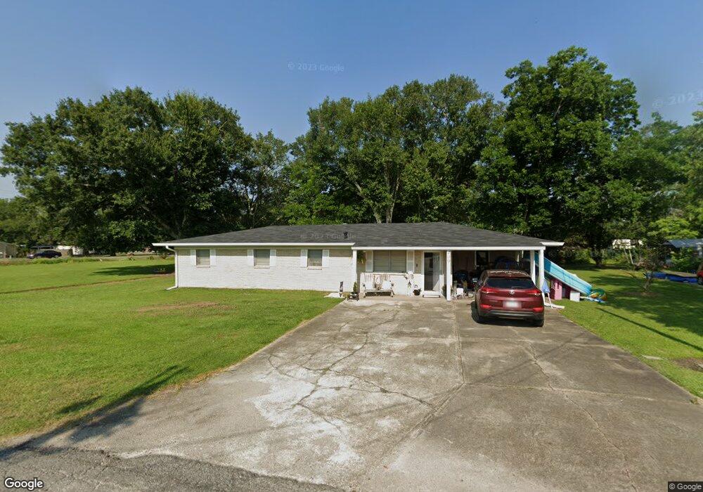
This home is located at 409 Floyd St, Welsh, LA 70591 and is currently estimated at $128,064, approximately $99 per square foot. 409 Floyd St is a home located in Jefferson Davis Parish with nearby schools including Welsh Elementary School, Welsh-Roanoke Junior High School, and Welsh High School.
Ownership History
Date
Name
Owned For
Owner Type
Purchase Details
Closed on
Mar 26, 2018
Sold by
Mabry Sandra B and Blessington Howard Leo
Bought by
Doucet Jacob Paul and Doucet Haley Daniel
Current Estimated Value
Home Financials for this Owner
Home Financials are based on the most recent Mortgage that was taken out on this home.
Original Mortgage
$111,111
Outstanding Balance
$94,215
Interest Rate
4.4%
Mortgage Type
New Conventional
Estimated Equity
$33,849
Create a Home Valuation Report for This Property
The Home Valuation Report is an in-depth analysis detailing your home's value as well as a comparison with similar homes in the area
Home Values in the Area
Average Home Value in this Area
Purchase History
We collect this data history from publicly available records. To have your information removed, we recommend requesting removal directly through your county’s website.
| Date | Buyer | Sale Price | Title Company |
|---|---|---|---|
| Doucet Jacob Paul | $110,000 | -- |
Source: Public Records
Mortgage History
We collect this data history from publicly available records. To have your information removed, we recommend requesting removal directly through your county’s website.
| Date | Status | Borrower | Loan Amount |
|---|---|---|---|
| Open | Doucet Jacob Paul | $111,111 |
Source: Public Records
Tax History
| Year | Tax Paid | Tax Assessment Tax Assessment Total Assessment is a certain percentage of the fair market value that is determined by local assessors to be the total taxable value of land and additions on the property. | Land | Improvement |
|---|---|---|---|---|
| 2025 | $1,011 | $11,825 | $900 | $10,925 |
| 2024 | $1,007 | $11,825 | $900 | $10,925 |
| 2023 | $777 | $10,400 | $900 | $9,500 |
| 2022 | $268 | $10,400 | $900 | $9,500 |
| 2021 | $777 | $10,400 | $900 | $9,500 |
| 2020 | $777 | $10,400 | $900 | $9,500 |
| 2019 | $796 | $10,450 | $1,560 | $8,890 |
| 2018 | $912 | $10,450 | $1,560 | $8,890 |
| 2017 | $446 | $5,100 | $1,560 | $3,540 |
| 2015 | $444 | $5,100 | $1,560 | $3,540 |
| 2014 | $444 | $5,100 | $1,560 | $3,540 |
| 2013 | $454 | $5,100 | $1,560 | $3,540 |
Source: Public Records
Map
Nearby Homes
- 105 Radeke St
- 0 Tbd Hwy Unit SWL26001653
- 101 Bourgeois St
- 820 E South St
- 17188 Highway 90 Unit Suite B
- 17180 Highway 90
- 0 Highway 90
- 201 Powers St
- 0 Grove St Unit SWL25002212
- 0 Grove St Unit SWL25002213
- 0 Grove St Unit SWL25002211
- 0 Grove St Unit SWL25002210
- 0 S Simmons St Unit SWL25002203
- 0 S Simmons St Unit SWL25002209
- 0 S Simmons St Unit SWL25002206
- 0 S Simmons St Unit SWL25002205
- 0 S Simmons St Unit SWL25002208
- 0 S Simmons St Unit SWL25002217
- 0 S Simmons St Unit SWL25002207
- 507 Beaufort St
- 628 E Russell Ave
- 404 Floyd St
- 622 E Russell Ave
- 405 Floyd St
- 221 Willard St
- 709 E Russell Ave
- 402 Floyd St
- 717 E Russell Ave
- 701 E Russell Ave
- 701 E Russell Ave
- 701 E Russell Ave
- 701 E Russell Ave
- 303 Willard St
- 719 E Russell Ave
- 305 Willard St
- 219 Willard St
- 112 Ronald St
- 217 Willard St
- 306 Willard St
- 323 Willard St
Your Personal Tour Guide
Ask me questions while you tour the home.