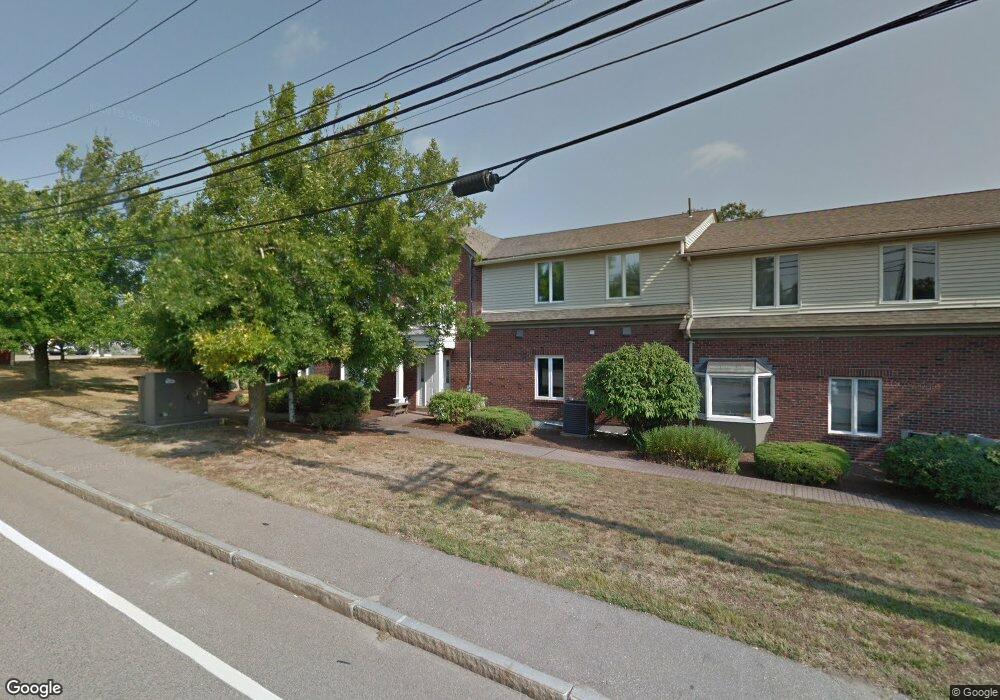
409 Pond St Unit 12 Braintree, MA 02184
South Braintree NeighborhoodEstimated Value: $396,757
Studio
--
Bath
1,373
Sq Ft
$289/Sq Ft
Est. Value
About This Home
This home is located at 409 Pond St Unit 12, Braintree, MA 02184 and is currently estimated at $396,757, approximately $288 per square foot. 409 Pond St Unit 12 is a home located in Norfolk County with nearby schools including Braintree High School, Step Ahead Kindergarten, and Lighthouse Baptist Christian Academy.
Ownership History
Date
Name
Owned For
Owner Type
Purchase Details
Closed on
Aug 28, 2019
Sold by
Cnc Properties Llc
Bought by
Choice Community Supports
Current Estimated Value
Purchase Details
Closed on
Apr 25, 2013
Sold by
Cap Rt and Gately
Bought by
Cnc Props Llc
Home Financials for this Owner
Home Financials are based on the most recent Mortgage that was taken out on this home.
Original Mortgage
$112,500
Interest Rate
3.64%
Mortgage Type
Commercial
Purchase Details
Closed on
Jan 2, 2013
Sold by
Gately Carol
Bought by
Cap Rt and Gately
Create a Home Valuation Report for This Property
The Home Valuation Report is an in-depth analysis detailing your home's value as well as a comparison with similar homes in the area
Home Values in the Area
Average Home Value in this Area
Purchase History
We collect this data history from publicly available records. To have your information removed, we recommend requesting removal directly through your county’s website.
| Date | Buyer | Sale Price | Title Company |
|---|---|---|---|
| Choice Community Supports | $275,000 | -- | |
| Cnc Props Llc | $145,000 | -- | |
| Cnc Props Llc | $145,000 | -- | |
| Cap Rt | -- | -- |
Source: Public Records
Mortgage History
We collect this data history from publicly available records. To have your information removed, we recommend requesting removal directly through your county’s website.
| Date | Status | Borrower | Loan Amount |
|---|---|---|---|
| Previous Owner | Cnc Props Llc | $112,500 | |
| Previous Owner | Cnc Props Llc | $58,500 | |
| Previous Owner | Cap Rt | $125,000 |
Source: Public Records
Tax History
| Year | Tax Paid | Tax Assessment Tax Assessment Total Assessment is a certain percentage of the fair market value that is determined by local assessors to be the total taxable value of land and additions on the property. | Land | Improvement |
|---|---|---|---|---|
| 2025 | $0 | $303,100 | $0 | $303,100 |
| 2024 | $0 | $301,500 | $0 | $301,500 |
| 2023 | $0 | $287,500 | $0 | $287,500 |
| 2022 | $0 | $268,800 | $0 | $268,800 |
| 2021 | $0 | $170,500 | $0 | $170,500 |
| 2020 | $3,719 | $170,500 | $0 | $170,500 |
| 2019 | $3,608 | $162,500 | $0 | $162,500 |
| 2018 | $3,594 | $153,800 | $0 | $153,800 |
| 2017 | $3,337 | $140,700 | $0 | $140,700 |
| 2016 | $3,470 | $140,700 | $0 | $140,700 |
| 2015 | $3,510 | $140,700 | $0 | $140,700 |
| 2014 | $3,768 | $144,600 | $0 | $144,600 |
Source: Public Records
Map
Nearby Homes
- 399 Pond St Unit D1
- 4 Lake St
- 801 Granite St
- 11 Hingston Cir
- 11 Royal Lake Dr Unit 6
- 111 Barstow Dr
- 614 Pond St Unit 2306
- 614 Pond St Unit 1303
- 42 Maitland Ave
- 122 Franklin St
- 6 Franklin St
- 137 Eleanor Dr
- 107 Meadow Ln Unit 107
- 14 Lewis Rd
- 1 Brewster Rd
- 24 Brow Ave
- 25 Hobart Ave
- 1579 Washington St
- 31 Brierwood Rd
- 77 French Ave
- 409 Pond St Unit 2
- 409 Pond St Unit 9
- 409 Pond St Unit 8
- 409 Pond St
- 999 Granite St
- 947 Granite St
- 937 Granite St
- 935 Granite St
- 951 Granite St
- 951 Granite St Unit 1
- 951 Granite St Unit 2
- 399 Pond St Unit F12
- 399 Pond St Unit E12
- 399 Pond St Unit F11
- 399 Pond St Unit E11
- 399 Pond St Unit F10
- 399 Pond St Unit E10
- 399 Pond St Unit G9
- 399 Pond St Unit F9
- 399 Pond St Unit E9
Your Personal Tour Guide
Ask me questions while you tour the home.