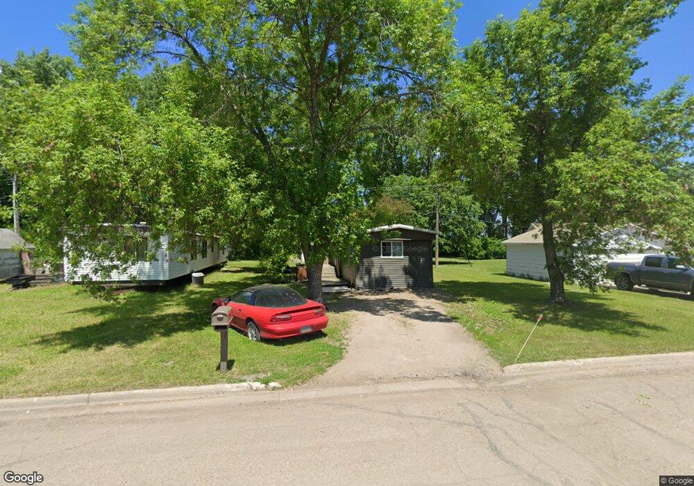
409 River Range Rd Drayton, ND 58225
Estimated Value: $36,076 - $86,000
Studio
--
Bath
--
Sq Ft
7,492
Sq Ft Lot
About This Home
This home is located at 409 River Range Rd, Drayton, ND 58225 and is currently estimated at $62,519. 409 River Range Rd is a home with nearby schools including Drayton Elementary School and Drayton High School.
Ownership History
Date
Name
Owned For
Owner Type
Purchase Details
Closed on
Nov 21, 2025
Sold by
Passa Ian and Passa Christopher
Bought by
Vancamp Nicholas
Current Estimated Value
Home Financials for this Owner
Home Financials are based on the most recent Mortgage that was taken out on this home.
Original Mortgage
$37,400
Outstanding Balance
$35,793
Interest Rate
6.24%
Mortgage Type
New Conventional
Estimated Equity
$26,726
Purchase Details
Closed on
Apr 4, 2024
Sold by
Kuznia David and Kuznia Debra
Bought by
Kuznia David and Kuznia Debra
Purchase Details
Closed on
Sep 7, 2022
Sold by
Kuznia Melissa S
Bought by
Kuznia Rebecca L
Purchase Details
Closed on
Oct 15, 2014
Sold by
Schlittenhard Linda
Bought by
Pembina County
Purchase Details
Closed on
Nov 9, 2006
Sold by
Bloomquist Daniel and Bloomquist Dawn Berry
Bought by
Kuznia Melissa
Create a Home Valuation Report for This Property
The Home Valuation Report is an in-depth analysis detailing your home's value as well as a comparison with similar homes in the area
Purchase History
| Date | Buyer | Sale Price | Title Company |
|---|---|---|---|
| Vancamp Nicholas | $44,000 | None Listed On Document | |
| Kuznia David | -- | None Listed On Document | |
| Kuznia Rebecca L | $700 | -- | |
| Pembina County | $205 | None Available | |
| Kuznia Melissa | -- | None Available |
Source: Public Records
Mortgage History
| Date | Status | Borrower | Loan Amount |
|---|---|---|---|
| Open | Vancamp Nicholas | $37,400 |
Source: Public Records
Tax History
| Year | Tax Paid | Tax Assessment Tax Assessment Total Assessment is a certain percentage of the fair market value that is determined by local assessors to be the total taxable value of land and additions on the property. | Land | Improvement |
|---|---|---|---|---|
| 2024 | $51 | $5,354 | $1,130 | $4,224 |
| 2023 | $196 | $5,151 | $1,088 | $4,063 |
| 2022 | $197 | $5,151 | $1,088 | $4,063 |
| 2021 | $180 | $4,906 | $1,036 | $3,870 |
| 2020 | $196 | $4,906 | $1,036 | $3,870 |
| 2019 | $197 | $4,906 | $1,036 | $3,870 |
| 2018 | $184 | $4,500 | $950 | $3,550 |
| 2017 | $181 | $4,500 | $950 | $3,550 |
| 2016 | $66 | $0 | $0 | $0 |
| 2015 | $68 | $0 | $0 | $0 |
| 2014 | $186 | $0 | $0 | $0 |
| 2013 | $121 | $0 | $0 | $0 |
Source: Public Records
Map
Nearby Homes
- 103 E Leslie Ave
- 204 N 3rd St
- 207 S Main St
- 15505 County Road 9
- TBD Main St
- 504 E Franklin Ave
- 21 Eastwood Dr
- 315 Burgamott Ave
- 320 Prospect Ave
- 647 Noben Ave
- 98 E 5th St
- 826 Stephen Ave
- 624 Western Ave
- 906 Griggs Ave
- 1118 Hill Ave
- 1135 Hill Ave
- 1320 Manvel Ave
- 1407 Manvel Ave
- 919 Lawler Ave
- 1452 Hill Ave
- 413 River Range Rd
- 407 River Range Rd
- 403 River Range Rd
- 317 River Range Rd
- 301 River Range Rd
- 506 Ordway St
- 504 Ordway St
- 709 Dakota Ct
- 204 E Scribner Ave
- 410 Ordway St
- 408 Ordway St
- 507 Windom St
- 207 E Harper Ave
- 203 E Scribner Ave
- 511 Windom St
- 505 Windom St
- 807 Red River Place
- 503 Windom St
- 411 Windom St
- 701 Dakota Ct
Your Personal Tour Guide
Ask me questions while you tour the home.