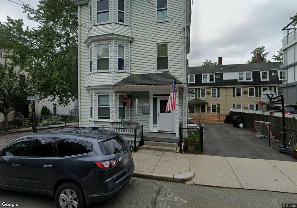
41 Franklin St Brookline, MA 02445
Brookline Village NeighborhoodEstimated Value: $1,415,000 - $1,940,000
6
Beds
3
Baths
2,970
Sq Ft
$574/Sq Ft
Est. Value
About This Home
This home is located at 41 Franklin St, Brookline, MA 02445 and is currently estimated at $1,703,667, approximately $573 per square foot. 41 Franklin St is a home located in Norfolk County with nearby schools including William H. Lincoln School, Brookline High School, and Bridge Boston Charter School.
Ownership History
Date
Name
Owned For
Owner Type
Purchase Details
Closed on
Apr 3, 1978
Bought by
Jennings Eileen T
Current Estimated Value
Create a Home Valuation Report for This Property
The Home Valuation Report is an in-depth analysis detailing your home's value as well as a comparison with similar homes in the area
Home Values in the Area
Average Home Value in this Area
Purchase History
We collect this data history from publicly available records. To have your information removed, we recommend requesting removal directly through your county’s website.
| Date | Buyer | Sale Price | Title Company |
|---|---|---|---|
| Jennings Eileen T | $30,000 | -- |
Source: Public Records
Mortgage History
We collect this data history from publicly available records. To have your information removed, we recommend requesting removal directly through your county’s website.
| Date | Status | Borrower | Loan Amount |
|---|---|---|---|
| Open | Jennings Eileen T | $190,000 | |
| Closed | Jennings Eileen T | $80,000 |
Source: Public Records
Tax History
| Year | Tax Paid | Tax Assessment Tax Assessment Total Assessment is a certain percentage of the fair market value that is determined by local assessors to be the total taxable value of land and additions on the property. | Land | Improvement |
|---|---|---|---|---|
| 2025 | $16,185 | $1,639,800 | $655,400 | $984,400 |
| 2024 | $16,318 | $1,670,200 | $630,200 | $1,040,000 |
| 2023 | $15,179 | $1,522,500 | $547,700 | $974,800 |
| 2022 | $14,776 | $1,450,000 | $521,600 | $928,400 |
| 2021 | $13,663 | $1,394,200 | $501,500 | $892,700 |
| 2020 | $12,943 | $1,369,600 | $455,900 | $913,700 |
| 2019 | $12,222 | $1,304,400 | $434,200 | $870,200 |
| 2018 | $11,597 | $1,225,900 | $373,200 | $852,700 |
| 2017 | $11,216 | $1,135,200 | $352,200 | $783,000 |
| 2016 | $10,753 | $1,032,000 | $329,100 | $702,900 |
| 2015 | $10,020 | $938,200 | $307,600 | $630,600 |
| 2014 | $10,334 | $907,300 | $279,600 | $627,700 |
Source: Public Records
Map
Nearby Homes
- 293 Cypress St
- 68 Chestnut St Unit 2
- 166 Chestnut St Unit 1
- 22 Chestnut Place Unit 210
- 255 Walnut St Unit B
- 18 Chestnut Place
- 1 Chestnut Place
- 57-59 Highland Rd Unit 57
- 65 Glen Rd Unit H1
- 8 Leverett St Unit 4
- 60 Glen Rd Unit 101
- 241 Perkins St Unit D204
- 241 Perkins St Unit G102
- 16 Kennard Rd
- 428 Boylston St
- 69 Walnut St Unit 4
- 99 Pond Ave Unit 222
- 99 Pond Ave Unit 417
- 77 Pond Ave Unit 412
- 77 Pond Ave Unit 401
- 19 Roberts St Unit 1
- 19 Roberts St
- 19 Roberts St Unit 19 Roberts Street
- 19 Roberts St Unit 8
- 19 Roberts St Unit 4
- 19 Roberts St Unit 19,2
- 19 Roberts St Unit 2/3
- 19 Roberts St
- 19 Roberts St Unit 2
- 19 Roberts St Unit 3
- 51 Franklin St Unit 53
- 17 Roberts St Unit 3
- 17 Roberts St Unit 2
- 17 Roberts St Unit 1
- 17 Roberts St
- 23 Roberts St
- 23 Roberts St Unit 2
- 23 Roberts St Unit 1
- 13 Roberts St
- 20 Hart St
Your Personal Tour Guide
Ask me questions while you tour the home.