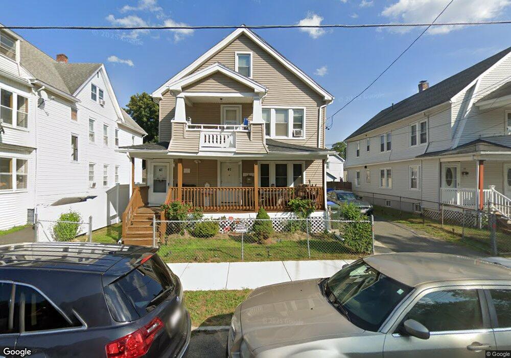
41 Langdon St Unit 43 Springfield, MA 01104
Liberty Heights NeighborhoodEstimated Value: $352,036 - $417,000
8
Beds
3
Baths
2,870
Sq Ft
$137/Sq Ft
Est. Value
About This Home
This home is located at 41 Langdon St Unit 43, Springfield, MA 01104 and is currently estimated at $392,259, approximately $136 per square foot. 41 Langdon St Unit 43 is a home located in Hampden County with nearby schools including Glenwood School, Van Sickle Academy, and High School Of Commerce.
Ownership History
Date
Name
Owned For
Owner Type
Purchase Details
Closed on
Sep 14, 2023
Sold by
Santiago Enrique
Bought by
White Brick Llc
Current Estimated Value
Purchase Details
Closed on
Feb 15, 2017
Sold by
Agosto Marisabel and Galarza Juan
Bought by
Santiago Enrique
Home Financials for this Owner
Home Financials are based on the most recent Mortgage that was taken out on this home.
Original Mortgage
$116,400
Interest Rate
4.2%
Mortgage Type
New Conventional
Purchase Details
Closed on
Nov 10, 1995
Sold by
Kennedy William and Kennedy Thomas F
Bought by
Agosto Marisabel and Saez Guillermo
Home Financials for this Owner
Home Financials are based on the most recent Mortgage that was taken out on this home.
Original Mortgage
$69,550
Interest Rate
7.62%
Mortgage Type
Purchase Money Mortgage
Create a Home Valuation Report for This Property
The Home Valuation Report is an in-depth analysis detailing your home's value as well as a comparison with similar homes in the area
Home Values in the Area
Average Home Value in this Area
Purchase History
We collect this data history from publicly available records. To have your information removed, we recommend requesting removal directly through your county’s website.
| Date | Buyer | Sale Price | Title Company |
|---|---|---|---|
| White Brick Llc | -- | None Available | |
| Santiago Enrique | $120,000 | -- | |
| Agosto Marisabel | $69,000 | -- |
Source: Public Records
Mortgage History
We collect this data history from publicly available records. To have your information removed, we recommend requesting removal directly through your county’s website.
| Date | Status | Borrower | Loan Amount |
|---|---|---|---|
| Previous Owner | Santiago Enrique | $116,400 | |
| Previous Owner | Agosto Marisabel | $69,550 |
Source: Public Records
Tax History
| Year | Tax Paid | Tax Assessment Tax Assessment Total Assessment is a certain percentage of the fair market value that is determined by local assessors to be the total taxable value of land and additions on the property. | Land | Improvement |
|---|---|---|---|---|
| 2025 | $4,673 | $298,000 | $37,200 | $260,800 |
| 2024 | $3,830 | $238,500 | $37,200 | $201,300 |
| 2023 | $3,277 | $192,200 | $32,900 | $159,300 |
| 2022 | $3,239 | $172,100 | $30,800 | $141,300 |
| 2021 | $3,139 | $166,100 | $28,000 | $138,100 |
| 2020 | $2,994 | $153,300 | $28,000 | $125,300 |
| 2019 | $2,507 | $127,400 | $23,200 | $104,200 |
| 2018 | $2,524 | $133,600 | $23,200 | $110,400 |
| 2017 | $2,524 | $128,400 | $24,700 | $103,700 |
| 2016 | $2,536 | $129,000 | $24,700 | $104,300 |
| 2015 | $2,455 | $124,800 | $24,700 | $100,100 |
Source: Public Records
Map
Nearby Homes
- 127 Governor St
- 78 Governor St
- 70 Norman St
- 774-776 Liberty St
- 36 Parkin St
- 138 Wilber St
- 105 Wilber St
- 32-34 Van Buren Ave
- 17 Mcbride St
- 140 Eddy St
- 127 Melha Ave
- 827-831 Armory St
- 46 Knollwood St
- 18 Los Angeles St
- 14-16 Wolcott St
- 85 Farnsworth St
- 33-35 Algonquin Place
- 521 Liberty St
- 181 Merrimac Ave
- 34 Savoy Ave Unit 36
- 41-43 Langdon St
- 37 Langdon St Unit 39
- 47 Langdon St Unit 49
- 44 Home St Unit 46
- 44-46 Home St
- 31 Langdon St Unit 33
- 53 Langdon St
- 51-53 Langdon St
- 46 Home St
- 51 Langdon St
- 40 Home St Unit 42
- 50 Home St
- 36 Home St
- 54 Home St Unit 56
- 27 Langdon St
- 57 Langdon St Unit 59
- 38 Langdon St Unit 40
- 38-40 Langdon St
- 36 Langdon St
- 34 Langdon St Unit 36
Your Personal Tour Guide
Ask me questions while you tour the home.