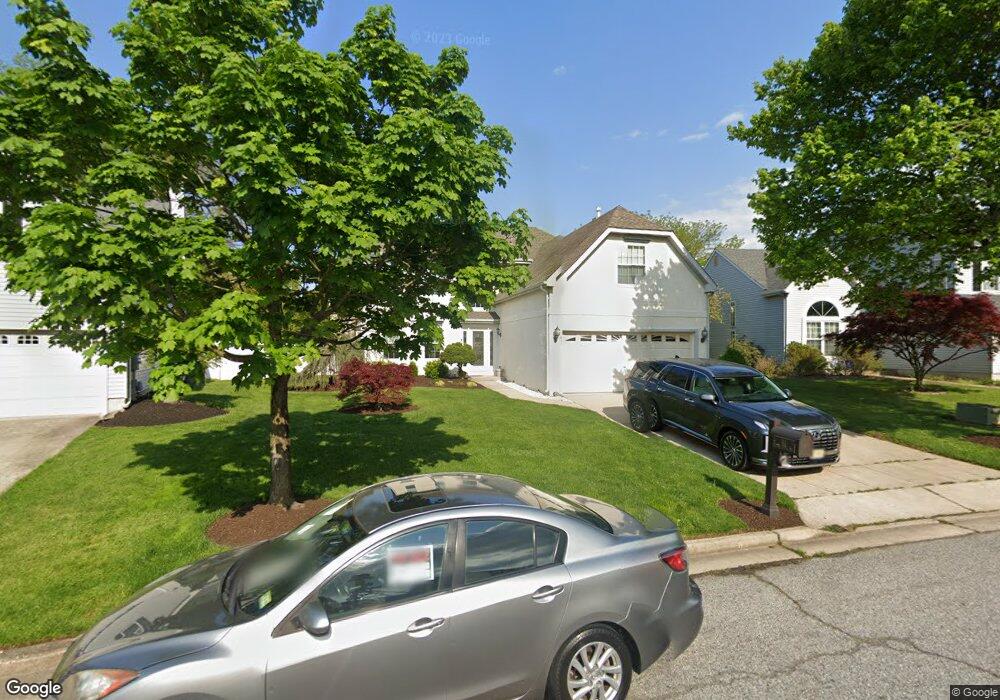
41 Longbridge Dr Mount Laurel, NJ 08054
Estimated Value: $525,346 - $629,000
Studio
--
Bath
2,122
Sq Ft
$272/Sq Ft
Est. Value
About This Home
This home is located at 41 Longbridge Dr, Mount Laurel, NJ 08054 and is currently estimated at $577,837, approximately $272 per square foot. 41 Longbridge Dr is a home located in Burlington County with nearby schools including Countryside Elementary School, T.E. Harrington Middle School, and Mount Laurel Hartford School.
Ownership History
Date
Name
Owned For
Owner Type
Purchase Details
Closed on
Mar 27, 2026
Sold by
Polter and Polter Betty
Bought by
Polter Brian and Polter Betty
Current Estimated Value
Purchase Details
Closed on
Jan 13, 1995
Sold by
Orleans Construction Corp
Bought by
Polter Brian and Polter Betty
Purchase Details
Closed on
Jan 13, 1994
Sold by
Orleans Construction Corp
Bought by
Polter Brian and Polter Betty
Create a Home Valuation Report for This Property
The Home Valuation Report is an in-depth analysis detailing your home's value as well as a comparison with similar homes in the area
Home Values in the Area
Average Home Value in this Area
Purchase History
We collect this data history from publicly available records. To have your information removed, we recommend requesting removal directly through your county’s website.
| Date | Buyer | Sale Price | Title Company |
|---|---|---|---|
| Polter Brian | -- | None Listed On Document | |
| Polter Brian | $184,691 | Settlers Title Agency | |
| Polter Brian | $184,691 | Settlers Title Agency |
Source: Public Records
Tax History
| Year | Tax Paid | Tax Assessment Tax Assessment Total Assessment is a certain percentage of the fair market value that is determined by local assessors to be the total taxable value of land and additions on the property. | Land | Improvement |
|---|---|---|---|---|
| 2025 | $9,348 | $296,100 | $100,500 | $195,600 |
| 2024 | $8,996 | $296,100 | $100,500 | $195,600 |
| 2023 | $8,996 | $296,100 | $100,500 | $195,600 |
| 2022 | $8,966 | $296,100 | $100,500 | $195,600 |
| 2021 | $8,797 | $296,100 | $100,500 | $195,600 |
| 2020 | $8,625 | $296,100 | $100,500 | $195,600 |
| 2019 | $8,537 | $296,100 | $100,500 | $195,600 |
| 2018 | $8,471 | $296,100 | $100,500 | $195,600 |
| 2017 | $8,252 | $296,100 | $100,500 | $195,600 |
| 2016 | $8,128 | $296,100 | $100,500 | $195,600 |
| 2015 | $8,033 | $296,100 | $100,500 | $195,600 |
| 2014 | $7,953 | $296,100 | $100,500 | $195,600 |
Source: Public Records
Map
Nearby Homes
- 17 Ballinger Way
- 41 Biddle Way
- 136 Buckingham Way
- 37 Elkington Dr
- 48 Meadowrue Ct
- 906B Oliphant Ln Unit 906B
- 44 Village Ln Unit 44
- 903 Ginger Ct
- 2702B Bluegrass Dr Unit B
- 27 Gardenia Dr
- 1206B Ginger Ct
- 10 Village Ct Unit 10
- 9 Village Ct Unit 9
- 91 Center Ln Unit 91
- 3 B E Daisy Ln Unit B
- 105 Wharton Rd Unit 105
- 3003 Sweetleaf Terrace Unit 3003
- 21 A E Daisy Ln
- 1202 Wharton Rd Unit 1202
- 1303 Wharton Rd
- 43 Longbridge Dr
- 39 Longbridge Dr
- 60 Watson Dr
- 45 Longbridge Dr
- 37 Longbridge Dr
- 37 Long Bridge Dr
- 56 Watson Dr
- 62 Watson Dr
- 40 Longbridge Dr
- 42 Longbridge Dr
- 47 Longbridge Dr
- 35 Longbridge Dr
- 54 Watson Dr
- 38 Longbridge Dr
- 64 Watson Dr
- 44 Long Bridge Dr
- 44 Longbridge Dr
- 36 Longbridge Dr
- 33 Longbridge Dr
- 49 Longbridge Dr
Your Personal Tour Guide
Ask me questions while you tour the home.