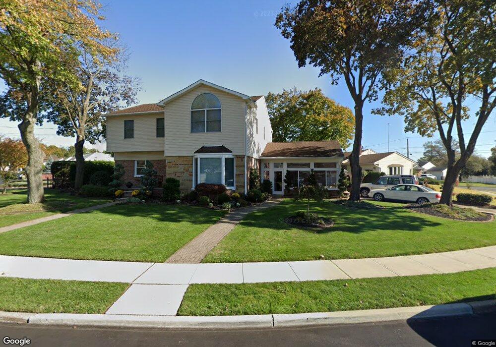
41 Sharon Ave Edison, NJ 08817
Estimated Value: $615,293 - $699,000
Studio
--
Bath
2,159
Sq Ft
$312/Sq Ft
Est. Value
About This Home
This home is located at 41 Sharon Ave, Edison, NJ 08817 and is currently estimated at $674,573, approximately $312 per square foot. 41 Sharon Ave is a home located in Middlesex County with nearby schools including Benjamin Franklin Elementary School, Herbert Hoover Middle School, and Edison High School.
Ownership History
Date
Name
Owned For
Owner Type
Purchase Details
Closed on
Apr 14, 2021
Sold by
Irving Sue Lynn and Irving Roy L
Bought by
Irving Sue Lynn and Irving Roy L
Current Estimated Value
Purchase Details
Closed on
Apr 16, 1997
Sold by
Wessel Laura
Bought by
Irving Roy and Ramdhanie Sue Lynn
Home Financials for this Owner
Home Financials are based on the most recent Mortgage that was taken out on this home.
Original Mortgage
$144,000
Outstanding Balance
$18,407
Interest Rate
7.76%
Mortgage Type
FHA
Estimated Equity
$656,166
Create a Home Valuation Report for This Property
The Home Valuation Report is an in-depth analysis detailing your home's value as well as a comparison with similar homes in the area
Home Values in the Area
Average Home Value in this Area
Purchase History
We collect this data history from publicly available records. To have your information removed, we recommend requesting removal directly through your county’s website.
| Date | Buyer | Sale Price | Title Company |
|---|---|---|---|
| Irving Sue Lynn | -- | None Available | |
| Irving Roy | $145,000 | -- |
Source: Public Records
Mortgage History
We collect this data history from publicly available records. To have your information removed, we recommend requesting removal directly through your county’s website.
| Date | Status | Borrower | Loan Amount |
|---|---|---|---|
| Open | Irving Roy | $144,000 |
Source: Public Records
Tax History
| Year | Tax Paid | Tax Assessment Tax Assessment Total Assessment is a certain percentage of the fair market value that is determined by local assessors to be the total taxable value of land and additions on the property. | Land | Improvement |
|---|---|---|---|---|
| 2025 | $11,382 | $191,200 | $85,400 | $105,800 |
| 2024 | $11,321 | $191,200 | $85,400 | $105,800 |
| 2023 | $11,321 | $191,200 | $85,400 | $105,800 |
| 2022 | $11,325 | $191,200 | $85,400 | $105,800 |
| 2021 | $11,287 | $191,200 | $85,400 | $105,800 |
| 2020 | $11,183 | $191,200 | $85,400 | $105,800 |
| 2019 | $10,554 | $191,200 | $85,400 | $105,800 |
| 2018 | $10,370 | $191,200 | $85,400 | $105,800 |
| 2017 | $10,274 | $191,200 | $85,400 | $105,800 |
| 2016 | $10,088 | $191,200 | $85,400 | $105,800 |
| 2015 | $9,701 | $191,200 | $85,400 | $105,800 |
| 2014 | $9,419 | $191,200 | $85,400 | $105,800 |
Source: Public Records
Map
Nearby Homes
- 165 Old Post Rd
- 213 Old Post Rd
- 31 Stevens Rd
- 130 Garden Terrace
- 4 Conover Ct
- 144 Garden Terrace
- 12 Old Post Rd
- 55 Market St
- 31 Pacific St
- 25 Hill Rd
- 24 Woodedge Ave Unit 8
- 38 Simpson Ave
- 2 Dey Place
- 56 Ferris Rd
- 340 Old Post Rd
- 42 Plainfield Ave
- 22 Meyer Rd
- 7 Bayberry Ct
- 11 Melbourne St
- 17 Hillcrest Ave
- 39 Violet Place
- 39 Violet Place Unit 5
- 43 Violet Place
- 35 Violet Place
- 47 Violet Place
- 46 Sharon Ave
- 48 Sharon Ave
- 34 Violet Place
- 52 Sharon Ave
- 31 Violet Place
- 40 Violet Place
- 44 Sharon Ave
- 53 Violet Place
- 56 Sharon Ave
- 44 Violet Place
- 27 Violet Place
- 7 Gurley Rd
- 23 Violet Place
- 57 Violet Place
- 48 Violet Place
Your Personal Tour Guide
Ask me questions while you tour the home.