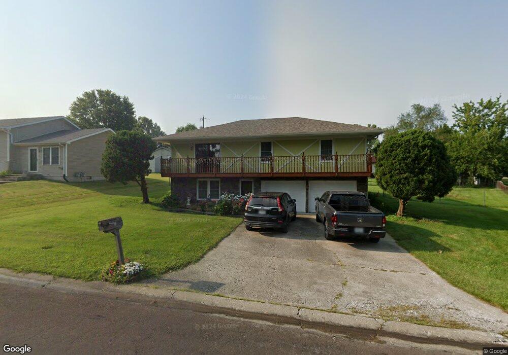
410 Chestnut Dr Marshall, MO 65340
Estimated Value: $155,360 - $206,000
About This Home
This home is located at 410 Chestnut Dr, Marshall, MO 65340 and is currently estimated at $177,090, approximately $115 per square foot. 410 Chestnut Dr is a home located in Saline County with nearby schools including Marshall Senior High School and St. Peter Catholic School.
Ownership History
We collect this data history from publicly available records. To have your information removed, we recommend requesting removal directly through your county’s website.
Purchase Details
Home Financials for this Owner
Home Financials are based on the most recent Mortgage that was taken out on this home.Home Values in the Area
Average Home Value in this Area
Purchase History
We collect this data history from publicly available records. To have your information removed, we recommend requesting removal directly through your county’s website.
| Date | Buyer | Sale Price | Title Company |
|---|---|---|---|
| $119,949 | Truman Title Inc |
Mortgage History
We collect this data history from publicly available records. To have your information removed, we recommend requesting removal directly through your county’s website.
| Date | Status | Borrower | Loan Amount |
|---|---|---|---|
| Open | $95,959 |
Tax History
We collect this data history from publicly available records. To have your information removed, we recommend requesting removal directly through your county’s website.
| Year | Tax Paid | Tax Assessment Tax Assessment Total Assessment is a certain percentage of the fair market value that is determined by local assessors to be the total taxable value of land and additions on the property. | Land | Improvement |
|---|---|---|---|---|
| 2025 | $1,271 | $23,420 | $1,690 | $21,730 |
| 2024 | $1,251 | $20,370 | $1,470 | $18,900 |
| 2023 | $1,251 | $20,370 | $1,470 | $18,900 |
| 2022 | $991 | $20,370 | $1,470 | $18,900 |
| 2021 | $990 | $20,370 | $1,470 | $18,900 |
| 2020 | $726 | $13,270 | $1,470 | $11,800 |
| 2019 | $715 | $13,270 | $13,270 | $0 |
| 2018 | $711 | $13,270 | $13,270 | $0 |
| 2017 | $715 | $13,270 | $0 | $0 |
| 2016 | $710 | $13,270 | $0 | $0 |
| 2015 | -- | $13,270 | $0 | $0 |
| 2014 | -- | $13,270 | $0 | $0 |
Map
- 405 W High St
- 430 Chestnut Dr
- 630 N Lyon Ave
- 621 N Ellsworth Ave
- 329 W Slater St
- 126 W Slater St
- 112 W Slater St
- 600 N Franklin Ave
- 618 N Franklin Ave
- 502 N Ellsworth Ave
- 694 N Ted Ave
- 617 N Odell Ave
- 306 E High St
- 425 N Bond Ave
- 406 N Odell Ave
- 0 E Shamrock Dr
- 214 N Bell Ave
- 710 N Brunswick Ave
- 600 N Brunswick Ave
- 460 W Arrow St
- 411 W High St
- 343 W High St
- 644 N Ellsworth Ave
- 339 W High St
- 647 N Ellsworth Ave
- 331 W High St
- 415 W High St
- 340 Chestnut Dr
- 642 N Ellsworth Ave
- 340 W High St
- 643 N Ellsworth Ave
- 323 W High St
- 330 Chestnut Dr
- 639 N Ellsworth Ave
- 640 N Ellsworth Ave
- 315 W High St
- 400 Chestnut Dr
- 634 N Ellsworth Ave
- 310 Chestnut Dr
- 320 W High St
Ask me questions while you tour the home.