Estimated Value: $376,000 - $402,839
3
Beds
2
Baths
1,956
Sq Ft
$202/Sq Ft
Est. Value
About This Home
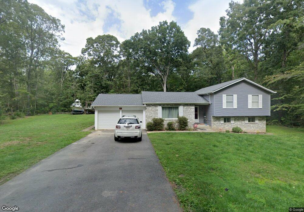
This home is located at 410 Range Rd E, Lusby, MD 20657 and is currently estimated at $394,460, approximately $201 per square foot. 410 Range Rd E is a home located in Calvert County with nearby schools including Dowell Elementary School, Mill Creek Middle School, and Patuxent High School.
Ownership History
Date
Name
Owned For
Owner Type
Purchase Details
Closed on
Aug 5, 2016
Sold by
Dodson Patrick and Pd Investment Trust
Bought by
Thomas Sarah and Thomas Sarah Michelle
Current Estimated Value
Home Financials for this Owner
Home Financials are based on the most recent Mortgage that was taken out on this home.
Original Mortgage
$256,966
Outstanding Balance
$204,564
Interest Rate
3.41%
Mortgage Type
New Conventional
Estimated Equity
$189,896
Purchase Details
Closed on
May 2, 2016
Sold by
U S Bank National Association
Bought by
Dodson Patrick and Pd Investments Trust
Home Financials for this Owner
Home Financials are based on the most recent Mortgage that was taken out on this home.
Original Mortgage
$97,461
Interest Rate
3.58%
Mortgage Type
Purchase Money Mortgage
Purchase Details
Closed on
Oct 15, 2015
Sold by
Jones Robert E
Bought by
U S Bank National Association
Purchase Details
Closed on
Aug 15, 2005
Sold by
Bohn Robert Leroy
Bought by
Jones Robert E
Home Financials for this Owner
Home Financials are based on the most recent Mortgage that was taken out on this home.
Original Mortgage
$20,900
Interest Rate
7.84%
Mortgage Type
Adjustable Rate Mortgage/ARM
Purchase Details
Closed on
Jul 29, 2005
Sold by
Bohn Robert Leroy
Bought by
Jones Robert E
Home Financials for this Owner
Home Financials are based on the most recent Mortgage that was taken out on this home.
Original Mortgage
$20,900
Interest Rate
7.84%
Mortgage Type
Adjustable Rate Mortgage/ARM
Purchase Details
Closed on
Oct 4, 1993
Sold by
Moody M M
Bought by
Bohn Robert L
Home Financials for this Owner
Home Financials are based on the most recent Mortgage that was taken out on this home.
Original Mortgage
$97,500
Interest Rate
7%
Purchase Details
Closed on
Dec 18, 1990
Sold by
Quality Built Homes Inc
Bought by
Moody Michael W and Moody Betty E
Home Financials for this Owner
Home Financials are based on the most recent Mortgage that was taken out on this home.
Original Mortgage
$100,478
Interest Rate
9.56%
Create a Home Valuation Report for This Property
The Home Valuation Report is an in-depth analysis detailing your home's value as well as a comparison with similar homes in the area
Home Values in the Area
Average Home Value in this Area
Purchase History
| Date | Buyer | Sale Price | Title Company |
|---|---|---|---|
| Thomas Sarah | $249,900 | Titlemax Llc | |
| Dodson Patrick | $95,550 | New World Title Company Llc | |
| U S Bank National Association | $356,106 | None Available | |
| Jones Robert E | $262,000 | -- | |
| Jones Robert E | $262,000 | Brennan Title Co | |
| Jones Robert E | $262,000 | -- | |
| Bohn Robert L | $97,500 | -- | |
| Moody Michael W | $98,900 | -- |
Source: Public Records
Mortgage History
| Date | Status | Borrower | Loan Amount |
|---|---|---|---|
| Open | Thomas Sarah | $256,966 | |
| Previous Owner | Dodson Patrick | $97,461 | |
| Previous Owner | Jones Robert E | $20,900 | |
| Previous Owner | Jones Robert E | $20,900 | |
| Previous Owner | Jones Robert E | $52,400 | |
| Previous Owner | Bohn Robert L | $97,500 | |
| Previous Owner | Moody Michael W | $100,478 |
Source: Public Records
Tax History
| Year | Tax Paid | Tax Assessment Tax Assessment Total Assessment is a certain percentage of the fair market value that is determined by local assessors to be the total taxable value of land and additions on the property. | Land | Improvement |
|---|---|---|---|---|
| 2025 | $3,784 | $310,233 | $0 | $0 |
| 2024 | $3,456 | $280,267 | $0 | $0 |
| 2023 | $2,755 | $250,300 | $55,200 | $195,100 |
| 2022 | $2,522 | $242,733 | $0 | $0 |
| 2021 | $5,896 | $235,167 | $0 | $0 |
| 2020 | $2,796 | $227,600 | $55,200 | $172,400 |
| 2019 | $2,259 | $215,300 | $0 | $0 |
| 2018 | $2,129 | $203,000 | $0 | $0 |
| 2017 | $2,394 | $190,700 | $0 | $0 |
| 2016 | -- | $189,933 | $0 | $0 |
| 2015 | $2,597 | $189,167 | $0 | $0 |
| 2014 | $2,597 | $188,400 | $0 | $0 |
Source: Public Records
Map
Nearby Homes
- 357 Cayuse Cir
- 334 Longhorn Cir
- 454 Dogwood Dr
- 298 Cove Dr
- 12817 Abilene Trail
- 12846 Laurel Way
- 484 Lake Dr
- 422 Lessin Dr
- 12646 High Sierra Rd
- 400 Clubhouse Dr
- 12751 Powder Horn Trail
- 206 Harbor Dr
- 12971 Mills Creek Dr
- 12990 Barreda Blvd
- 12921 Pine Ln
- 13000 Mills Creek Dr
- 12995 Rousby Hall Rd
- 12635 Western Cir
- 12959 Pine Ln
- 12820 Lake View Dr
- 410 E Range Rd
- 385 E Range Rd
- 378 Longhorn Cir
- 370 Longhorn Cir
- 380 E Range Rd
- 413 E Range Rd
- 405 E Range Rd
- 389 E Range Rd
- 417 E Range Rd
- 390 Longhorn Cir
- 12864 Longhorn Cir
- 401 E Range Rd
- 355 Longhorn Cir
- 412 S West Ct
- 408 S West Ct
- 368 E Range Rd
- 387 Longhorn Cir
- 12876 Rio Grande Trail
- 362 Longhorn Cir
- 391 Longhorn Cir
Your Personal Tour Guide
Ask me questions while you tour the home.