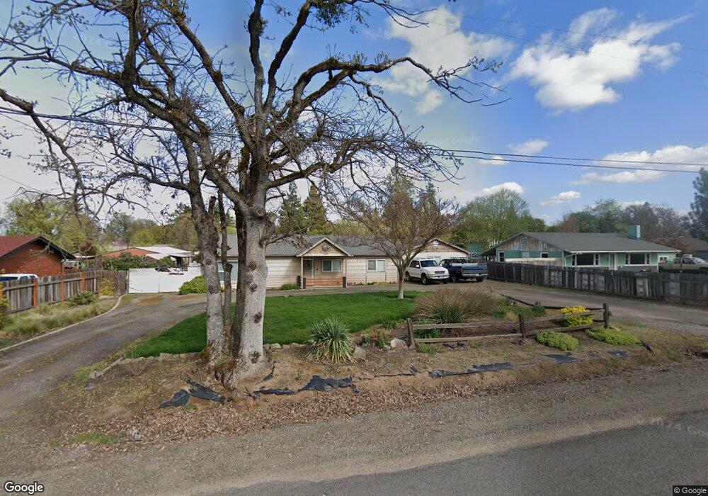
4118 Grant Rd Central Point, OR 97502
Estimated Value: $435,826 - $576,000
About This Home
This home is located at 4118 Grant Rd, Central Point, OR 97502 and is currently estimated at $495,609, approximately $295 per square foot. 4118 Grant Rd is a home located in Jackson County with nearby schools including Richardson Elementary School, Scenic Middle School, and Crater High School.
Ownership History
We collect this data history from publicly available records. To have your information removed, we recommend requesting removal directly through your county’s website.
Purchase Details
Purchase Details
Home Financials for this Owner
Home Financials are based on the most recent Mortgage that was taken out on this home.Purchase Details
Purchase Details
Purchase Details
Home Financials for this Owner
Home Financials are based on the most recent Mortgage that was taken out on this home.Purchase Details
Purchase History
We collect this data history from publicly available records. To have your information removed, we recommend requesting removal directly through your county’s website.
| Date | Buyer | Sale Price | Title Company |
|---|---|---|---|
| $193,550 | None Available | ||
| $188,000 | First American Title | ||
| $199,976 | None Available | ||
| -- | First American Title | ||
| $242,000 | First American | ||
| $140,650 | First American Title Ins Co |
Mortgage History
We collect this data history from publicly available records. To have your information removed, we recommend requesting removal directly through your county’s website.
| Date | Status | Borrower | Loan Amount |
|---|---|---|---|
| Previous Owner | $185,551 | ||
| Previous Owner | $193,600 | ||
| Closed | $48,400 |
Tax History
We collect this data history from publicly available records. To have your information removed, we recommend requesting removal directly through your county’s website.
| Year | Tax Paid | Tax Assessment Tax Assessment Total Assessment is a certain percentage of the fair market value that is determined by local assessors to be the total taxable value of land and additions on the property. | Land | Improvement |
|---|---|---|---|---|
| 2026 | $2,687 | $220,090 | -- | -- |
| 2025 | $2,625 | $213,680 | $132,480 | $81,200 |
| 2024 | $2,625 | $207,460 | $98,220 | $109,240 |
| 2023 | $2,538 | $201,420 | $95,360 | $106,060 |
| 2022 | $2,484 | $201,420 | $95,360 | $106,060 |
| 2021 | $2,414 | $195,560 | $92,580 | $102,980 |
| 2020 | $2,343 | $189,870 | $89,880 | $99,990 |
| 2019 | $2,289 | $178,980 | $84,730 | $94,250 |
| 2018 | $2,218 | $173,770 | $82,260 | $91,510 |
| 2017 | $2,165 | $173,770 | $82,260 | $91,510 |
| 2016 | $2,102 | $163,800 | $77,540 | $86,260 |
| 2015 | $2,005 | $163,800 | $77,540 | $86,260 |
| 2014 | -- | $154,400 | $73,090 | $81,310 |
Map
- 928 Buck Point St
- 1028 Buck Point St
- 1043 Sandoz St
- 1301 River Run St
- 429 Mayberry Ln
- 50 Kathryn Ct
- 0 Boulder Ridge St
- 607 Palo Verde Way
- 861 Mendolia Way
- 10 Donna Way
- 430 Bridge Creek Dr
- 545 Diego Ct Unit 1
- 441 N 1st St
- 610 Pheasant Creek
- 409 Castle Rock Dr
- 1618 River Run St
- 212 Windsor Way
- 4626 N Pacific Hwy
- 349 W Pine St
- 409 Sand Pointe Dr
- 4102 Grant Rd
- 4138 Grant Rd
- 4080 Grant Rd
- 4147 Grant Rd
- 4164 Grant Rd
- 4175 Carlton Ave
- 4165 Carlton Ave
- 4163 Carlton Ave
- 2496 Taylor Rd
- 4038 Grant Rd
- 805 Buck Point St
- 4178 Grant Rd
- 803 Buck Point St
- 4131 Carlton Ave
- 2400 Tulane Ave
- 2492 Taylor Rd
- 809 Buck Point St
- 2395 Tulane Ave
- 2395 Tulane Ave
- 807 Buck Point St
Ask me questions while you tour the home.