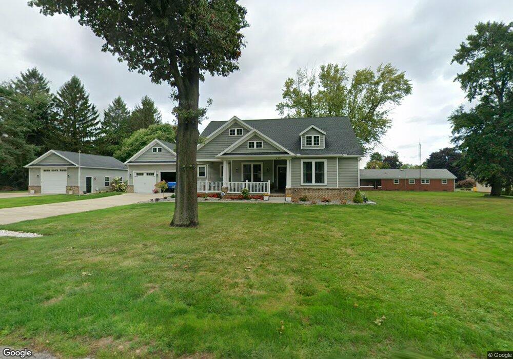
412 Walnut St Conneaut, OH 44030
Estimated Value: $423,000 - $451,800
3
Beds
2
Baths
2,072
Sq Ft
$213/Sq Ft
Est. Value
About This Home
This home is located at 412 Walnut St, Conneaut, OH 44030 and is currently estimated at $440,450, approximately $212 per square foot. 412 Walnut St is a home with nearby schools including Lakeshore Primary Elementary School, Gateway Elementary School, and Conneaut Middle School.
Ownership History
Date
Name
Owned For
Owner Type
Purchase Details
Closed on
Oct 15, 2024
Sold by
Peterson George A and Peterson Sandra K
Bought by
Greenfield Family Trust and Greenfield
Current Estimated Value
Purchase Details
Closed on
Aug 15, 2014
Sold by
Peterson Evelyn M
Bought by
Peterson George A and Peterson Sandra K
Purchase Details
Closed on
Oct 2, 2012
Sold by
Peterson Sandra K and Peterson George J
Bought by
Peterson Evelyn M
Purchase Details
Closed on
Jun 25, 2012
Sold by
Peterson Evelyn M
Bought by
Peterson George A and Peterson Sandra K
Create a Home Valuation Report for This Property
The Home Valuation Report is an in-depth analysis detailing your home's value as well as a comparison with similar homes in the area
Home Values in the Area
Average Home Value in this Area
Purchase History
| Date | Buyer | Sale Price | Title Company |
|---|---|---|---|
| Greenfield Family Trust | $430,000 | Title Professionals Group | |
| Greenfield Family Trust | $430,000 | Title Professionals Group | |
| Peterson George A | -- | None Available | |
| Peterson Evelyn M | -- | -- | |
| Peterson George A | -- | None Available |
Source: Public Records
Tax History
| Year | Tax Paid | Tax Assessment Tax Assessment Total Assessment is a certain percentage of the fair market value that is determined by local assessors to be the total taxable value of land and additions on the property. | Land | Improvement |
|---|---|---|---|---|
| 2024 | $8,142 | $111,300 | $15,120 | $96,180 |
| 2023 | $5,157 | $111,300 | $15,120 | $96,180 |
| 2022 | $4,364 | $82,920 | $11,660 | $71,260 |
| 2021 | $4,440 | $82,920 | $11,660 | $71,260 |
| 2020 | $4,437 | $82,920 | $11,660 | $71,260 |
| 2019 | $4,257 | $78,160 | $12,780 | $65,380 |
| 2018 | $4,058 | $78,160 | $12,780 | $65,380 |
| 2017 | $3,002 | $78,160 | $12,780 | $65,380 |
| 2016 | $3,605 | $75,610 | $12,360 | $63,250 |
| 2015 | $1,953 | $39,690 | $9,590 | $30,100 |
| 2014 | $417 | $9,590 | $9,590 | $0 |
| 2013 | $463 | $10,960 | $10,960 | $0 |
Source: Public Records
Map
Nearby Homes
Your Personal Tour Guide
Ask me questions while you tour the home.