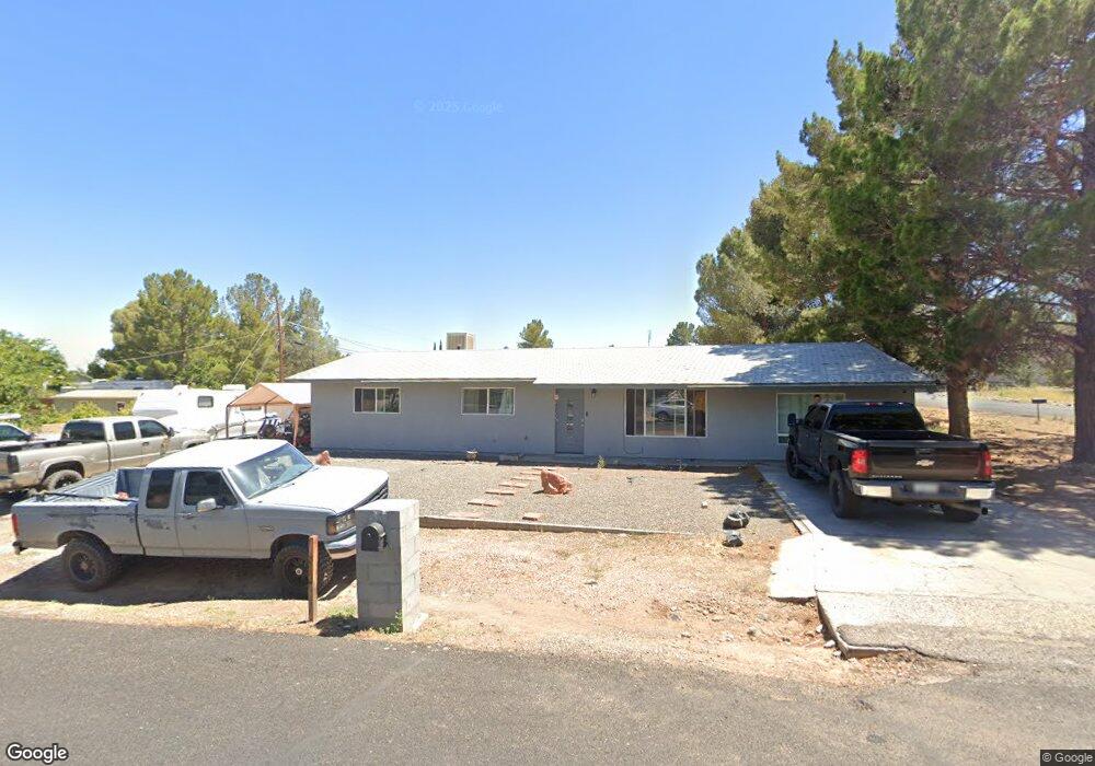
413 E Date St Cottonwood, AZ 86326
Cottonwood NeighborhoodEstimated Value: $336,000 - $405,000
3
Beds
2
Baths
1,248
Sq Ft
$296/Sq Ft
Est. Value
About This Home
This home is located at 413 E Date St, Cottonwood, AZ 86326 and is currently estimated at $369,453, approximately $296 per square foot. 413 E Date St is a home located in Yavapai County with nearby schools including Dr Daniel Bright Elementary School, Cottonwood Elementary School, and Cottonwood Community School.
Ownership History
Date
Name
Owned For
Owner Type
Purchase Details
Closed on
May 3, 2011
Sold by
Budde Mary Ann and Buckner Marti
Bought by
Montoya Loretta
Current Estimated Value
Home Financials for this Owner
Home Financials are based on the most recent Mortgage that was taken out on this home.
Original Mortgage
$92,227
Outstanding Balance
$63,975
Interest Rate
4.84%
Mortgage Type
Purchase Money Mortgage
Estimated Equity
$305,478
Create a Home Valuation Report for This Property
The Home Valuation Report is an in-depth analysis detailing your home's value as well as a comparison with similar homes in the area
Home Values in the Area
Average Home Value in this Area
Purchase History
| Date | Buyer | Sale Price | Title Company |
|---|---|---|---|
| Montoya Loretta | $89,000 | Yavapai Title Agency Cottonw |
Source: Public Records
Mortgage History
| Date | Status | Borrower | Loan Amount |
|---|---|---|---|
| Open | Montoya Loretta | $92,227 |
Source: Public Records
Tax History
| Year | Tax Paid | Tax Assessment Tax Assessment Total Assessment is a certain percentage of the fair market value that is determined by local assessors to be the total taxable value of land and additions on the property. | Land | Improvement |
|---|---|---|---|---|
| 2026 | $1,077 | $32,234 | -- | -- |
| 2024 | $1,055 | $31,823 | -- | -- |
| 2023 | $1,055 | $25,686 | $3,534 | $22,152 |
| 2022 | $1,052 | $20,885 | $2,854 | $18,031 |
| 2021 | $765 | $14,918 | $2,985 | $11,933 |
| 2020 | $759 | $0 | $0 | $0 |
| 2019 | $755 | $0 | $0 | $0 |
| 2018 | $725 | $0 | $0 | $0 |
| 2017 | $695 | $0 | $0 | $0 |
| 2016 | $683 | $0 | $0 | $0 |
| 2015 | $684 | $0 | $0 | $0 |
| 2014 | $609 | $0 | $0 | $0 |
Source: Public Records
Map
Nearby Homes
- 743 S 3rd Dr
- 301 E Cottonwood Dr
- 260 Boulder Ln
- 652 Silver Springs Cir
- 912 S 6th St
- 706 S 2nd St
- 623 S 3rd St
- 910 S Tigres Trail
- 615 Silver Springs Cir
- 601 Clover Way Unit 7
- 9 E Crimson Rd Unit Lot 18
- 5 W Cottonwood St Unit 23
- 641 S Willard St
- 325 W Scenic Route 89a Unit 40
- 1161 S 10th St
- 208 W Whipple Dr
- 1191 S Vista Grande Dr
- 1203 S Settlers Cir
- 1151 E State Route 89a --
- 315 S Willard St
Your Personal Tour Guide
Ask me questions while you tour the home.