Estimated Value: $245,000 - $258,000
About This Home
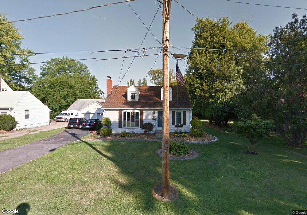
This home is located at 413 Stowe St, Huron, OH 44839 and is currently estimated at $249,660, approximately $161 per square foot. 413 Stowe St is a home located in Erie County with nearby schools including Shawnee Elementary School, Woodlands Intermediate School, and McCormick Junior High School.
Ownership History
We collect this data history from publicly available records. To have your information removed, we recommend requesting removal directly through your county’s website.
Purchase Details
Home Financials for this Owner
Home Financials are based on the most recent Mortgage that was taken out on this home.Home Values in the Area
Average Home Value in this Area
Purchase History
We collect this data history from publicly available records. To have your information removed, we recommend requesting removal directly through your county’s website.
| Date | Buyer | Sale Price | Title Company |
|---|---|---|---|
| $110,000 | None Available |
Mortgage History
We collect this data history from publicly available records. To have your information removed, we recommend requesting removal directly through your county’s website.
| Date | Status | Borrower | Loan Amount |
|---|---|---|---|
| Open | $88,000 |
Tax History
We collect this data history from publicly available records. To have your information removed, we recommend requesting removal directly through your county’s website.
| Year | Tax Paid | Tax Assessment Tax Assessment Total Assessment is a certain percentage of the fair market value that is determined by local assessors to be the total taxable value of land and additions on the property. | Land | Improvement |
|---|---|---|---|---|
| 2025 | $2,304 | $52,902 | $12,425 | $40,477 |
| 2024 | $2,304 | $52,902 | $12,425 | $40,477 |
| 2023 | $2,305 | $45,786 | $10,923 | $34,863 |
| 2022 | $1,944 | $45,790 | $10,923 | $34,867 |
| 2021 | $1,939 | $45,790 | $10,920 | $34,870 |
| 2020 | $1,813 | $41,700 | $10,920 | $30,780 |
| 2019 | $1,892 | $41,700 | $10,920 | $30,780 |
| 2018 | $1,902 | $41,700 | $10,920 | $30,780 |
| 2017 | $1,904 | $40,540 | $13,380 | $27,160 |
| 2016 | $1,845 | $40,540 | $13,380 | $27,160 |
| 2015 | $1,845 | $40,540 | $13,380 | $27,160 |
| 2014 | $1,819 | $39,500 | $13,380 | $26,120 |
| 2013 | $1,745 | $39,500 | $13,380 | $26,120 |
Map
- 323 Portland Dr
- 346 Main St
- 28 Turtle Bay
- 11 Turtle Bay
- 810 Taylor Ave
- 115 Turtle Bay Unit 115
- 301 Willow Dr
- 4075 Coventry Cir
- 823 Gloucester Dr
- 404 Leisure Dr Unit 404
- 937 Ridgeview Dr
- 328 Windsor Ct
- 305 Concord Ct
- 1 Cleveland Rd W
- 203 Ashland Ave
- 1114 Mudbrook Rd
- 1140 Sheltered Brook Dr
- 124 Tiffin Ave
- 124 Tiffin Ave Unit A/B
- 126 Mckinley St Unit A/B
Ask me questions while you tour the home.