Estimated Value: $326,620 - $391,000
2
Beds
3
Baths
1,060
Sq Ft
$338/Sq Ft
Est. Value
About This Home
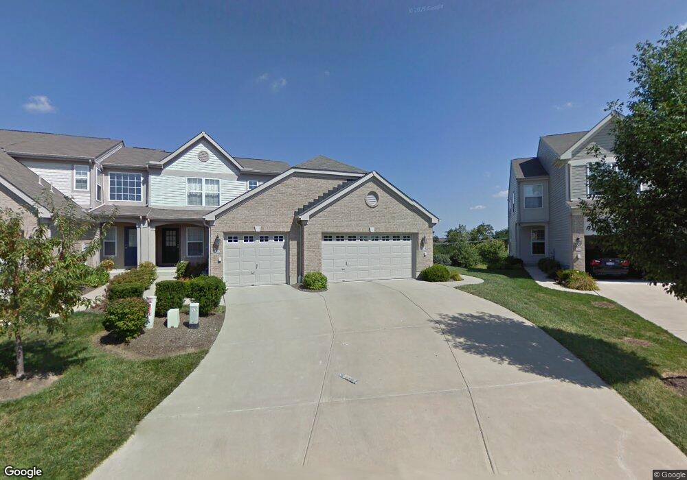
This home is located at 4134 Fieldsedge Dr Unit 288F, Mason, OH 45040 and is currently estimated at $358,655, approximately $338 per square foot. 4134 Fieldsedge Dr Unit 288F is a home located in Warren County with nearby schools including Mason Intermediate Elementary School, Mason Middle School, and William Mason High School.
Ownership History
Date
Name
Owned For
Owner Type
Purchase Details
Closed on
Jun 6, 2003
Sold by
The Drees Co
Bought by
Walker Richard
Current Estimated Value
Home Financials for this Owner
Home Financials are based on the most recent Mortgage that was taken out on this home.
Original Mortgage
$136,000
Outstanding Balance
$55,392
Interest Rate
5.4%
Mortgage Type
Purchase Money Mortgage
Estimated Equity
$303,263
Create a Home Valuation Report for This Property
The Home Valuation Report is an in-depth analysis detailing your home's value as well as a comparison with similar homes in the area
Home Values in the Area
Average Home Value in this Area
Purchase History
| Date | Buyer | Sale Price | Title Company |
|---|---|---|---|
| Walker Richard | $186,000 | Attorney Title Agency |
Source: Public Records
Mortgage History
| Date | Status | Borrower | Loan Amount |
|---|---|---|---|
| Open | Walker Richard | $136,000 |
Source: Public Records
Tax History
| Year | Tax Paid | Tax Assessment Tax Assessment Total Assessment is a certain percentage of the fair market value that is determined by local assessors to be the total taxable value of land and additions on the property. | Land | Improvement |
|---|---|---|---|---|
| 2025 | $4,011 | $98,830 | $24,500 | $74,330 |
| 2024 | $4,011 | $98,830 | $24,500 | $74,330 |
| 2023 | $3,650 | $75,964 | $10,675 | $65,289 |
| 2022 | $3,602 | $75,964 | $10,675 | $65,289 |
| 2021 | $3,413 | $75,964 | $10,675 | $65,289 |
| 2020 | $3,262 | $62,265 | $8,750 | $53,515 |
| 2019 | $2,999 | $62,265 | $8,750 | $53,515 |
| 2018 | $3,009 | $62,265 | $8,750 | $53,515 |
| 2017 | $2,641 | $51,013 | $7,291 | $43,722 |
| 2016 | $2,720 | $51,013 | $7,291 | $43,722 |
| 2015 | $2,726 | $51,013 | $7,291 | $43,722 |
| 2014 | $2,732 | $47,680 | $6,810 | $40,860 |
| 2013 | $2,738 | $61,210 | $8,750 | $52,460 |
Source: Public Records
Map
Nearby Homes
- 4019 Fieldsedge Dr
- 4109 Old Manchester Ct
- 6323 Tarton Fields Ln
- 4190 E Village Dr
- 4202 E Village Dr
- 3808 Sandtrap Cir Unit 3808
- 6246 Fairway Dr
- 6565 Covefield Ct
- 6388 Inverness Way
- 3887 Saint Andrews Ct
- 6416 Eagleview Dr
- 5921 Fairway Dr
- 602 Bunker Ln
- 618 Bunker Ln
- 382 Walnut Ln
- 6790 Parklake Dr
- 7111 Scarlet Oak Ct
- 7119 White Oak Ct
- 4618 Kamm Ln
- 215 Jefferson Dr
- 4136 Fieldsedge Dr
- 4138 Fieldsedge Dr Unit 288D
- 4126 Fieldsedge Dr
- 4140 Fieldsedge Dr
- 4124 Fieldsedge Dr Unit 287B
- 4142 Fieldsedge Dr
- 4122 Fieldsedge Dr Unit 287C
- 4144 Fieldsedge Dr
- 4120 Fieldsedge Dr
- 4118 Fieldsedge Dr
- 4116 Fieldsedge Dr Unit 287F
- 4161 Fieldsedge Dr
- 4089 Fieldsedge Dr
- 4158 Fieldsedge Dr
- 4163 Fieldsedge Dr Unit 284B
- 4160 Fieldsedge Dr Unit 289B
- 4165 Fieldsedge Dr Unit 284C
- 4085 Fieldsedge Dr Unit 285D
- 4167 Fieldsedge Dr Unit 284D
- 4162 Fieldsedge Dr
Your Personal Tour Guide
Ask me questions while you tour the home.