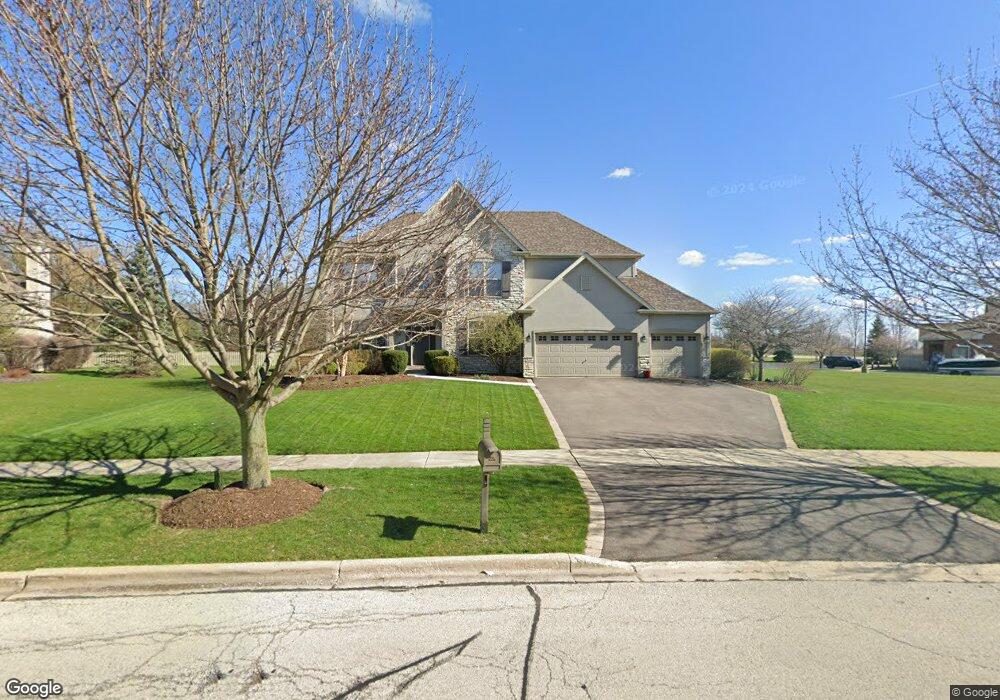
415 Bennett Dr Unit 2 North Aurora, IL 60542
Nelson Lake NeighborhoodEstimated Value: $556,504 - $698,000
4
Beds
4
Baths
3,378
Sq Ft
$187/Sq Ft
Est. Value
About This Home
This home is located at 415 Bennett Dr Unit 2, North Aurora, IL 60542 and is currently estimated at $630,126, approximately $186 per square foot. 415 Bennett Dr Unit 2 is a home located in Kane County with nearby schools including Fearn Elementary School, Herget Middle School, and West Aurora High School.
Ownership History
Date
Name
Owned For
Owner Type
Purchase Details
Closed on
May 16, 2022
Sold by
Weakman David B
Bought by
Weakman David B and Weakman Pamela S
Current Estimated Value
Purchase Details
Closed on
Jun 29, 2011
Sold by
R A F Limited Partnership
Bought by
Weakman David B and Weakman Pamela S
Home Financials for this Owner
Home Financials are based on the most recent Mortgage that was taken out on this home.
Original Mortgage
$282,400
Interest Rate
4.53%
Mortgage Type
New Conventional
Purchase Details
Closed on
Dec 30, 2008
Sold by
R A Faganel Builders Inc
Bought by
Raf Limited Partnership
Purchase Details
Closed on
Jun 16, 2004
Sold by
Neumann Homes Inc
Bought by
R A Faganel Builders Inc
Create a Home Valuation Report for This Property
The Home Valuation Report is an in-depth analysis detailing your home's value as well as a comparison with similar homes in the area
Home Values in the Area
Average Home Value in this Area
Purchase History
| Date | Buyer | Sale Price | Title Company |
|---|---|---|---|
| Weakman David B | -- | None Listed On Document | |
| Weakman Pamela S | -- | None Listed On Document | |
| Weakman David B | $390,000 | Chicago Title Insurance Co | |
| Raf Limited Partnership | $461,000 | Chicago Title Insurance Co | |
| R A Faganel Builders Inc | $1,606,500 | Chicago Title Insurance Comp |
Source: Public Records
Mortgage History
| Date | Status | Borrower | Loan Amount |
|---|---|---|---|
| Previous Owner | Weakman David B | $282,400 |
Source: Public Records
Tax History
| Year | Tax Paid | Tax Assessment Tax Assessment Total Assessment is a certain percentage of the fair market value that is determined by local assessors to be the total taxable value of land and additions on the property. | Land | Improvement |
|---|---|---|---|---|
| 2024 | $10,062 | $139,119 | $17,831 | $121,288 |
| 2023 | $9,764 | $125,559 | $16,093 | $109,466 |
| 2022 | $10,498 | $130,399 | $14,770 | $115,629 |
| 2021 | $10,310 | $124,808 | $14,137 | $110,671 |
| 2020 | $10,231 | $121,883 | $13,806 | $108,077 |
| 2019 | $10,571 | $120,093 | $13,603 | $106,490 |
| 2018 | $11,476 | $125,917 | $13,603 | $112,314 |
| 2017 | $11,664 | $124,485 | $13,448 | $111,037 |
| 2016 | $12,290 | $127,251 | $13,093 | $114,158 |
| 2015 | -- | $120,875 | $12,582 | $108,293 |
| 2014 | -- | $116,886 | $14,000 | $102,886 |
| 2013 | -- | $116,886 | $14,000 | $102,886 |
Source: Public Records
Map
Nearby Homes
- 2184 Schrader Ln
- 4s072 Deerpath Rd
- 647 Bennett Dr
- 664 Bennett Dr
- 2518 Imgrund Rd Unit 3
- 2519 Imgrund Rd Unit 3
- 601 Meade Blvd
- 890 Stratford Dr
- 2717 Berman Rd Unit 1A
- 2744 Moutray Ln Unit 3
- 217 Kathryn Ln
- 858 Hathaway Ct
- 867 Fair Meadow Ct
- 1799 Breton Ave
- 924 Fair Meadow St
- 925 Fair Meadow St
- 1622 Patterson Ave
- 1792 Breton Ave
- 1614 Patterson Ave
- Lot 1 North Orchard Gateway Blvd
- 423 Bennett Dr
- 416 Bennett Dr
- 424 Bennett Dr
- 408 Bennett Dr
- 439 Bennett Dr
- 2303 Orr Ct
- 432 Bennett Dr
- 2256 Schrader Ln
- 2248 Schrader Ln
- 440 Bennett Dr
- 2264 Schrader Ln
- 2311 Orr Ct
- 2310 Orr Ct
- 3S930 Deer Oaks Rd
- 2240 Schrader Ln
- 448 Bennett Dr
- 455 Bennett Dr
- 2319 Orr Ct
- 2272 Schrader Ln
- 3S896 Deer Oaks Rd
Your Personal Tour Guide
Ask me questions while you tour the home.