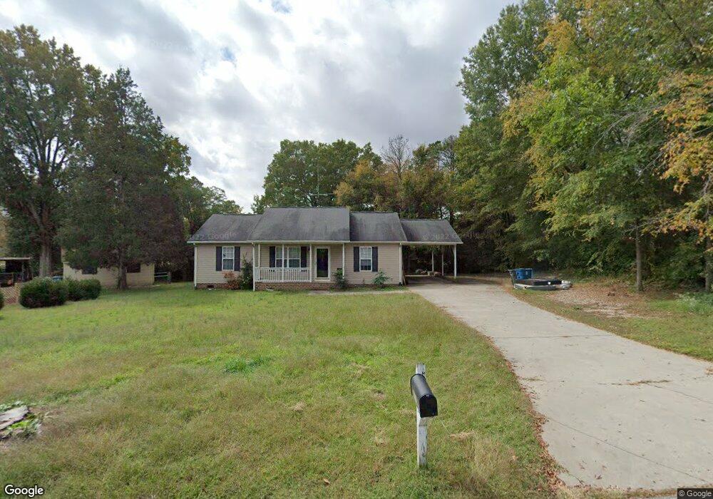
415 Mining Ave Salisbury, NC 28147
Estimated Value: $207,505 - $271,000
About This Home
This home is located at 415 Mining Ave, Salisbury, NC 28147 and is currently estimated at $240,876, approximately $200 per square foot. 415 Mining Ave is a home with nearby schools including Knollwood Elementary School, North Rowan Middle School, and Salisbury High School.
Ownership History
We collect this data history from publicly available records. To have your information removed, we recommend requesting removal directly through your county’s website.
Purchase Details
Home Financials for this Owner
Home Financials are based on the most recent Mortgage that was taken out on this home.Home Values in the Area
Average Home Value in this Area
Purchase History
We collect this data history from publicly available records. To have your information removed, we recommend requesting removal directly through your county’s website.
| Date | Buyer | Sale Price | Title Company |
|---|---|---|---|
| $10,000 | -- |
Mortgage History
We collect this data history from publicly available records. To have your information removed, we recommend requesting removal directly through your county’s website.
| Date | Status | Borrower | Loan Amount |
|---|---|---|---|
| Previous Owner | $92,000 |
Tax History
We collect this data history from publicly available records. To have your information removed, we recommend requesting removal directly through your county’s website.
| Year | Tax Paid | Tax Assessment Tax Assessment Total Assessment is a certain percentage of the fair market value that is determined by local assessors to be the total taxable value of land and additions on the property. | Land | Improvement |
|---|---|---|---|---|
| 2025 | $2,268 | $189,632 | $32,825 | $156,807 |
| 2024 | $2,268 | $189,632 | $32,825 | $156,807 |
| 2023 | $2,268 | $189,632 | $32,825 | $156,807 |
| 2022 | $1,658 | $120,393 | $20,200 | $100,193 |
| 2021 | $1,658 | $120,393 | $20,200 | $100,193 |
| 2020 | $1,658 | $120,393 | $20,200 | $100,193 |
| 2019 | $1,658 | $120,393 | $20,200 | $100,193 |
| 2018 | $1,381 | $101,652 | $20,200 | $81,452 |
| 2017 | $1,374 | $101,652 | $20,200 | $81,452 |
| 2016 | $1,336 | $101,652 | $20,200 | $81,452 |
| 2015 | $1,344 | $101,652 | $20,200 | $81,452 |
| 2014 | $1,252 | $95,792 | $12,928 | $82,864 |
Map
- 419 Winsley Dr
- 612 Rowan Mills Rd
- 418 Winsley Dr
- 0 Henderson Grove Church Rd
- 709 Sunset Dr
- 0 601 Hwy Unit CAR4336269
- 402 Swaim Ct
- 1950 Rosemont St
- 317 W D Ave
- 1823 2nd St
- 204 W C Ave
- 1411 Ludwick Heights Ln
- 1212 Rowan Mills Rd
- 0 Suzannes Rd
- 1020 Suzannes Rd
- 806 Maupin Ave
- 812 Maupin Ave Unit 812
- 1325 Jake Alexander Blvd W
- 801 Mitchell Ave
- 119 Heilig Ave
- 203 Balfour Dr
- 414 Rowan Mills Rd
- 503 Mining Ave
- 303 Balfour Dr
- 218 Balfour Dr
- 400 Rowan Mills Rd
- 303 Rink St
- 506 Rowan Mills Rd
- 216 Balfour Dr
- 302 Balfour Dr
- 210 Balfour Dr
- 324 Rowan Mills Rd
- 316 Balfour Dr
- 204 Balfour Dr
- 505 Rowan Mills Rd
- 324 Rowan Mill Rd
- 510 Rowan Mills Rd
- 327 Rowan Mills Rd
- 405 Rowan Mills Rd
- 515 Rowan Mills Rd
Ask me questions while you tour the home.