Estimated Value: $187,000 - $240,000
Studio
--
Bath
1,749
Sq Ft
$121/Sq Ft
Est. Value
About This Home
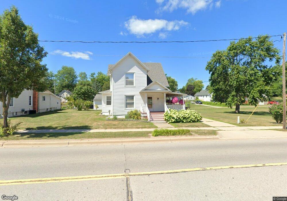
This home is located at 415 N Main, Perry, MI 48872 and is currently estimated at $211,014, approximately $120 per square foot. 415 N Main is a home located in Shiawassee County with nearby schools including Perry Elementary School, Perry Middle School, and Perry High School.
Ownership History
Date
Name
Owned For
Owner Type
Purchase Details
Closed on
Jul 17, 2025
Sold by
Forman Lynnette Mae and Depew Robert W
Bought by
Depew Robert and Depew Katrice
Current Estimated Value
Home Financials for this Owner
Home Financials are based on the most recent Mortgage that was taken out on this home.
Original Mortgage
$227,272
Outstanding Balance
$225,906
Interest Rate
6.85%
Mortgage Type
New Conventional
Estimated Equity
-$14,892
Purchase Details
Closed on
Mar 23, 2022
Sold by
Depew Sonya C
Bought by
Depew Sonya C
Create a Home Valuation Report for This Property
The Home Valuation Report is an in-depth analysis detailing your home's value as well as a comparison with similar homes in the area
Purchase History
| Date | Buyer | Sale Price | Title Company |
|---|---|---|---|
| Depew Robert | $225,000 | Ata National Title Group | |
| Depew Robert | $225,000 | Ata National Title Group | |
| Depew Sonya C | -- | None Listed On Document |
Source: Public Records
Mortgage History
| Date | Status | Borrower | Loan Amount |
|---|---|---|---|
| Open | Depew Robert | $227,272 | |
| Closed | Depew Robert | $227,272 |
Source: Public Records
Tax History
| Year | Tax Paid | Tax Assessment Tax Assessment Total Assessment is a certain percentage of the fair market value that is determined by local assessors to be the total taxable value of land and additions on the property. | Land | Improvement |
|---|---|---|---|---|
| 2025 | $3,131 | $100,800 | $0 | $0 |
| 2024 | $2,950 | $105,900 | $0 | $0 |
| 2023 | $1,961 | $86,000 | $0 | $0 |
| 2022 | $2,772 | $79,900 | $0 | $0 |
| 2021 | $2,652 | $72,500 | $0 | $0 |
| 2020 | $2,640 | $68,800 | $0 | $0 |
| 2019 | $2,563 | $63,400 | $0 | $0 |
| 2018 | $2,533 | $57,700 | $0 | $0 |
| 2017 | $2,391 | $57,100 | $0 | $0 |
| 2016 | -- | $57,100 | $0 | $0 |
| 2015 | -- | $56,700 | $0 | $0 |
| 2014 | $15 | $54,900 | $0 | $0 |
Source: Public Records
Map
Nearby Homes
- 337 Green
- 340 Lamb St
- 0 M-52 Hwy Unit 261982
- 10980 S M 52
- 250 N Washington St
- 612 Launch Point Dr
- 604 Launch Point Dr
- 606 Launch Point Dr
- 00 W Riverview Dr
- 707 W Windward Way
- 713 W Windward Way
- VL Washington St
- 603 Country Dr
- 806 Starlight Way
- 712 Starlight Way
- 807 Little Creek Path
- 10650 Bennett Dr
- 0 E Lansing Rd
- 9627 M 52
- 4 Blue Water Way
Your Personal Tour Guide
Ask me questions while you tour the home.