Estimated Value: $238,000 - $275,309
About This Home
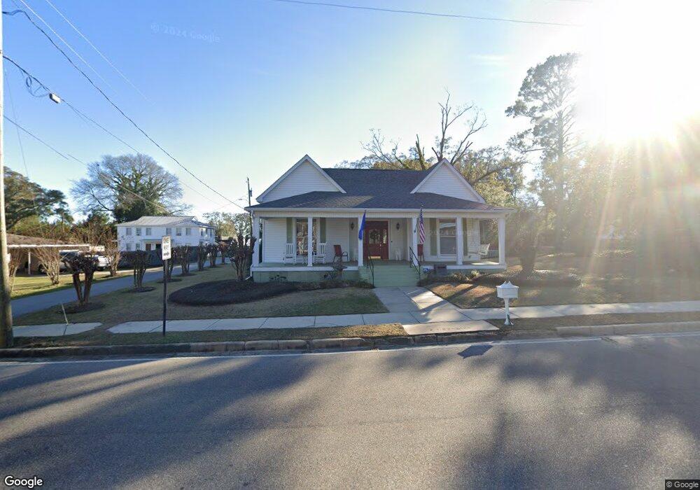
This home is located at 416 E Broad St, Ozark, AL 36360 and is currently estimated at $252,077, approximately $97 per square foot. 416 E Broad St is a home located in Dale County with nearby schools including Lisenby Primary School, Mixon Intermediate School, and D. A. Smith Middle School.
Ownership History
We collect this data history from publicly available records. To have your information removed, we recommend requesting removal directly through your county’s website.
Purchase Details
Home Financials for this Owner
Home Financials are based on the most recent Mortgage that was taken out on this home.Purchase Details
Home Financials for this Owner
Home Financials are based on the most recent Mortgage that was taken out on this home.Purchase Details
Purchase Details
Purchase Details
Purchase History
We collect this data history from publicly available records. To have your information removed, we recommend requesting removal directly through your county’s website.
| Date | Buyer | Sale Price | Title Company |
|---|---|---|---|
| $269,000 | None Listed On Document | ||
| $269,000 | None Listed On Document | ||
| $269,000 | None Listed On Document | ||
| $269,000 | None Listed On Document | ||
| -- | None Available | ||
| -- | None Available | ||
| $143,020 | None Available | ||
| $143,020 | None Available | ||
| -- | -- | ||
| -- | -- |
Mortgage History
We collect this data history from publicly available records. To have your information removed, we recommend requesting removal directly through your county’s website.
| Date | Status | Borrower | Loan Amount |
|---|---|---|---|
| Open | $264,127 | ||
| Closed | $264,127 |
Tax History
We collect this data history from publicly available records. To have your information removed, we recommend requesting removal directly through your county’s website.
| Year | Tax Paid | Tax Assessment Tax Assessment Total Assessment is a certain percentage of the fair market value that is determined by local assessors to be the total taxable value of land and additions on the property. | Land | Improvement |
|---|---|---|---|---|
| 2025 | $1,088 | $22,620 | $1,260 | $21,360 |
| 2024 | $1,088 | $20,300 | $1,000 | $19,300 |
| 2023 | $778 | $17,640 | $1,000 | $16,640 |
| 2022 | $519 | $14,400 | $14,400 | $0 |
| 2021 | $475 | $13,420 | $1,000 | $12,420 |
| 2020 | $678 | $14,560 | $1,000 | $13,560 |
| 2019 | $526 | $14,560 | $1,000 | $13,560 |
| 2018 | $514 | $14,300 | $1,000 | $13,300 |
| 2017 | $514 | $14,300 | $1,000 | $13,300 |
| 2016 | $514 | $14,300 | $1,000 | $13,300 |
| 2015 | $615 | $16,580 | $1,000 | $15,580 |
| 2014 | $602 | $16,300 | $1,000 | $15,300 |
| 2013 | $682 | $16,300 | $1,000 | $15,300 |
Map
- 445 E Eufaula St
- 445 E Eufaula St
- 546 E Broad St
- 373 E College St
- 0 Ellens Path 23b Unit 204863
- 0 Ellens Path 26b Unit 204858
- 0 Pierce's Station 36c Unit 204851
- 0 Pierce's Station 49c Unit 204846
- 0 Pierces Station 46c Unit 207554
- 0 Pierces Station 18a Unit 204868
- 0 Ellens Path 21b Unit 204866
- 0 Pierces Station 15a Unit 204869
- 0 Ellen's Path 32b Unit 204855
- 0 Ellens Path 34b Unit 204853
- 0 Ellens Path 24b Unit 204862
- 0 Ellens Path 31b Unit 204856
- 0 Ellens Path 25b Unit 204860
- 0 Pierce's Station 37c Unit 204850
- 0 Pierce's Station 41c Unit 204849
- 0 Pierces Station 17a Unit 204859
- 416 E Broad St
- 440 E Broad St
- 146 Carroll Ave
- 146 Carroll Ave
- 139 Carroll Ave
- 384 E Broad St
- 441 E Broad St
- 145 E Broad St
- 460 E Broad St
- 160 Carroll Ave
- 421 E Broad St
- 403 E Broad St
- 461 E Broad St
- 130 Patterson Dr
- 478 E Broad St
- 121-145 Patterson St
- 121,123,127,129 Patterson St
- 363 E Broad St
- 363 E Broad St
- 350 E Broad St
Ask me questions while you tour the home.