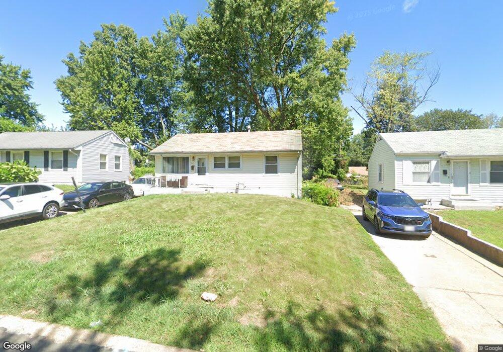
417 Lanark Rd Saint Louis, MO 63137
Estimated Value: $91,000 - $111,000
3
Beds
1
Bath
854
Sq Ft
$113/Sq Ft
Est. Value
About This Home
This home is located at 417 Lanark Rd, Saint Louis, MO 63137 and is currently estimated at $96,670, approximately $113 per square foot. 417 Lanark Rd is a home located in St. Louis County with nearby schools including Riverview Gardens Senior High School and Grace Chapel Lutheran School.
Ownership History
Date
Name
Owned For
Owner Type
Purchase Details
Closed on
May 7, 2002
Sold by
Sauer Anthony A and Sauer Cheryl K
Bought by
Mcintyre John and Mcintyre Annette
Current Estimated Value
Home Financials for this Owner
Home Financials are based on the most recent Mortgage that was taken out on this home.
Original Mortgage
$40,500
Outstanding Balance
$17,306
Interest Rate
7.1%
Estimated Equity
$79,364
Create a Home Valuation Report for This Property
The Home Valuation Report is an in-depth analysis detailing your home's value as well as a comparison with similar homes in the area
Home Values in the Area
Average Home Value in this Area
Purchase History
| Date | Buyer | Sale Price | Title Company |
|---|---|---|---|
| Mcintyre John | $45,000 | -- |
Source: Public Records
Mortgage History
| Date | Status | Borrower | Loan Amount |
|---|---|---|---|
| Open | Mcintyre John | $40,500 |
Source: Public Records
Tax History
| Year | Tax Paid | Tax Assessment Tax Assessment Total Assessment is a certain percentage of the fair market value that is determined by local assessors to be the total taxable value of land and additions on the property. | Land | Improvement |
|---|---|---|---|---|
| 2025 | $1,114 | $12,850 | $780 | $12,070 |
| 2024 | $1,114 | $10,610 | $1,580 | $9,030 |
| 2023 | $1,099 | $10,610 | $1,580 | $9,030 |
| 2022 | $977 | $7,380 | $1,960 | $5,420 |
| 2021 | $968 | $7,380 | $1,960 | $5,420 |
| 2020 | $730 | $6,140 | $1,600 | $4,540 |
| 2019 | $709 | $6,140 | $1,600 | $4,540 |
| 2018 | $671 | $5,480 | $860 | $4,620 |
| 2016 | $671 | $5,610 | $1,240 | $4,370 |
Source: Public Records
Map
Nearby Homes
- 404 Lancashire Rd
- 334 Lancashire Rd Unit 3
- 10370 Renfrew Dr
- 325 Lancashire Rd
- 10320 Renfrew Dr
- 10416 Durness Dr
- 419 Cameron Rd
- 10435 Renfrew Dr
- 345 Cameron Rd
- 506 Dornoch Dr
- 10309 Durness Dr Unit 1
- 10514 Renfrew Dr
- 225 Coburg Dr
- 10518 Renfrew Dr
- 10519 Renfrew Dr
- 601 Shepley Dr
- 254 Estridge Rd
- 10058 Jeffrey Dr
- 244 Estridge Rd
- 10500 Prestwick Dr
Your Personal Tour Guide
Ask me questions while you tour the home.