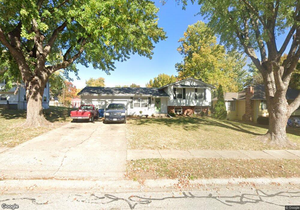
417 Sherry Ln Liberty, MO 64068
Estimated Value: $261,000 - $269,000
About This Home
This home is located at 417 Sherry Ln, Liberty, MO 64068 and is currently estimated at $266,102, approximately $270 per square foot. 417 Sherry Ln is a home located in Clay County with nearby schools including Alexander Doniphan Elementary School, Discovery Middle School, and Liberty High School.
Ownership History
We collect this data history from publicly available records. To have your information removed, we recommend requesting removal directly through your county’s website.
Purchase Details
Home Financials for this Owner
Home Financials are based on the most recent Mortgage that was taken out on this home.Purchase Details
Home Financials for this Owner
Home Financials are based on the most recent Mortgage that was taken out on this home.Purchase Details
Home Financials for this Owner
Home Financials are based on the most recent Mortgage that was taken out on this home.Home Values in the Area
Average Home Value in this Area
Purchase History
We collect this data history from publicly available records. To have your information removed, we recommend requesting removal directly through your county’s website.
| Date | Buyer | Sale Price | Title Company |
|---|---|---|---|
| -- | First American Title Co | ||
| -- | United Title Company | ||
| -- | -- |
Mortgage History
We collect this data history from publicly available records. To have your information removed, we recommend requesting removal directly through your county’s website.
| Date | Status | Borrower | Loan Amount |
|---|---|---|---|
| Open | $65,000 | ||
| Closed | $82,450 | ||
| Previous Owner | $72,000 |
Tax History
We collect this data history from publicly available records. To have your information removed, we recommend requesting removal directly through your county’s website.
| Year | Tax Paid | Tax Assessment Tax Assessment Total Assessment is a certain percentage of the fair market value that is determined by local assessors to be the total taxable value of land and additions on the property. | Land | Improvement |
|---|---|---|---|---|
| 2025 | $2,262 | $31,480 | -- | -- |
| 2024 | $2,127 | $27,660 | -- | -- |
| 2023 | $2,163 | $27,660 | $0 | $0 |
| 2022 | $1,999 | $25,230 | $0 | $0 |
| 2021 | $1,983 | $25,232 | $6,650 | $18,582 |
| 2020 | $1,965 | $23,470 | $0 | $0 |
| 2019 | $1,964 | $23,470 | $0 | $0 |
| 2018 | $1,681 | $19,720 | $0 | $0 |
| 2017 | $1,665 | $19,720 | $3,800 | $15,920 |
| 2016 | $1,665 | $19,720 | $3,800 | $15,920 |
| 2015 | $1,665 | $19,720 | $3,800 | $15,920 |
| 2014 | $1,610 | $18,900 | $3,800 | $15,100 |
Map
- 441 Wilshire Blvd
- 1500 Amesbury Ave
- 7408 N Lane Ave
- Lot 2 Bent Oaks Dr
- 1605 High Dr
- 8819 NE 74th Terrace
- 8820 Timber Creek Ln
- Lot 2A Oak Crest Dr
- 1617 Welleslay Ln
- 717 Riverwood Dr
- 1913 CeMcO Dr
- 2133 Winding Woods Dr
- 401 Smiley Rd
- 7431 N Lewis Ave
- 8808 Orchard St
- 7514 N Lewis Ave
- 1550 Dover Ct
- 7218 N Lewis Ave
- 7008 N Church Rd
- 1002 Dunwich Dr
- 413 Sherry Ln
- 421 Sherry Ln
- 411 Sherry Ln
- 410 Bancroft St
- 414 Bancroft St
- 410 Bancroft Ave
- 414 Bancroft Ave
- 611 Glendale Rd
- 406 Bancroft St
- 418 Sherry Ln
- 416 Sherry Ln
- 424 Sherry Ln
- 409 Sherry Ln
- 603 Glendale Rd
- 412 Sherry Ln
- 703 Glendale Rd
- 402 Bancroft St
- 410 Sherry Ln
- 407 Sherry Ln
- 705 Glendale Rd
Ask me questions while you tour the home.