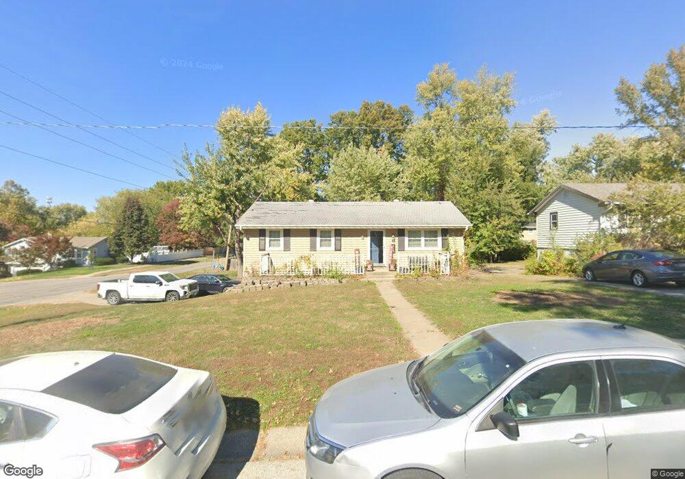
418 Stuart St Liberty, MO 64068
Estimated Value: $254,810 - $289,000
4
Beds
1
Bath
1,312
Sq Ft
$207/Sq Ft
Est. Value
About This Home
This home is located at 418 Stuart St, Liberty, MO 64068 and is currently estimated at $271,703, approximately $207 per square foot. 418 Stuart St is a home located in Clay County with nearby schools including Manor Hill Elementary School, Liberty Middle School, and Liberty High School.
Ownership History
Date
Name
Owned For
Owner Type
Purchase Details
Closed on
Aug 3, 2004
Sold by
Donovan Michelle D and Houston Michelle D
Bought by
Castillo Ricardo and Castillo Lesa
Current Estimated Value
Home Financials for this Owner
Home Financials are based on the most recent Mortgage that was taken out on this home.
Original Mortgage
$130,732
Outstanding Balance
$65,944
Interest Rate
6.26%
Mortgage Type
FHA
Estimated Equity
$205,759
Purchase Details
Closed on
May 1, 2000
Sold by
Houston Kent L
Bought by
Donovan Michelle D and Houston Michelle D
Create a Home Valuation Report for This Property
The Home Valuation Report is an in-depth analysis detailing your home's value as well as a comparison with similar homes in the area
Home Values in the Area
Average Home Value in this Area
Purchase History
| Date | Buyer | Sale Price | Title Company |
|---|---|---|---|
| Castillo Ricardo | -- | Stewart Title | |
| Donovan Michelle D | -- | -- |
Source: Public Records
Mortgage History
| Date | Status | Borrower | Loan Amount |
|---|---|---|---|
| Open | Castillo Ricardo | $130,732 |
Source: Public Records
Tax History
| Year | Tax Paid | Tax Assessment Tax Assessment Total Assessment is a certain percentage of the fair market value that is determined by local assessors to be the total taxable value of land and additions on the property. | Land | Improvement |
|---|---|---|---|---|
| 2025 | $2,452 | $36,630 | -- | -- |
| 2024 | $2,452 | $31,880 | -- | -- |
| 2023 | $2,493 | $31,880 | $0 | $0 |
| 2022 | $2,249 | $28,390 | $0 | $0 |
| 2021 | $2,231 | $28,386 | $5,320 | $23,066 |
| 2020 | $2,166 | $25,880 | $0 | $0 |
| 2019 | $2,166 | $25,880 | $0 | $0 |
| 2018 | $1,922 | $22,550 | $0 | $0 |
| 2017 | $1,904 | $22,550 | $3,420 | $19,130 |
| 2016 | $1,904 | $22,550 | $3,420 | $19,130 |
| 2015 | $1,904 | $22,550 | $3,420 | $19,130 |
| 2014 | $1,750 | $20,560 | $3,420 | $17,140 |
Source: Public Records
Map
Nearby Homes
- 516 Sharon Dr
- 1705 Johnston St
- 191 Grant St
- 1010 Wellington Way
- 819 S Main St
- 408 W Murray Rd
- 1842 White Tail Ln
- 716 W Hurt St
- 1116 Owen Dr
- 843 Sherrill Ave
- 336 Georgia Ct
- 822 Sherrill Ave
- 1312 Wellington Way
- 225 Groom St
- 1955 Birmingham Rd
- 2600 Magnolia Ave
- 1856 Arbor Trail
- 606 Thornton St
- 1232 Old Manor Rd
- 1768 Homestead Dr
Your Personal Tour Guide
Ask me questions while you tour the home.