Estimated Value: $307,595 - $397,000
Studio
1
Bath
1,712
Sq Ft
$201/Sq Ft
Est. Value
About This Home
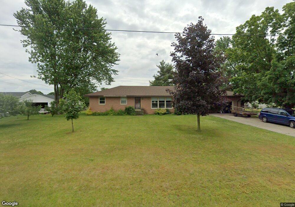
This home is located at 4185 Maple St, Dorr, MI 49323 and is currently estimated at $344,899, approximately $201 per square foot. 4185 Maple St is a home with nearby schools including Wayland High School, St. Stanislaus School, and Moline Christian School.
Ownership History
Date
Name
Owned For
Owner Type
Purchase Details
Closed on
Oct 25, 2023
Sold by
Grevenstuk George Gerrit and Grevenstuk Julie Ann
Bought by
Grevenstuk Living Trust and Grevenstuk
Current Estimated Value
Purchase Details
Closed on
Jan 28, 2008
Sold by
Open Dorr Reformed Church
Bought by
Grevenstuk George G and Grevenstuk Juel A
Home Financials for this Owner
Home Financials are based on the most recent Mortgage that was taken out on this home.
Original Mortgage
$130,000
Interest Rate
5.75%
Mortgage Type
Purchase Money Mortgage
Create a Home Valuation Report for This Property
The Home Valuation Report is an in-depth analysis detailing your home's value as well as a comparison with similar homes in the area
Home Values in the Area
Average Home Value in this Area
Purchase History
| Date | Buyer | Sale Price | Title Company |
|---|---|---|---|
| Grevenstuk Living Trust | -- | None Listed On Document | |
| Grevenstuk Living Trust | -- | None Listed On Document | |
| Grevenstuk George G | $130,000 | Mbt Title West Mi | |
| Open Dorr Reformed Church | -- | Mbt Title Of West Mi |
Source: Public Records
Mortgage History
| Date | Status | Borrower | Loan Amount |
|---|---|---|---|
| Previous Owner | Open Dorr Reformed Church | $130,000 |
Source: Public Records
Tax History
| Year | Tax Paid | Tax Assessment Tax Assessment Total Assessment is a certain percentage of the fair market value that is determined by local assessors to be the total taxable value of land and additions on the property. | Land | Improvement |
|---|---|---|---|---|
| 2025 | $2,527 | $155,300 | $55,800 | $99,500 |
| 2024 | $2,290 | $140,900 | $48,700 | $92,200 |
| 2023 | $2,345 | $125,200 | $45,100 | $80,100 |
| 2022 | $2,290 | $107,400 | $35,200 | $72,200 |
| 2021 | $2,123 | $102,400 | $33,800 | $68,600 |
| 2020 | $1,998 | $98,400 | $32,200 | $66,200 |
| 2019 | $1,998 | $88,200 | $29,300 | $58,900 |
| 2018 | $1,954 | $83,000 | $14,300 | $68,700 |
| 2017 | $0 | $87,100 | $14,300 | $72,800 |
| 2016 | $0 | $67,900 | $14,300 | $53,600 |
| 2015 | -- | $67,900 | $14,300 | $53,600 |
| 2014 | -- | $61,100 | $14,800 | $46,300 |
| 2013 | -- | $58,200 | $14,800 | $43,400 |
Source: Public Records
Map
Nearby Homes
- 1341 142nd Ave
- Lots A&B 142nd Ave
- 4162 Radstock Dr
- 4076 Ranchero Dr
- 4221 Century Dr
- Lot 11 Walnut Dale Dr
- 4365 Chappel St
- 1232 Rosewood Ave
- 1164 144th Ave
- 4285 Highpoint Dr Unit 108
- 4273 Highpoint Dr Unit 112
- 4269 Highpoint Dr Unit 114
- 4271 Highpoint Dr Unit 113
- 4294 Highpoint Dr Unit 103
- 1069 Sunnyside Dr
- 1585 135th Ave
- 4279 Highpoint Dr
- Lot A 142nd Ave
- Lot B 142nd Ave
- 10785 Windward Ave SW
Your Personal Tour Guide
Ask me questions while you tour the home.